Geography Handbook
290 likes | 533 Vues
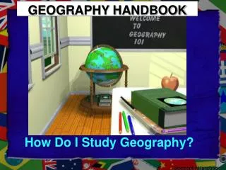
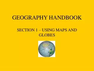
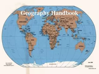
Geography Handbook. Maps: Making the Most of Them (pM4 & M5). map - a drawing, on a flat surface, of a part of the Earth . All maps will usually contain this information: title, key, locator map, scale, latitude & longitude, boundaries, & a compass rose.

Geography Handbook
E N D
Presentation Transcript
Maps: Making the Most of Them (pM4 & M5) map- a drawing, on a flat surface, of a part of the Earth. • All maps will usually contain this information: title, key, locator map, scale, latitude & longitude, boundaries, & a compass rose. Title- tells you what kind of information the map contains. Key-also called a legend, it explains the symbols for the map. Locator map-relates the area to a larger area.
Maps • Scale-allows you to tell distances between places. Latitude and longitude- tell the exact location. Boundaries- divides different places. Compass rose-tells where north is on the map. • Turn to page 608 & 609. Find the title, key, locator map, scale, latitude & longitude, boundaries, compass rose.
An Inset Map/ Grid Insets- a main map with one or more smaller maps. Grid- Evenly spaced horizontal and vertical lines which help you locate a particular area on the map. • Find an inset map in your textbook • Answer questions p. M6 & M7.
Distance Scale p.M8 • Distances on maps are smaller than the real distances on Earth. Why? • Distance scale- shows how much smaller the map scale is to its actual size. • Usually a certain # of inches stands for miles or centimeters for kilometers. • What is the distance in miles from Kaduna to Port Harcourt? Porto-Novo to N’Djumena? & Benim City to Abuja?
Map Key p. M10 • To use a map you must know what its colors or symbols stand for. Cartographer- mapmaker Key- also called a legend. • Describe the map key on p. 612 & 613. • Do you think maps are more accurate today than in the past? Why?
Compass Rose p. M11 Compass rose- is a small drawing that shows directions on a map. • Its tips point to the 4 cardinal directions (N,S,E, & W). It also shows intermediate directions. • Intermediate directions- in-between directions (NE, SE, NW, & SW) • Answer questions “Be a tourists in New Zealand” p. m11.
Latitude p. M12 • You can locate things on earth if you know latitude & longitude. Equator- the line of latitude that runs around the center of the Earth. (0 degrees). • Latitude lines show how far north or south of the equator a place is located. Latitude- lines run in a east/west direction. They are called parallels. • The Equator divides the Earth into the Northern & Southern Hemispheres. • Answer questions p. M12
Tropic of Cancer • The Tropic of Cancer is located at 23.5 degrees N latitude. • On June 21 the sun is directly overhead the Tropic of Cancer at noon. It marks the first day of summer for the Northern hemisphere. It is the farthest the sun travels north.
Tropic of Capricorn • The Tropic of Capricorn is located at 23.5 degrees S latitude. • On December 21 the sun is directly overhead the Tropic of Capricorn at noon. It marks the first day of winter for the Northern hemisphere. It is the farthest south the sun will travel. • The tropics is the area from the Tropic of Cancer to the Tropic of Capricorn.
Longitude p. M13 Longitude- the vertical lines on a map that go from the North Pole to the South Pole. They are also called meridians. Prime meridian- the starting point for longitude. (Zero degrees) • The prime meridian runs through Greenwich, England. It is sometimes called the Greenwich Meridian. • Meridians are counted east & west from the prime meridian. The prime meridian & the international date line divides the Earth into the Western & Eastern Hemisphere. • Answer questions M13
Latitude & Longitude • Minutes and Seconds For precision purposes, degrees of longitude and latitude have been divided into minutes (') and seconds ("). There are 60 minutes in each degree. Each minute is divided into 60 seconds. Seconds can be further divided into tenths, hundredths, or even thousandths.
International Date Line p. M13 • International Date Line- halfway around the world from the prime meridian is the 180 degree meridian. This is the point where at midnight a new day begins. • If it is Sunday west of the line, it is Saturday to the east of it. • Why do you think the line is not straight? • Answer questions M14 Tuesday Monday
Special Purpose Maps • The 2 most common kinds of maps are political & physical maps. Political map- uses color to show nations & states. Physical map- shows natural features of the land. Special-purpose maps- have only 1 purpose, such as precipitation, crops or oil. Precipitation- moisture that falls to Earth as rain, snow, sleet, or hail. * Find a political map, physical map, and a special purpose map in you textbook.
Product Map Product maps- show resources, such as coal, are found where crops, such as cotton, are grown. • Questions p. M16
Natural Resource Map Natural resource map- a map that shows resources from nature (forests, coal, iron, etc.) Forests Coal
Time Zones • The sun doesn’t hit all parts of the world at the same time. When it is light in 1 part of the world, it is dark in another part. • The Earth is divided into 24 time zones- one for each hour of the day. • Time zones often zigzag when they cross land so that people living in the same area have the same times. • We are in the Eastern Standard Time Zone. • Questions M19
Daylight Savings Time • Daylight Saving Time begins at 2:00 a.m. local time on the second Sunday in March. • On the first Sunday in November areas on Daylight Saving Time return to Standard Time at 2:00 a.m. • It was Ben Franklin’s idea. He wanted to put the daylight during the summer to better use.
Why Aren’t All Maps of the Same Place Alike? • It is difficult to show the curved surface of the Earth on a flat map. It is like flattening a ball. • Parts of the surface will stick up, causing distortions. • On most maps, the regions near the center are the most accurate. Regions farther away from the center are distorted. • Compare the size of Greenland & Antarctica on different maps.
Oceans • There are 5 oceans in the world. The oceans in order from largest to smallest are: • Pacific • Atlantic • Indian • Southern (new in 2000) • Arctic • About 70% of the Earth’s surface is covered by oceans. About 97% of the Earth’s water is found in the oceans. The Southern Ocean surrounds Antarctica.
Continents are the large land masses on the Earth. There are 7 continents in order from largest to smallest are:: Asia, Africa, North America, South America, Antarctica, Europe, & Australia. • Greenland is a part of N. America. It is sometimes called a subcontinent. Continents
One super continent existed about 250 million years ago before they were separated into the current continents. • Fossil evidence of Pangea includes similar & identical species on continents that are now far apart. • Amasia is possible future super continent that could be formed in about 250 million years by the merger of America with Asia because of ocean plates. If this happens the Atlantic will be the largest ocean.
Hemispheres • A hemisphere is a half of a globe. The earth has 4 hemispheres. • The Equator splits the Earth into the Northern & Southern Hemispheres. • The Prime Meridian splits the Earth into Western & Eastern Hemispheres. • Which continent has all 4 hemispheres?
Orange Activity p. M21 • You may work with your 3 O’clock. • Find another group to double date with. (Make a group of 4) • One group member will get an orange & a paper towel. • Another group member will use a permanent marker to draw outlines of the continents of the world on the orange. • Have a different group member peel the orange so that there is only 1 peel. • A fourth group member will try to flatten the peel. • Write a paragraph explaining what happened to your map on the orange. Put all group members names on it & put it your class period’s IN tray. • You may divide up your orange evenly & eat it.