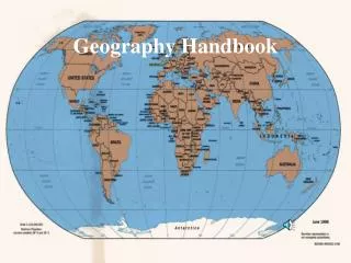
Understanding Geography: Latitude, Longitude, and Map Skills
This geography handbook provides a comprehensive introduction to fundamental concepts such as latitude, longitude, and the use of maps and globes. Learn how the Equator and Prime Meridian divide the Earth into hemispheres, and explore how latitude (north-south) and longitude (east-west) lines help determine absolute location. Discover the significance of special latitude lines like the Tropics and Circles, as well as the concept of the great circle for calculating the shortest distance between places. Enhance your geography skills with informative diagrams and practical applications.

Understanding Geography: Latitude, Longitude, and Map Skills
E N D
Presentation Transcript
GEOGRAPHY HANDBOOK How Do I Study Geography? Geography Handbook
Using Maps and Globes Hemispheres The Equator - imaginary line that divides the earthinto Northern and Southern Hemispheres. N-S hemispheres
Using Maps and Globes Equator pictures
Using Maps and Globes Hemispheres The Prime Meridian along with the International Date Line divide the earth into Eastern and Western Hemispheres. E-W hemispheres
Using Maps and Globes Prime meridian pictures
Using Maps and Globes Hemispheres diagram
Using Maps and Globes Directions to the local bank? Latitude Lines Parallels circle the earth and show latitude, the distance in degrees north or south of the equator. (0 degrees latitude). The North Pole is 90 degrees North latitude. The South Pole is 90 degrees South latitude. Latitude
Latitude represents north-south location, and it is shown on a map or globe by a series of east-west running lines that parallel the equator, which marks the midpoint between the two poles all around the earth's circumference -- these lines of latitude are called "parallels." Figure 2 -- parallels of latitude
Using Maps and Globes Latitude diagram
Using Maps and Globes Latitude Other important latitude lines are: Tropic of Cancer (23 1/2 degrees N. lat.) Tropic of Capricorn (23 1/2 degrees S. lat.) Arctic Circle (66 1/2 degrees N. lat.) Antarctic Circle (66 1/2 degrees S. lat.). Special latitude lines
Using Maps and Globes Special lines diagram
Using Maps and Globes Longitude Meridians run north to south from pole to pole. They tell longitude, the distance in degrees east or west of the Prime Meridian(0 degrees longitude). Opposite the Prime Meridian is the International Date Line (180 degrees long.). Longitude
Longitude represents east-west location, and it is shown on a map or globe by a series of north-south running lines that all come together at the North Pole and at the South Pole and are the widest apart at the equator -- these lines of longitude are called "meridians." Figure 1 -- meridians of longitude Be aware of the potential for confusing yourself: a. Longitude = E/W location, but it is shown by a series of N/S running lines called meridians. b. Latitude = N/S location, but it is shown by a series of E/W running lines called parallels.
Using Maps and Globes Longitude diagrams
Using Maps and Globes Absolute Location Using the earth's grid system, latitude and longitude, gives you the absolute location of a place. Absolute location
Using Maps and Globes Global grid diagram
Using Maps and Globes In mathematics, how do you determine the shortest distance between two places? Great Circle Route The shortest distance between two places on the earth. A great circle divides the earth into equal halves. Great circle route
Using Maps and Globes Great Circle Route Traveling along a great circle is called a great circle route. Globes show them accurately. Maps can distort distances so the great circle route may appear longer than a straight line on a flat map. Never Trust A Map! Great circle route
Relative Location Continent – 7 –