Download
1 / 35
350 likes | 370 Vues
Explore ocean earthquakes, tsunamis, and their consequences with insights on notable events like the Sumatra and Chile earthquakes. Learn about plate boundaries and seismic zones to understand the science behind these natural disasters.

E N D
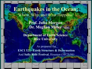
Earthquakes in the Ocean: Where, Why, and What Happens? Prof. Julia Morgan Dr. Meghan Miller Department of Earth Science Rice University As prepared for ESCI 323 - Earth Structure & Deformation And Sally Ride Festival, Houston (10/25/06)
An aside: Dale Sawyer’s Discovering Plate Boundaries Exercise(http://terra.rice.edu/plateboundary) • Designed for students to observe & classify • Appropriate for broad range of ages/exper. • Designed for 3 days, w/ variations • Excellent framework for MARGINS & similar
Where do all the earthquakes occur?? (Press et al., Understanding Earth, 4th Ed.)
Tectonic Setting- Kuriles • Subduction of Pacific Plate Plate beneath Okhotsk/N. America. • Conv. rate: ~ 9 cm/yr. • Sakhalin Island & Japan are rifted cont. Political Setting • Russia “stole” from Japan after WW II
Convergent Boundaries: Three Types In the Oceans Ocean-ocean Sumatra earthquake! M ~9.3 (2004) Ocean-continent Chile earthquake! M ~9.5 (1960) Continent-continent South Asian earthquake! M ~7.5 (2005) (Press et al., Understanding Earth, 4th Ed.)
Chile - 5/22/1960 (Source: Sawyer, Discovering Plate Boundaries) M 9.5 Earthquake (Largest worldwide) • Rupture zone ~1000 mi long. • Generated a tsunami that spread across Pacific. • Run-up: 25 m in Chile; 10.7 in Hilo; 1.7 in CA. • ~ 6000 people died, most from tsunami. • $3.5 Billion property damage
Alaska - 3/27/1964 (Source: Sawyer, Discovering Plate Boundaries) M 9.2 Earthquake (3rd or 4th largest worldwide) • 750 mi long rupture zone. • Large landslide and tsunami across Pacific. • Ground displacements 25 ft x 3 ft. • 122 people died worldwide, most from tsunami. • Property damage $500 million.
Alaska Tsunami (Press et al., Understanding Earth, 4th Ed.)
Southeast Asia - 12/26/2004 (Source: Sawyer, Discovering Plate Boundaries) M 9.3 Earthquake (2nd largest worldwide) • 1000 km long fault rupture. • Generated a tsunami that went around the world. • No warning. • More than 200,000 people died. • Untold property damage….
Sumatra Earthquake Sumatra Epicenter Indian Plate Fault zone rupture ~ 1000 km in length (Source: USGS)
What is a tsunami & How does it form? • A sudden impulse pushes the water, forming a train of waves that spreads outward from the source. • Tsunami front propagates at ~450 mi/hr (~600 km/hr). (Source: Prof. Miho Aoki, U. Alaska Fairbanks)
Tsunami Generation & Propagation (http://staff.aist.go.jp/kenji.satake/animation.gif) • Sumatra Tsunami (12/26/04) • red: rise in sea level • blue: fall in sea level
What Happens Nearshore? • As the water column shallows, wave height grows. • Tsunami run-ups can be MUCH larger than original wave. (Press et al., Understanding Earth, 4th Ed.)
What are the Consequences? (Source: Prof. Miho Aoki, U. Alaska Fairbanks) • Coastal damage and destruction.
Oregon-Washington - 1/26/1700 (Source: Sawyer, Discovering Plate Boundaries) M ~9 Cascadia Earthquake (7th largest?) • No historic record in North America. • Recorded in Japan ~9 hrs later. • Tsunami deposits found along Oregon coast. • Recurrence interval is 300-500 yrs!
January 1700 Cascadia Tsunami (Source: K. Satake, http://www.pgc.nrcan.gc.ca/press/index_e.php)
Where do Great Earthquakes occur? Rocks Sediments Tsunamigenic Slip Aseismic Slip Coseismic Slip Seismogenic Zone • Plate boundary mega-thrust Why do Great Earthquakes occur?
Where can we study great earthquakes? • Nankai Trough • Subduction of the Philippine Sea Plate beneath Eurasia. • Convergence rate: ~4 cm/yr. • Thick clastic-rich sediment section (hemipelagites and turbidites).
Earthquake Recurrence • Nankai margin is subject to repeated large (M ~ 8) earthquakes. • Evidence for tectonic segmentation of the margin. • Earthquake recurrence ~180 yrs. • -> There will be future earthquakes!! (Ando, 1975)
Co-seismic Slip Zone (Bangs et al., 2004) Up-dip limit
Toe of Muroto Transect NANKAI PRISM PROTO-THRUST ZONE NANKAI TROUGH Frontal thrusts Proto- thrusts Deformation front 1 km Depth (m) Trench Fill turbidites Shikoku Basin Strata hemipelagic sediments Proto-decollement Decollement Ocean Crust
Prism Architecture (J.C. Moore and Saffer, 2001) Seismogenic Zone Coseismic Zone Aseismic Zone Up-dip limit (after G.F. Moore et al., 2001) • Décollement partitions the incoming section: • - Accreted section vs. underthrust section. • Décollement steps down near the updip limit.
Décollement Amplitude • Downdip decrease in décollement amplitude. • Suggests dewatering of underthrust section. (Bangs et al., 2004)
Pore Fluid Pressures Seismogenic Zone Coseismic Zone Updip limit (after G.F. Moore et al., 2001) (J.C. Moore and Saffer, 2001) • Modeled pore fluid pressures are highest near up-dip limit.
Seismic-Aseismic Transition-> Onset of Earthquakes • Coincident with onset of coseismic sliding: • Out of sequence thrust. • Step down in décollement. • Reduced décollement amplitude. • Increased pore fluid pressures. • Why? Something changes along décollement: • Frictional behavior: stable vs. unstable? • Loss of strength in underthrust sediments? • Something completely different? Future fault zone drilling may tell us….