Download
1 / 24
240 likes | 419 Vues
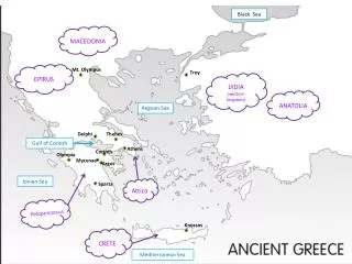
Operational Monitoring and Forecasting in the Aegean Sea Kostas Nittis National Centre for Marine Research, Athens, Greece. Review of existing monitoring and forecasting systems Present capabilities Problems - Limitations Perspectives. Overview. Research efforts on O.O.

E N D
Operational Monitoring and Forecasting in the Aegean Sea Kostas Nittis National Centre for Marine Research, Athens, Greece • Review of existing monitoring and forecasting systems • Present capabilities • Problems - Limitations • Perspectives
Research efforts on O.O. • POSEIDON Project (1997-2000, 14.1 Meuro EFTA+HMNE) • Integrated monitoring and forecasting system: real-time data from buoy network, daily forecasts, end-user products • Partners:NCMR, ΟCEANOR, UoA, UoT, NTUA • Operational since May 2000 • MFS (1998-2001, 2002-2004): Development of multiparametric M3A station, VOS Measurements, High resolution regional and coastal models • MARSAIS (2001-2003): Synergy between SAR and buoy data, Validation of Algorithms, Detection and forecasting of oil-spills • FerryBox (2002-2005): Implementation of a European network for FerryBox measurements, Operational phase: 2002-2003 • MAMA (2002-2004): Coordination on Mediterranean Scale, Capacity building, MERSEA (2002-2003): Towards GMES (2008)
The POSEIDON buoy network SeaWatch Buoys • Meteorological Sensors • Air Temperature • Atm. Pressure • Wind Speed/Direction • “Blue” Sensors • Temperature • Salinity • Current • Waves • “Green” Sensors • Dissolved Oxygen • Chlorophyll-A • Light Attenuation • Radioactivity • Height: 7.9 m • Width: 1.75 m • Weight: 900 kgr • Energy: Solar panels + batteries • Communication: Imarsat C, GSM every 3 hours
End-user products www.poseidon.ncmr.gr POSEIDON Products • On-line data (“meteo”, “blue” and “green”) • Processed Data (statistics etc.) • Meteorological Forecasts • Sea-State Forecasts (waves) • Hydrodynamic model Forecasts (currents, T,S) • Dispersion of Pollutants (oil-spills) • Near-shore wave conditions
Surface circulation characteristics Nittis et al., GAOS 2002
High frequency variability Nittis et al., MPB 2001
Tracing of Water Masses Nittis et al., GAOS 2002
Operational Models: POSEIDON (1st generation) • Based on ETA LAM • Resolution: 20/10 km • Products: Wind, Air temperature, Relative Humidity, Precipitation, Cloud cover, Atm. Pressure, Fog, … • Based on DAUT model (2d generation) • Resolution: 5km • Buoy data assimilation • Products : Height, Direction and Period fields • Based on POM • Resolution: 5km, 31lev • Rivers and Dardanelles outflow simulation • Products: 3-D Velocity, Temperature and Salinity fields
New generation Wave Model (WAM) Mediterranean Wave Model • Based on : WAM • Resolution : 0.25 o • Forced by the coarse (20km) atmospheric model Aegean Wave Model • Nested to Mediterranean model • Resolution : 0.05 o • Forced by the fine (10km) atmospheric model
New Generation HD Model Eastern Mediterranean Model • Based on : POM • Resolution : 10 km • Vertical Res. : 19 sigma levels • Forced by the coarse (20km) atmospheric model • Dardanelle's (open boundary) / Rivers Parameterisation • Initial + boundary values: MODB • 12 years climatology, 95-99 ECMWF analysis, operational 1999-now • Interactive estimation of fluxes (heat-water) Aegean Sea Model • Nested to EMED model • Resolution : 5 km • Vertical Res. : 31 σ-levels • Forced by the fine (10km) atmospheric model • Boundary values updated every 1h (T, S, U, V, W, Z + free radiation)
Forecasting Skill Evaluation a) Buoy data M: 24 hours forecasts O: Buoy observations Atmospheric Model Statistics Model Against Buoy data
Forecasting Skill Eval. c) mesoscale features Forecasted Sea Level Elevation during Summer 2000 AVHRR SST SST 1 October 2000: 24h forecast
POSEIDON Operational Oil-spill Model • Based on: PARCEL model (Koutitas 1988, Johansen 1985) • Processes: • Evaporation (Stiver et al. 1989) • Emulsification (Rasmussen 1985) • Beaching and sedimentation (Gundlach 1987) • Advection – diffusion: • 3-D current field • Horizontal and vertical mixing coefficients from hydrodynamic model (Smagorinsky, Mellor-Yamada) • Wave field • Additional data: • Date and the position of the “event” • Initial volume of the pollutant • Density of the different elements • Evacuation time • (Density of evaporation and emulsification, retention time) • Products: • Oil Concentration • Beaching • Evaporation, emulsification Pollani et al., MPB 2000
Synergy with SAR data: oil slicks detection • Synthetic Aperture Radar: • ERS1/2, RADARSAT, ENVISAT • 0,056 μm, 5,3 GHz • Repeat cycle: 35 days • Resolution: 30m • Swath width: 100km (400km Envisat)
Towards forecasting in Coastal Areas Saronikos Gulf Model • Resolution : 1.8 km • Vertical Res. : 16σ-levels • Forced by the fine (10km) atmospheric model • Nested to Aegean 5km model: Initial + boundary conditions • Boundary values updated every 1h (T, S, U, V, W, Z + free radiation)
Next steps ? • Extend the current observing capacity • Deeper layers (0-500 / 0-1000m) • New platforms (eg HF radars) • Operational RS products • Continue / Intensify efforts in coastal areas • Coordinate efforts with pan-european monitoring and forecasting efforts – Towards GMES (GMES Forum, EuroGOOS conference 3-6 December, Athens)