Download
1 / 39
410 likes | 572 Vues
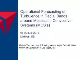
This overview highlights the mission of the 25th Operational Weather Squadron (25 OWS) under the USAF, focused on providing accurate turbulence forecasts and severe weather support for over 1,500 aircraft in 11 CONUS states. Emphasizing recent turbulence forecasting technologies and the different types of turbulence—such as low-level, thermal, mechanical, and upper-level—this presentation aims to improve operational safety during flight. With over 12,000 forecast products generated monthly, including essential weather briefings, the 25 OWS plays a pivotal role in ensuring safe military operations.

E N D
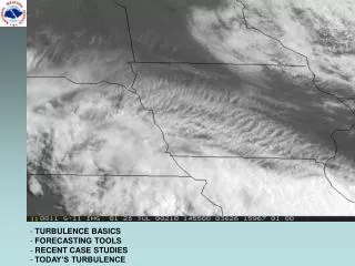
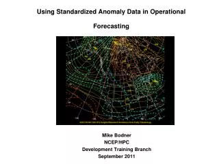
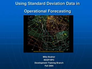
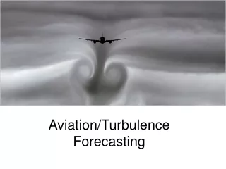
USAF Operational Turbulence Forecasting Capt Bill Ryerson Mission Execution Flight Commander 23 Oct 08
Overview • 25th Operational Weather Squadron Mission • Turbulence in All Its Forms • Recent Turbulence Forecasting Technology
Overview • 25th Operational Weather Squadron Mission • Turbulence in All Its Forms • Recent Turbulence Forecasting Technology
25 OWS Mission • Provide forecasts and severe weather support for 82 DoD locations (~1,500 aircraft) in 11 W CONUS states • Over 12,000 forecast products per month, including 2,200 Flight Weather Briefings • Forecasts for 5 bombing ranges / military operating areas • Total Assigned: 21 Officer, 134 Enlisted
25 OWS Mission 341st Space Wing Fairchild AFB East Zone McChord AFB Vagabond AAF Fort Lewis Malmstrom AFB Northwest Zone Great Falls IAP Portland ANGB Helena MTARNG AASF Colony Boise – Gowen Field Mountain Home AFB Cheyenne Regional AP RAPCON, AASF 90th Space Wing Kingsley Field ANGB FE Warren AFB Hill AFB Greely ANG Southwest Zone Reno-Stead Salt Lake City IAP Buckley AFB Boulder Beale AFB USAF Academy Peterson AFB Cheyenne Mt AFS Schriever AFB Commerce City Deseret Chemical Depot Reno-Tahoe IAP Dixon Tonopah Test Range Michael AAF Fort Carson Mather AFB Travis AFB Stockton AASF Creech AFB Rocky Mountain Arsenal Moffet Field Nellis Range 63 Onizuka AFS Fresno AT Elephant Butte (AFSSS) Nellis AFB Fresno AVCRAD Pinion Canyon Maneuver Site Phoenix Sky Harbor IAP Bicycle Lake AAF Kirtland AFB Hunter Ligget Reservation National Training Center Edwards AFB Cannon AFB Barstow Daggett Palmdale Papago AAF Santa Fe March AFB Luke AFB Los Angeles IAP Williams Gateway Melrose Range Yuma TARS Los Alamitos AAF Gila Radar McGregor Range Deming TARS San Diego Radar Marana Tucson IAP Holloman AFB Gila Bend Davis-Monthan AFB Biggs AAF, Ft. Bliss Fort Huachuca Marfa TARS Full Forecast Sites (20) Ft Huachuca TARS Severe Weather Support Sites (62)
25 OWS Mission • Provide thunderstorm and low-level (below FL180) icing and turbulence forecasts for W NORTHCOM • Provide upper-level (above FL180) icing and turbulence forecasts for all of NORTHCOM • Once-day production cycle with forecasts out to 48hr • Continuously amended
Overview • 25th Operational Weather Squadron Mission • Turbulence in All Its Forms • Recent Turbulence Forecasting Technology
Turbulence in All Its Forms • Turbulence is all the same – rapid variation in wind velocities but… • The mechanisms and conceptual models differ
Turbulence in All Its Forms • Low-level turbulence (affected by the ground) • Thermal • Vertical wind shear • Mechanical • Untrapped lee waves • Trapped lee waves • Upper-level turbulence (above effects of ground) • Vertical wind shear • Pattern recognition • Atmospheric Deformation • Frontogenesis
Thermal Turbulence • Associated with rising “thermals” above a heated ground • If temperature decreases by >3°C between ground and 1000ft, very good chance for thermal turbulence • Normally LGT • Extends to height where lapse rate no longer >3°C / 1000ft
Vertical Wind Shear • Variation of wind velocity vector (direction and speed) with height • Very reliable, “straightforward” turbulence producer (at all levels) • Thresholds for turbulence highly dependent on mean wind speed of the layer • Different from horizontal shear, which also produces turbulence
Mechanical Turbulence • Caused by various frictional effects of wind flow over the Earth • Magnitude and downstream behavior of wave depends on: • Wind Speed • Perpendicularity of wind to the barrier • Roughness / abruptness of terrain • Stability of atmosphere (warm air over cold air, or vice-versa)
Mechanical Turbulence • In an unstable environment, wave is quickly dissipated by mixing downstream of barrier • Turbulence can still be SVR, but covers smaller volume • A stable environment favors less mixing, more downstream propagation • Mountain wave turbulence caused by a specific type of propagating wave
Pattern Recognition • Identifies most likely areas for upper-level turbulence in relation to meteorological features • Ahead of shortwave troughs (leading edge of cool air in upper levels) • Strong cold air advection of 0.5°C/hr or more • Turbulence centered north of jet • Turbulence rarely found behind trough Jet Stream Area of Turbulence Shortwave Trough
Pattern Recognition • Cyclogenesis (development of low pressure) at the surface • MDT if low is deepening at 1mb/hr • MDT-SVR if deepening >1mb/hr and jet stream is >140kts
Pattern Recognition • “Digging” jet stream / jet maximum • Jet max (localized maximum in jet wind speeds) pushing southward • Shortwave trough ahead of jet max • MDT turbulence in region where jet speeds rapidly decrease Jet Max
Pattern Recognition • Two jets in close proximity • There exists several branches of the jet stream • Different jets usually at different heights • Turbulence expected if within 5° latitude
Pattern Recognition • Sharp ridge / anticyclonic curvature • Wind speeds typically decelerate at top of ridge • MDT if jet is >100kts and decelerates >25kts/°lat • SVR if jet is >140kts and decelerates >50kts/°lat • Typical height of turbulence is 6000ft below tropopause to 1000ft above it Ridge
Atmospheric Deformation • A measure of 3-D “non uniformity” of the wind • Combines: • Vertical and horizontal wind shear • Horizontal “stretching” • Horizontal convergence • Calculated using model-predicted wind flow and computer-based algorithm (Ellrod-Knapp index) • Turbulence thresholds found empirically, vary based on model resolution Ellrod-Knapp = VWS (total deformation + convergence)
Frontogenesis • The increase in the horizontal temperature gradient • Demonstrated to be one of best upper-level turbulence predictors in recent research by National Center for Atmospheric Research (NCAR) • Frontogenesis inherently leads to vertical wind shear Negative Frontogenesis Positive Frontogenesis Frontogenesis = (horizontal temperature gradient) (component of convergence perpendicular to temperature gradient)
Overview • 25th Operational Weather Squadron Mission • Turbulence in All Its Forms • Recent Turbulence Forecasting Technology
Forecast Production • Turbulence Forecaster Dashboard provides access to all tools leveraging various techniques • Utilizes overlay technology • User selects combination of products he/she wants to see • Enables end user to see products used to make forecast
Vertical Wind Shear Vertical Wind Shear w/ threshold barbs Vertical Wind Shear w/ barbs Vertical Wind Shear MDT Turbulence (with 61-120kt winds)
Mechanical Turbulence Maximum Wind Speed Near Ridge Height • Magnitude and downstream behavior of wave depends on: • Wind Speed • Perpendicularity of wind to the barrier • Roughness / abruptness of terrain • Stability of atmosphere (warm air over cold air, or vice-versa)
Mechanical Turbulence Most Favorable Wind Direction and Height for Selected Ridges • Magnitude and downstream behavior of wave depends on: • Wind Speed • Perpendicularity of wind to the barrier • Roughness / abruptness of terrain • Stability of atmosphere (warm air over cold air, or vice-versa)
Mechanical Turbulence • Magnitude and downstream behavior of wave depends on: • Wind Speed • Perpendicularity of wind to the barrier • Roughness / abruptness of terrain • Stability of atmosphere (warm air over cold air, or vice-versa) Ridge-Top Wind Direction and Perpendicular Speed Component
Mechanical Turbulence • Magnitude and downstream behavior of wave depends on: • Wind Speed • Perpendicularity of wind to the barrier • Roughness / abruptness of terrain • Stability of atmosphere (warm air over cold air, or vice-versa) Terrain Roughness
Terrain Roughness Mechanical Turbulence Max WindSpeed Terrain Roughness
Mechanical Turbulence Low-Level Lapse Rates (Stability) • Magnitude and downstream behavior of wave depends on: • Wind Speed • Perpendicularity of wind to the barrier • Roughness / abruptness of terrain • Stability of atmosphere (warm air over cold air, or vice-versa)
Mechanical Turbulence Panofsky Index • Panofsky Index • Combines wind speed, vertical wind shear, stability into one product • Used from Surface to 5000ft LGT MDT SVR Panofsky Index = (Wind speed)2 (1-((Richardson Number) / (Critical Richardson Number)) *Critical Richardson Number = 0.25
Atmospheric Deformation • Ellrod-Knapp Index Single-Layer Image Multi-Level Contoured
Atmospheric Deformation • Ellrod-Knapp Index Deep and Organized Deep but Disorganized Disorganized and Dispersed
Frontogenesis Automated Frontogenesis Product
Graphical Turbulence Guidance (GTG) • Upper-level turbulence verification and short-range (12hr) diagnostic • Combines 11 upper-level indices into single product, meshes it with live reports • Produced by NCAR and ingested into Dashboard at verification and forecasting tool Graphical Turbulence Guidance (GTG)
Overview • 25th Operational Weather Squadron Mission • Turbulence in All Its Forms • Recent Turbulence Forecasting Technology
Backup Slides Additional Upper-Level Turbulence Patterns