Download

1 / 10
100 likes | 222 Vues
Capt. Caroline Bower from the Joint Typhoon Warning Center details comprehensive operational weather forecasting methods. Utilizing QuikSCAT as a primary data source, the center verifies closed cyclonic circulations and assesses the classification of tropical disturbances. Key elements include evaluating wind distribution, proximity to land, and various factors affecting storm dynamics. Although data limitations present challenges, the integration of all available data fosters accurate warning positions for effective tropical cyclone analysis. For inquiries, reach Capt. Bower at 808-474-3946 or via email.

E N D
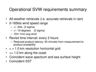
SVW in Operational Weather Forecasting Capt Caroline Bower Joint Typhoon Warning Center
Area of Responsibility 180o 140o Tokyo CPHC 33% 11% NHC New Delhi 8% 17% Australia Nadi, Fiji La Reunion 11% 13% 7%
METWATCH • QuikSCAT is the primary data source for verifying the presence of closed cyclonic circulations • Used to identify open/easterly waves, westerly wind bursts, surface convergence and troughing • Used to identify directional flow (i.e., southwesterly monsoon)
Development • Used to assess tropical disturbance classification • Poor, Fair, Good (TCFA) • First warning
TC Analysis • Assess TC wind distribution • Distribution of winds • Critical wind radii • Max wind speed reported • Position • Multiple impacts • Warning position and wind distribution • Bogus message (dotcom file) used to prime atmospheric models (i.e., NOGAPS, COAMPS, GFDN)
Usage • Assess image • Proximity to land • Rain flags (compare to vis/IR imagery) • Identify circulation center • Identify area of 35-knot winds • Measure distance to outer 35-knot wind vector in each quadrant • Assess distribution of 50-knot winds, measure radii • Assess overall symmetry of wind distribution, potential complicating factors (i.e., gradient compression)
Usage • All available data incorporated into composite fix (warning position)
Limitations • Data missing or rain flagged where it is most important • Sensor unable to accurately assess inner core winds • Data latency often on the order of several hours • Given current architecture, cannot use WindSat, TMI, SSM/I, SSMI/S (storm-centered displays) to METWATCH
Questions? Capt Caroline Bower JTWC 808 474-3946 e-mail: caroline.bower@navy.mil