Download
1 / 17
170 likes | 336 Vues
TOTAL LIGHTNING OBSERVATIONS OF SEVERE THUNDERSTORMS OVER OKLAHOMA. Christopher D. Burling Atmospheric Science Group, Department of Geosciences Texas Tech University. Relationship between lightning activity and updraft intensity

E N D
TOTALLIGHTNING OBSERVATIONS OF SEVERE THUNDERSTORMS OVER OKLAHOMA Christopher D. Burling Atmospheric Science Group, Department of Geosciences Texas Tech University
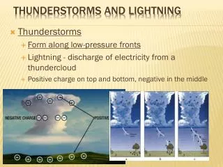
Relationship between lightning activityand updraft intensity • - stronger updrafts enhance processes that lead to charge separation • - enhanced vertical development • - inferred relationship between flash rate and severe weather • Rapid increases in flash rate, termed “lightning jumps”, have been found to precede the occurrence of severe weather (Williams et al. 1999)
Objective: to determine the effectiveness of total lightning data for the prediction of severe weather and the extent to which it may be used to supplement or surpass radar data in an operational setting Data: Total lightning (IC + CG) – Oklahoma LMA Radar – Oklahoma City WSR-88D (KTLX) Storm Reports – SPC Hypothesis: - severe weather is preceded by distinct features in the total lightning: a threshold value of flash rate, a lightning jump - that lightning data provide a longer lead time prior to severe weather than do radar data in some cases - faster update time
CALCULATION OF FLASH RATE • Flash Criteria: sources must occur within 150 ms of one another • sources must occur within a horizontal distance of 3km • at least 10 sources comprise a group • LMA data is available in 10 minute intervals • Flashes are counted and then binned into 1 minute intervals to determine a flash rate (flashes/min)
JUMP ALGORITHM (Gatlin and Goodman 2009) 2-minute average flash rate ( f ) calculated from original 1 minute flash rate data Time rate of change in flash rate ( f’ ) calculated from f Threshold value is calculated based upon running average and standard deviation of f’ from previous 20 minutes Lightning jump identified when f’(t) exceeds the threshold value
CASE 1 : 1 MAY 2008 - dryline stalled over central OK - formation of discrete supercells in unstable environment east of dry line during evening hours - southernmost cell moves NE across eastern OKC metro area and into surrounding counties 2320z May 1 – 0220z May 2 - 1 tornado (EF0), several hail reports (up to 3.5”) CASE 2 : 10 APRIL 2005 - similar to 1 May 2008 case - dryline moving slowly eastward - discrete supercell develops during evening hours - moves NE across OKC 2300 April 10 – 0230z April 11 - 1 tornado (F1), 5 hail reports, 1 wind report
1 MAY 2008 • Lightning jumps/relative maxima in flash rate coincide with or immediately precede most hail reports • Peak flash rate precedes tornado report by 11 minutes
10 APRIL 2008 • Lightning jumps/relative maxima in flash rate coincide with or immediately precede most hail reports • Lightning jump precedes 53 kt wind report • Tornado is reported well after peak in flash rate, during time of relatively minimal lightning activity
PRELIMINARY RESULTS • Majority of hail reports associated with lightning jumps/relative maxima in flash rate • Wind report preceded by lightning jump • Link between tornado reports and trends in flash rate inconclusive
FUTURE RESEARCH OBJECTIVES • Analyze flash rate trends on a much larger dataset • - identification of threshold peak flash rate value for severe vs. non-severe storms • - determine average lead times associated with different types of severe weather • - improve performance of jump algorithm • Comparison of total lightning with radar data
ACKNOWLEDGMENTS • Dr. Kyle Wiens • NWS – Lubbock • Donald MacGorman - NSSL
SOURCES Gatlin, P. N. and Goodman S.J., 2009: A Total Lightning Trending Algorithm to Identify Severe Thunderstorms. Journal of Atmospheric and Oceanic Technology. Williams, E. R. et al, 1999: The behavior of total lightning activity in severe Florida thunderstorms. Atmos. Res., 51, 245- 265.