Conservation Success in Coon Valley: From Floods to Productive Farms
380 likes | 399 Vues
Explore the transformation of Coon Valley from flooding and soil depletion to a successful conservation story. Learn how sustainable farming practices improved soil health and reduced erosion, leading to a thriving farming community.

Conservation Success in Coon Valley: From Floods to Productive Farms
E N D
Presentation Transcript
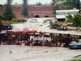
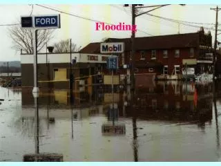
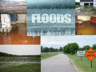
Flooding Farmers could no longer store their hay on the creek banks. Roads washed out regularly. Meanders changed every year. “One time back in the 20’s, we had three floods in one week.” -- Adolph Lee, Coon Valley farmer.
“Coon Valley … one of the thousand farm communities which, through the abuse of its originally rich soil, has not only filled the national dinner pail, but has created the Mississippi flood problem, the navigation problem, the overproduction problem, and the problem of its own future continuity.” Aldo Leopold, 1935
Huge dust clouds carried the soil hundreds of miles, all the way to the Atlantic Ocean. The soil was depleted and farms failed.
The Basic Plan • Open pasture, slopes >40% --- fence out cattle & plant trees • Woods with slope >25% --- fence out cattle & plant cover in critical spots (gullies) • Crop fields with slope >20% seed pasture or hay • Ridge top fields with slope <10% ----terrace and contour strips • All other fields with slope >3% contour strips • All flat fields ----use crop rotations
Who We Are... Since that time, NRCS has kept a commitment to protecting and conserving soil and other natural resources on America’s private lands.
Aerial view of Coon Creek Watershed showing contour strip cropping 1934 1967
95% of Coon Creek Watershed in conservation • Soil erosion reduced 75% • Gullies reduced 77% by 1978 • Grazed woodlands reduced by 85%
The Trout Barometer of Conservation Success • 1957 – 3 miles marginal trout water • 2000 - 65 miles highly productive trout streams
Soil Improvement • 20% increase in hydraulic conductivity • 100% increase in water-holding capacity • Flood peaks reduced 53%
Soil erosion reduced from 60 T/A/Y to 4 • Sediment reduced from 5.9 inches/yr to 0.2 inches/yr • 1939 - 391 linear miles of gullies; 92 miles of gullies in 1978