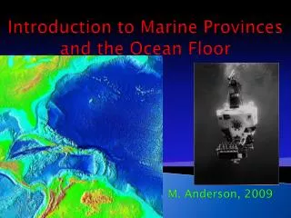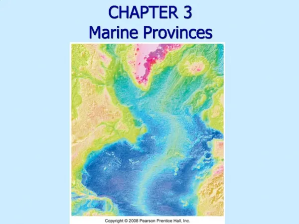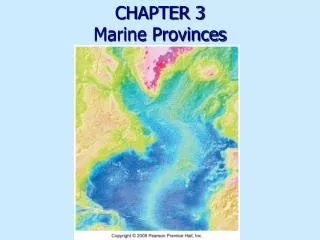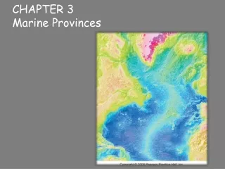
Chapter 3 Marine Provinces
Chapter 3 Marine Provinces. Essentials of Oceanography 7 th Edition. Bathymetry. Bathymetry is the measurement of ocean depths and the charting of the shape or topography of the ocean floor The ocean floor is a highly varied terrain that contains many interesting features

Chapter 3 Marine Provinces
E N D
Presentation Transcript
Chapter 3Marine Provinces Essentials of Oceanography 7th Edition
Bathymetry • Bathymetry is the measurement of ocean depths and the charting of the shape or topography of the ocean floor • The ocean floor is a highly varied terrain that contains many interesting features • Early methods of determining ocean depths involved using a long weighted line (called a sounding line)
Bathymetric techniques • Echosounders send sound through water to determine water depth and sea floor features Figure 3-1
Bathymetric techniques • Side-scan sonar uses a “fish” towed behind a ship to give a more detailed picture of the sea floor Figure 3-2
Bathymetric techniques • Low frequency sound is used to determine structure beneath the sea floor Figure 3-3
Bathymetric techniques • Satellites measure sea surface elevation, which mimics sea floor bathymetry Figure 3D
The hypsographic curve • The hypsographic curve shows the relationship between the height of the land and the depth of the oceans Figure 3-4
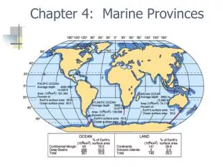
Major regions of the North Atlantic Ocean floor • Continental margin • Ocean basin floor • Mid-ocean ridge Figure 3-5
Passive versus active continental margins • Passive margin • No plate boundary • Shelf • Slope • Rise Figure 3-6
Passive versus active continental margins • Active margin • Plate boundary • Convergent • Shelf • Slope (steep) • Trench • Transform • Continental borderland Figure 3-6
Submarine canyons and deep-sea fans • Turbidity currents carve submarine canyons into the slope and shelf • Debris from turbidity currents creates graded bedding deposits and deep-sea fans Figure 3-8a
Diver in the La Jolla Submarine Canyon Figure 3-8b
Abyssal plains • Deep flat areas formed by suspension settling • Volcanic peaks poke through the sediment • Abyssal hills (seaknolls) • Seamounts • Tablemounts (guyots) Figure 3-9
Ocean trenches • Deepest parts of the ocean • Formed by plate convergence • Most trenches are in the Pacific Ocean • Associated with volcanic arcs • Island arc • Continental arc Figure 3-10
The mid-ocean ridge • Circles the globe like the seam of a baseball • Mostly traverses the middle of ocean basins • A topographically high mountain range • Entirely volcanic in origin • Associated with plate divergence • In the Pacific Ocean, called the East Pacific Rise • In the Atlantic Ocean, called the Mid-Atlantic Ridge • Internet flybys of portions of the mid-ocean ridge
The Mid-Atlantic Ridge • Traverses the center of the Atlantic Ocean • Contains a central down-dropped rift valley • Comes above sea level in Iceland Figure 3-12
Features of the mid-ocean ridge • Rift valleys • Form when plates split apart • Down-dropped areas associated with faults and earthquakes Figure 3-13
Features of the mid-ocean ridge • Pillow lava • Forms when hot lava comes into contact with cold seawater and quickly cools • Basalt composition Figure 3-14
Features of the mid-ocean ridge • Hydrothermal vents • Form when seawater is heated by magma • Black smokers emit hot water through chimneys • Associated with metal sulfide deposits and unusual lifeforms Figure 3-15
Transform faults and fracture zones • Transform Faults • Occur between segments of the mid-ocean ridge • Transform plate boundaries • Movement in opposite directions Figure 3-16
Transform faults and fracture zones • Fracture Zones • Occur beyond segments of the mid-ocean ridge • Not plate boundaries • Movement in the same direction Figure 3-16
End of Chapter 3 Essentials of Oceanography 7th Edition