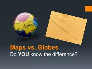
Kindergarten Unit On Maps and Globes
Kindergarten Unit On Maps and Globes. By Tabitha Angle and Celena Chastain. Table of Contents. Rationale Standards-based Education Unit Planning Template Standards Concept Map Lesson One Lesson Two Lesson Three Lesson Four Lesson Five Conclusion and Outcome

Kindergarten Unit On Maps and Globes
E N D
Presentation Transcript
Kindergarten Unit On Maps and Globes By Tabitha Angle and Celena Chastain
Table of Contents Rationale Standards-based Education Unit Planning Template Standards Concept Map Lesson One Lesson Two Lesson Three Lesson Four Lesson Five Conclusion and Outcome Teacher and Student Materials Resources
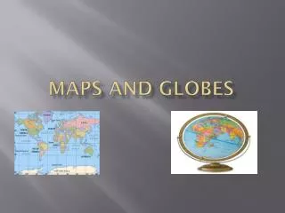
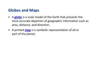
Rationale The rationale for creating this unit is to provide an opportunity for Kindergarten students to understand thata map is a drawing of a place and a globe is a model of the Earth. The unit will also increase their understanding of features of a map and globe. Throughout this unit, language arts concepts will be incorporated such as writing, listening, oral response, and reading comprehension.
Standard-based Education Unit Planning Template Standards-based Education Unit Planning Template Grade target: Kindergarten Subject: Social Studies, Language Arts Unit: Maps and Globes
Standard-based Education Unit Planning Template, Cont. • What should students know and be able to do? • They should know about the land and water features on a map and globe, explain that maps and globes show a view from above, and explain that maps and globes are a model of the Earth in a smaller size.
Social Studies State Standards SSKG2 The student will explain that a map is a drawing of a place and a globe is a model of the Earth. • a. Differentiate land and water features on simple maps and globes. • b. Explain that maps and globes show a view from above. • c. Explain that maps and globes show features in a smaller size. SEE THE STANDARDS WEBSITE AT: http://www.georgiastandards.org/SearchResults.aspx?viewmode=details&StandardIDSelected=522
Language Arts State StandardsFor Reading ELAKR6 The student gains meaning from orally presented text. The studenta. Listens to and reads a variety of literary (e.g., short stories, poems) and informational texts and materials to gain knowledge and for pleasure.c. Asks and answers questions about essential narrative elements (e.g., beginning-middle-end, setting, characters, problems, events, resolution) of a read-aloud text.f. Uses prior knowledge, graphic features (illustrations), and graphic organizers to understand text.g. Connects life experiences to read-aloud text.h. Retells important facts in the student’s own words.
Language Arts State Standard For Listening/Speaking/Viewing • ELAKLSV1 The student uses oral and visual skills to communicate. The studenta. Listens and speaks appropriately with peers and adults.b. Follows two-part oral directions.
Language Arts State Standards for Writing • ELAKW1 The student begins to understand the principles of writing. The studenta. Writes or dictates to describe familiar persons, places, objects, or experiences.b. Uses drawings, letters, and phonetically spelled words to create meaning.
Standard-based Education Unit Planning Template, Cont. • What are the essential understandings? • Understand that a map is a drawing of a place and a globe is a model of the Earth. • Students will need to know... That a map is a drawing of a place and a globe is a model of the Earth. • Students will need to be able to do... • Explain that maps is a drawing of a place and a globe is a model of the Earth. • Know that a symbol represents a real object. • Understand cardinal directions. • Design a simple map
Standard-based Education Unit Planning Template, Cont. How will I and they know when they are successful? Through teacher observation and whole group and hands-on activities students will begin to develop a sense of geographical awareness. Also through one-to-one discussions with the students and class discussions.
Standard-based Education Unit Planning Template, Cont. • What evidence will show that the students understand? (Performance Tasks, Quizzes, Tests, OtherEvidence) • What learning experiences will facilitate their success? On-line video, books, viewing sample maps and a globe, comparison of real objects and their symbols, acting out cardinal directions, and creating their own map. • What teaching and learning experiences will equip students to demonstrate the targeted understandings? The students will watch a video about maps and globes. Also, we will read a book giving information about maps and globes, view maps in our classroom, draw map symbols and compare the symbols to real-life objects, and writing about what they have learned.
Concept Web Click to view the concept map for this unit: Click here to view the unit outline:
Unit Essential Questions • Why are maps and globes important? • Why would you use a map? • When would it be necessary to use symbols? • How would life be different if we did not have cardinal directions?
Lesson One Goal: To introduce maps and globes. Learn “what are maps and globes?” Objectives: As a class, we will begin to fill out a KWL chart for prior knowledge. The students will listen to Maps and Globes by: Jack Knowlton to learn basic knowledge about the maps and globes. The students will watch a video about the features of maps and globes.
Lesson One, Cont. Activities: 1 Create a KWL chart on the Activboard or whiteboard. 2. Title the first section “What I Know about Maps and Globes”, title the second section “What I Want to Know about Maps and Globes” and title the third section “What I Learned about Maps and Globes”. 3. Complete the first and second section of the KWL chart with the students. 4. Read and discuss the following book with the children: “Maps and Globes by: Jack Knowlton to learn basic knowledge about the maps and globes. Students will participate in an oral discussion of the book. Questions should be asked based on the learners ability level. Assessment Activity: Watch and discuss with a partner the following United Streaming Maps and Globes video:
Lesson Two Goal: The students will learn about symbols on a map. Objective: The students will observe various maps. Students should pay close attention to the symbols (pictures) on the maps.
Lesson Two, Cont. Activities: 1. As a whole group, take a close look at several maps—State map, classroom map, school map, etc. 2. Have the students observe and discuss the pictures (symbols) that are on each map using EdHelper . Click to view: 3. Create a class T chart with one side labeled symbol and the other side labeled real objects. Assessment Activity: Finally, students will draw a picture to represent the objects they see in the classroom and usethe term “symbols”. Higher-level learners should be expected to label their symbols. Lower-level learners may only draw a few symbol pictures.
Lesson Three Goal: To provide the students with knowledge of cardinal directions. Objectives: Look at a map and globe to view a compass rose. Sing a song to learn about directions. Students act out cardinal directions: North, South, East, West.
Lesson Three, Cont. Activities: 1. Look at a map and globe to view a compass rose using EdHelper . Click to view: 2. Sing Dr. Jean’s “Directions” song to learn about directions. Assessment Activity: • Students act out cardinal directions: North, South, East, West. Higher-level learners should verbally tell their current cardinal direction as they are turning in the classroom.
Lesson Four Goal: To provide the students with knowledge on reading and using a map. Objectives: • Look at a map to locate various points. • Understand cardinal directions through song. • Complete City Map Reading Activity
Lesson Four, Cont. Activities: 1. Review a map and globe to view a compass rose using EdHelper . Click to view: 2. Sing Dr. Jean’s “Directions” song to learn about directions as in lesson three. 3. Complete City Map Reading Activity #1 (click the following link: http://www.enchantedlearning.com/geography/mapreading/city/ ) Assessment Activity: Children create their own map of their bedroom or another special place. Map creator online can be used for high-achieving or gifted students.
Lesson Five Goal: To find out what the children have learned about maps and globes. Objectives: The students will complete the final part of the KWL chart. The students will write about and discuss the essential question “Why are maps and globes important?”. Create a map with symbols and a compass rose.
Lesson Five, Cont. Activities: 1.As a class, complete the last section of the KWL chart. 2.Have the children answer the following essential question in their journal. Why are maps and globes important? Assessment Activities: Discuss the children’s writing. Learners will be at different levels. Some students will just draw a picture and verbally tell. Others may be writing as many as three sentences on the topic.
Conclusion and Outcome This unit is designed to help Kindergarten students understand why we use maps and globes. The students will understand maps and globes through the various activities in this unit, through observation, and discussions.
Teacher and Student Materials Maps and Globes by Jack Knowlton “Directions” by Dr. Jean Feldman (CD “Sing to Learn”) Activboard for T-Chart and KWL chart Computers with Internet connections Real life objects for creating symbols. Paper and crayons for creating a map Journals Primary resources Other resources
Resources http://www.georgiastandards.org/SearchResults.aspx?viewmode=details&StandardIDSelected=522: Georgia State Standards website http://player.discoveryeducation.com/index.cfm?guidAssetId=D90F4C51-5E6 :Unitedsteaming video clip on maps and globes 48C6-9D4F-53139D745455UnitedStreaming : maps and a globes video http://www.edhelper.com/community13_0_0.htm : Map symbols resource http://www.edhelper.com/community4_1_1.htm : Cardinal directions http://www.legis.state.ga.us/legis/2005_06/house/kids/elemen/elemindex.htm: Georgia geographical information (PRIMARY RESOURCE) http://www.atlapedia.com/index.html : viewing maps (PRIMARY RESOURCE)
Resources, Cont. • http://www.csun.edu/~hcedu013/plans.html : (PRIMARY RESOURCE) • http://www.col-ed.org/cur/sst/sst115.txt:Map skills • http://teacherlink.ed.usu.edu/TLRESOURCES/units/byrnesF2000/wenhal/hales.html : Concept web • http://teacherlink.ed.usu.edu/TLRESOURCES/units/byrnesF2000/wenhal/hales.html#anchor718466 : Map activities ideas • http://www.coreknowledge.org/CK/resrcs/lessons/K99Maps&Globes.pdf : lesson activity ideas for teaching mapping skills to Kindergarten students • http://www.gisnet.com/notebook/comprose.php :Origin of compass rose