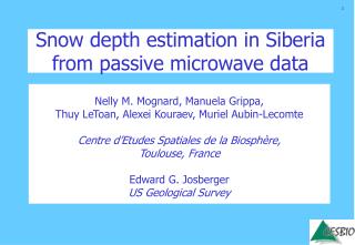
Snow depth estimation in Siberia from passive microwave data
190 likes | 426 Vues
Snow depth estimation in Siberia from passive microwave data. Nelly M. Mognard, Manuela Grippa, Thuy LeToan, Alexei Kouraev, Muriel Aubin-Lecomte Centre d’Etudes Spatiales de la Biosphère, Toulouse, France Edward G. Josberger US Geological Survey. Oceanic Circulation.

Snow depth estimation in Siberia from passive microwave data
E N D
Presentation Transcript
Snow depth estimation in Siberia from passive microwave data Nelly M. Mognard, Manuela Grippa, Thuy LeToan, Alexei Kouraev, Muriel Aubin-Lecomte Centre d’Etudes Spatiales de la Biosphère, Toulouse, France Edward G. Josberger US Geological Survey
Oceanic Circulation Atmospheric Circulation Freshwater budget Vegetation Functionning SNOW Permafrost Terrestrial Ecosystems C & H2O Cycles River Runoff
Snow Information Requirements • Snow Covered Area • Dates of start and end of snow accumulation • Snow Water Equivalent Passive Microwave Radiometers • Long time series: 20 year of SMM-R, SSM/I • Minimum atmospheric and sun effects • Basic principle of parameter recovering: - snow extent: emissivity contrast between snow covered and snow free ground - start and end of snow pack: difference in emissivity between snow and liquid water - snow water equivalent from snow depth: attenutation of emitted radiation by volume scattering
LaD averaged snow water equivalent estimates 1981-97 SMMR & SSM/I averaged snow water equivalent estimates 1981-97 NCEP air temperature averaged field 1981-97 Comparison Satellite SWE, LaD model SWE, Climatology SWE and NCEP air temperatures ETAC Climatology (US Air Force Environmental Technical ApplicationsCenter)
Satellite Passive Microwave estimates of snow depth with a dynamic algorithm Generic retrieval algorithm to globally estimate snow depth from Satellite Passive Microwave Brightness Temperature Major hypothesis: the main contributing factor to snow metamorphosis is the thermal gradient in the snow layer especially early in the snow season Dynamic algorithm allows spatio-temporal heterogeneities in the snow pack: snow crystal size varies in space and time
Dynamic algorithm • Takes in to account snow grain size metamorphism in time and space. • Requires surface air and ground temperature information.
Temperature Gradient Index, combines effects of temperature and time Linear relationship observed Differentiate Dynamic approach
Ground truth: 300 stations Validation of Dynamic Algorithm in the US Northern Great Plains SSM/I Dynamic Snow Water Equivalent algorithm validated with 300 in situ stations measurementsSnow grain size metamorphism: Dynamic Algorithm major improvement compared to classical Static Algorithm Dynamic Algorithm Static Algorithm
Dynamic algorithm very sensible to low values of dSG/dt, which correspond to SG slowly varying with time. Threshold for dSG/dt>1 Below threshold: the “static” algorithm is used with grain size derived from the dynamic algorithm at the threshold SG Temperature Static d=1.6 Dynamic Tb 19 H Tb 37 H Dynamic + Static algorithm Combined dynamic + static algorithm
Results SSM/I data 1988 -2001 + SSM-R data 1979-1987 Snow depth values calculated for each pentade (every five days). Validation of the SSM/I derived snow depth values using: - climatology from ETAC (US Air Force Technical Applications Center) - meteo sation data from HSDSD (HistoricalSoviet Database Snow Depth)
COMBINED ALGORITHM SSM/I ETAC CLIMATOLOGY (ANNUAL MAX SNOW STORAGE )*2 from IIASA STATIC ALGORITHM SSM/I Algorithm validation -I Snow depth over Siberia for January. SSM/I data have been averaged over the time period1988-2001.
COMBINED ALGORITHM SSM/I ETAC CLIMATOLOGY MEAN WINTER PRECIPITATION NCEP STATIC ALGORITHM SSM/I Algorithm validation -I Snow depth over Siberia for January. SSM/I and precipitation data have been averaged over the time period1988-2001.
Algorithm validation -II Snow depths means for January for different vegetation zone (from IIASA) Dynamic Static Climatology Snow Storage*2
Steppe Middle taiga Southern taiga Northern taiga Tundra Combined Static Climatology Algorithm validation -II The dynamic algorithm yields improved results over the static algorithm, especially in the regions of Steppe, Middle taiga and Tundra
Algorithm validation -III Comparison with meteo station data from HSDSD For each vegetation type, mean values are calculated over the pixels correspondent to the meteo station location +
Algorithm validation -III Southern taiga Steppe Temporal evolution of monthly snow depth from 1988 to 1994 Northern taiga Tundra Middle taiga Combined algorithm Static Meteo data from HSDS
Impact of snow parameters variability on the vegetation cycle • and the NPP: • analysis of the correlation of snow depth and • snowmelt date with NDVI index • Impact of snowpack variability on Arctic river discharge: • comparison with river discharge over the Ob basin Algorithm further improvements • Topography and vegetation effects • Use of dynamic map of permafrost temperatures Applications Acknowledgements: This work has been done in the framework of the Siberia-II project
Snow variables SSM/I Meteo variables NCEP SNOW MELT DATE SUMMER TEMPERATURE NDVI Spot/VGT NDVI SNOW DEPTH SUMMER PRECIPITATION Relationship between satellite-derived snow and vegetation parameters in Siberia Manuela Grippa, Thuy Le Toan, Nelly Mognard, Nicolas Delbart, Julien L’Hermitte, Alexei V. Kouraev and Muriel Aubin-Lecomte Centre d ’Etudes Spatiale de la BIOsphére, Toulouse, France Mean values over 1988-2001 Correlation between the interannual variations of NDVI and the variations of snow and meteorological parameters
TOPEX/Poseidon ground tracks over Ob ’ river watershed. Typical hydrograph (in situ data, 2001) and seasonal distribution of discharge Annual discharge at Salekhard from TOPEX/Poseidon (modelled) and in situ (RIMS) data Level (TOPEX/Poseidon) and discharge (in situ) relation for Salekhard, according to various hydrological phases