Download
1 / 18
180 likes | 347 Vues
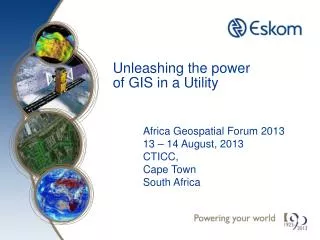
I. Unleashing the power of GIS in a Utility. Africa Geospatial Forum 2013 13 – 14 August, 2013 CTICC, Cape Town South Africa. About this presentation. Abbreviations Definitions Purpose of presentation Some background on Eskom Geospatial Science in Eskom

E N D
I Unleashing the power of GIS in a Utility Africa Geospatial Forum 201313 – 14 August, 2013CTICC, Cape TownSouth Africa
About this presentation • Abbreviations • Definitions • Purpose of presentation • Some background on Eskom • Geospatial Science in Eskom • Different views on current and end state • Geospatial Integration the Objective • People • Geospatial Data • Methods/Standards/Workflows • Software/hardware/network • Summary
ABBREVIATIONS • GISc (the science of geospatial) • GIT (the whole technology environment) • GIS (people, hardware, software, data and methods) • AM/FM (Utilities infrastructure management) • NIS (Network Information System) • HR (Hunan Resources) • IDM (Integrated demand management) • Asset Man. (Asset Management) • Outage Man. (Outage Management) • Eng. (Engineering) • Proj. Man. (Project Management) • OGC (Open source GIS Consortium) • COE (Centre Of Excellence Virtual)
Definitions • Google and Bing map • Commercial geospatial data: Is presented to attract the consumer with easy accessible and “understandable” geospatial data with the least effort and price • Currently it is still not engineering geospatial data • Visualisation of information by the incredible complex manipulations in backroom of many large and complex geospatial data sets by geoscientists supported by computers • Geospatial data is one of the critical success factors of a GIS • These geospatial data sets are captured/created through specialised activities and expanded through value adding and deriving exercises by Geoscientists and use is manipulations, analysis, what-if’s, sound geospatial decision making and consultancy. • Geospatial Science activities • Land Survey Geodesy DigitisingCartography • Converting alpha numeric data Geography Analysis • Remote sensing Airborne and Satellite Monitoring • What-if Questions Scenario building • IF YOU DREAM IT YOU CAN DO IT
Introduction Definitions • Geographic Information Systems • A GIS is a computer-based system to aid in the collection, maintenance, storage, analysis, output, and distribution of spatial data and information. (Source: Bolstad, 2012) • GIS is an integrating activity using existing knowledge, insight that geoscientists have long used to analyse natural and social systems. Computers have made it just more possible. A tool to make work performing more efficient and effective and enhance decision making • Automated Mapping and Facilities Mapping (AM/FM) • A GIS designed primarily for engineering and utility purposes, AM/FM is a system that manages databases related to spatially distributed facilities.(Source:http://www.archives.nysed.gov/a/ records/mrpubGIS 03_glossary. html
Purpose of presentation The Eskom Smallworld application with its integration of the network with operations, financial and customer service is a Automated Mapping Faculties management system • NETWORK INFORMATION SYSTEM (NIS) The improving of customer service through a more effective efficient linear network and workforce as the objective The challenge • Unleashing the power of GISc to the rest of the organisation The presentation will describe a possible way for Eskom to become a geospatial science entity
Eskom Strategic Staff functions Linefunctions Service functions Human Resources Transmission Enterprise Development Distribution Technology & Commercial Sustainability Generation Customer Service Finance & Group Capital
Generic GISc Groups within Eskom • Group 1 comprises the traditional GISc install base – workgroups and functions that use GIS • Group 2 is made up of functions that conduct business processes that have a strong location-specific component • Group 3 consists of functions that support business processes with some limited geospatial requirements • Group 4 represents non GISc users that see little or no value in geospatial capabilities
Operational Usage GISc High 1 2 4 3 GISc NIS SmallWorld Maximo NIS GISc HR – Centre of Excellence Finance Safety Generation – Ash Dumps Continuous Improvement Generation – Coal Supply Group Project Sourcing Customer care Environmental Generation, Transmission, Distribution HR IDM Supply Chain Operations GISc Importance of Geospatial Functions Sustainable Systems & Climate Change Risk & Resilience Primary Energy Network Related Top Customer Segment Construction Management GRID Access Unit Legal Outage Management Commercial & Residential Property Project Management Renewables Research, Testing & Development Engineering Project Monitoring Asset Management Project Development Low Source: IDC and ISSI, 2005 / White Paper, ESRI, Extending GIS to Enterprise Applications
Operational, Tactical and Strategic concept High Operational & Tactical GISc Applications Tactical & Strategic GISc Applications Importance of Geospatial Functions • Operational Support Systems • Are we doing things right? • Improving efficiency and effectiveness • Productivity • Established GISc • Are we doing the right things? • Doings things differently • Integration Platform • Spatially enabled applications Low Source: IDC and ISSI, 2005 / White Paper, ESRI, Extending GIS to Enterprise Applications
Commercial Residential Properties Operational Usage GISc Finance TxSIS HR NIS (AM/FM) SmallWorld, Maximo, etc. Safety HR Asset Man. ESIGIS IDM Outage Man. Proj. Man. Eng. Top Customer Segment ArcReader Construct. Man.
HR TxSIS TacticalStrategic Construct. Man. Safety HR COE NIS SmallWorld, Maximo, etc. IDM Commercial Residential Properties Asset Man. Outage Man. GIScESIGIS Proj. Man. Eng. Operations Tactical Top Customer Segment Finance ArcReader HR
Geospatial Integration Network Information System Web Services & Messaging Human Resources Primary Energy Environmental Geospatial Integration Risk and Resilience Top Customer Segment Flexible and Standards Based
People • Remedy • Education versus Training • Develop training and skills transfer • Career paths development (GISc) • Eskom to become Employer of choice • Providing training and experience to the benefit of South Africa • Bursaries, mentorships and internships as well as strategic relationships with tertiary education providers. • Requirements • Trained GISc staff (Geomaticians) • Trained GISc Application Staff • Life-long learning opportunities (research and development) • Universal GISc skills supported by training, workshops, awareness, etc. • Institutional GISc knowledgeGISc educated senior & Top management
Data • Remedy • Eskom must promote, support and assist with the South African Spatial Data Infrastructure initiative-This will benefit South Africa • Eskom to collaborate with development and funding of fundamental geospatial data sets (SBC SPOT6, Land Cover , etc.) • Investment in geospatial data must be seen as the creation of a strategic asset warranting enough sustainable support (funding, people, software, etc.) • Requirements • Eskom proprietary geospatial data developed to necessary standards • All geospatial data investment must be documented (metadata) and accessible to South Africa with few exceptions • All geospatial data must be accurate, useful and fit for purpose • Geospatial data must be developed and maintained with all Eskom requirements in mind • Ensure sustainability of all geospatial data created or acquired (medium to long-term)
Methods / Standards / Work flows • Remedy • Supporting the COE • Organisational skills • Marketing • Policy • Training/Education • Adoption of industry standards and best practises(OGC ) • Research into applications etc. The development of institutional knowledge) • Requirements • Establishment of GISc Centre of Excellence • Realisation of Eskom GISc “brain trust” • Support by Eskom management (buy-in) • Understanding of GISc as a strategic tool • Have management “mind share” • High-level visible sponsorship • Establishment of a GISc support structure within Eskom (Senior and Top management)
Software / Hardware / Networks • Requirements • Software / Hardware must align with Eskom Information Management policies and procedures • Implement the most appropriate software / hardware (fit for purpose) • Support for the standardised software platforms in South Africa and from within Eskom • Standards based (integration) • Systems / Applications must be cognisant of global and industry trends • Remedy • Line must be driving force for application and usage and not the IM/IT
Summary • Eskom • Promote Spatially enable decision making with the bigger picture in mind and using GISc as integral component • Grow awareness of GISc Educate senior and top managers • Training and exposure operational and professional staff • Sustainable contribution to fundamental geospatial data development • South Africa • Sustainable contribution in the development and maintenance of fundamental geospatial datasets • Grow GISc skills throughout SA