PART 7: “VOLCANO EXPLORER” ACTIVITY
390 likes | 570 Vues
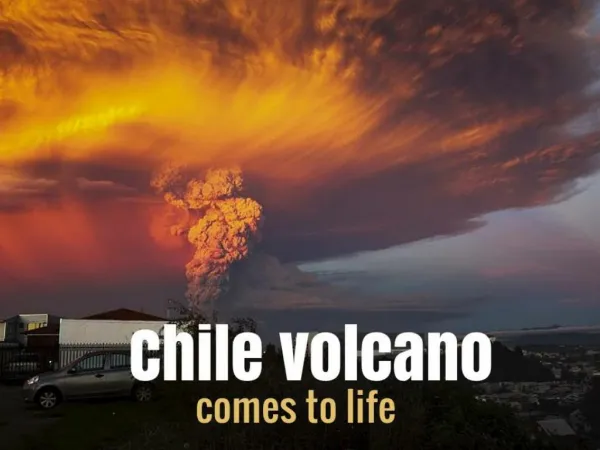
PART 7: “VOLCANO EXPLORER” ACTIVITY. GLOBAL PERSPECTIVE TECTONIC PLATES: The Earth's crust is broken into tectonic plates that fit together like a puzzle. Most of the Earth's active volcanoes can be found along these plate boundaries . RING OF FIRE :

PART 7: “VOLCANO EXPLORER” ACTIVITY
E N D
Presentation Transcript
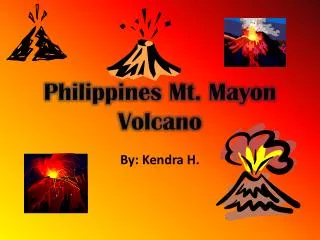
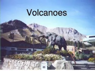
GLOBAL PERSPECTIVE TECTONIC PLATES: The Earth's crust is broken into tectonic plates that fit together like a puzzle. Most of the Earth's active volcanoes can be found along these plate boundaries. RING OF FIRE: The Ring of Fire is one of the Earth's most active volcanic zones. It runs around the Pacific Ocean. On the map below, show the area of the Ring of Fire.
LAYERS WITHIN The plates, which make up Earth's lithosphere, float on a semi-solid layer of molten rock called the mantle or the asthenosphere. The mantle has two layers: (1) the upper mantlewhich is more solid and (2) the lower mantlewhich is more liquid.
The lithospheric plates are constantly moving slowly, colliding with or drifting away from each other. Volcanoesform when this magma forces its way through weak spots in the lithospheric plates. This is most often at a plate boundary(where two plates meet).
The magma is relatively buoyant compared to the surrounding rock because it is hotter, and hotter things become less dense, causing them to rise above the rest. This increased buoyancy causes it to rise upward. When pressures are great enough, the magma ejects through the central ventand exits the volcano. A dike is a region of magmathat pushed out of the magma chamber and solidified, but never reached the surface.
Build your own volcano • Three factors affect the size • of the volcano and strength • of the eruption: • Viscosity = • resistance to flow, or • “thickness” of the magma. • (2)Amount of Gas • (3)Amount of Silica • (the more silica, • the higher the viscosity!!) • Generally, stronger eruptions are caused by __higher___ • viscosity, __higher___ gas, & _higher_ silica. CLICK THE VOLCANO For Volcano Explorer!!
VOLCANO SITES Virtual Volcano: http://dsc.discovery.com/convergence/pompeii/interactive/interactive.html Crater Lake: http://planetoddity.com/wp-content/uploads/2010/03/crater-lake-1.jpg Birth of an Island: http://www.snopes.com/photos/natural/maiken.asp Satellite Image of Eruption: http://cimss.ssec.wisc.edu/goes/blog/archives/4513 Iceland Eruption: http://www.youtube.com/watch?v=zXBER2uwepc Mt. St. Helens Eruption Video (7 min): http://www.youtube.com/watch?v=xP2dreOI8gI Hawaii Volcano Video (4min): http://video.nationalgeographic.com/video/environment/environment-natural-disasters/volcanoes/hawaii-volcanoes/
PART 10: EARTHQUAKE QUESTIONS & EPICENTER ACTIVITY FAULT: a break or crack along which rocks move - Rocks on one side of the fault slide past the rocks on the other side of the fault - Movements can be up, down, or sideways EARTHQUAKES • Two blocks of rock form at a fault - one on top of the other • Hanging wall: the block of rock above the fault • Footwall: the block below the fault • Stress can cause either the • hanging wall or the footwall to • move up or down along a fault
See the Fault Line? What wall is this? What wall is this?
Hanging wall moved UP relative to the foot wall REVERSE Hanging wall moved DOWN relative to the foot wall NORMAL Hanging wall moved up and OVER the foot wall REVERSE THRUST 2 plates move horizontally not vertically TYPES OF PLATE STRESSES LATERAL SAN ANDREAS FAULT, CA.
8.2 Measuring Earthquakes L-WAVES • Move up and down like a water wave • Slowest waves • Travel at Earth’s surface • Surface waves cause the most damage.
P-WAVES - push (compress) and pull (expand) in the direction that the waves travel • Have the greatest velocity of all earthquake waves - Travel through solids, liquids, and gases
S-WAVES • Shake particles at right angles • to the direction that they travel (side to side movement) - Travel only through solids - Slower velocity than P-waves
They affect our lives To better prepare for future earthquakes (improve building technologies) To gather information/data on where they occur, how often, how intense. Allow us to obtain information about the Earth’s interior Why is it important to study earthquakes?
Measuring Earthquakes Seismographs are instruments that record earthquake waves. Seismograms aretraces of amplified, electronically recorded ground motion made by seismographs.
1.Richter Scale (Outdated scale) • Based on the amplitude of the largest seismic wave • Does not estimate adequately the size of very large earthquakes Measuring Earthquakes 2. Moment Magnitude • • Estimates energy released by an earthquake • Derived from the amount of displacement that occurs along the fault zone • Measures very large earthquakes
LIQUIFACTION Tilted Victorian home at Howard and 17th Streets in the Mission District of San Francisco showing liquefaction-related damage from the 1906 earthquake. This area is underlain by marsh deposits that were covered by artificial fill in the middle to late 1800s. The earthquake shaking caused the artificial fill to liquefy and lose its ability to support the house.(Photograph U.S. Geological Survey)
TSUNAMIS A tsunami triggered by an earthquake occurs where a slab of the ocean floor is displaced vertically along a fault.
LANDSLIDESWith many earthquakes, the greatest damage to structures is from landslides and ground subsidence, or the sinking of the ground triggered by vibrations.
FIREIn the San Francisco earthquake of 1906, most of the destruction was caused by fires that started when gas and electrical lines were cut.
INDEX LINES PART 11: TOPOGRAPHIC MAPPING
B What is the contour interval? 20 Feet What is the highest point on the map? 859 feet What is the height at point A? 780 feet What is the height at point B? 660 feet What direction does Equation Creek flow? North Is the slope of the land greater under the green line or the purple line (lines are the same size!) A GREEN LINE