Mountain Weather Phenomena
660 likes | 727 Vues
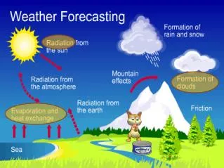
Learn about the impact of complex terrain on weather patterns, including mountain-valley circulations and terrain channeling effects. Explore resources for observing surface weather phenomena.

Mountain Weather Phenomena
E N D
Presentation Transcript
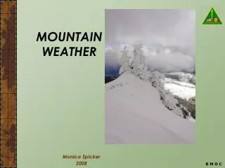
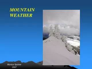
Mountain Weather Phenomena John Horel NOAA Cooperative Institute for Regional Prediction Department of Meteorology University of Utah jhorel@met.utah.edu With significant contributions from Dave Whiteman, U/Utah
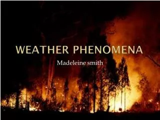
Cedar Fire Pyrobubble 28-29 October 2003 Mike Fromm, NRL Rene Servranckx, CMC Dan Lindsey, CO St. Larry Di Girolamo, U. IL Photos from http://www.wildlandfire.com/pics/cedar_socal/cedar.htm
Cedar Fire Hot Bubble Hot spots just before pyrobubble appears. Big hot spot is Cedar Fire. GOES-10 Ch 2-4 29 Oct 03 02:15 UTC
The Cedar Fire Pyrobubble Sequence GOES imagery 3.9 micron – 11 micron (channel 2 – channel 4) http://rammb.cira.colostate.edu/projects/pyrocu/29oct03/diffloop.asp 11 micron (Channel 4) http://rammb.cira.colostate.edu/projects/pyrocu/29oct03/irloop.asp Comments from M. Fromm: The pyrobubble was a singular event in the life of the So. CA fires in 2003. Note how the smoke blows strictly offshore before the ~02 UT blob “launch.” Then after launch, the low smoke veers from west to north to northeast to east. Note also a “trail” of material blowing off at different eastward directions behind the blob. This trail no doubt reveals the wind profile at that time. Thanks to Dan Lindsey, CIRA, for these loops.
Reference • Barry, R., 1992: Mountain Weather and Climate. Rutledge (new edition soon) • Blumen, W., 1990: Atmospheric Processes Over Complex Terrain. American Meteorological Society, Boston, MA. (old, but still good reference material) • Garratt, J., 1992: The Atmospheric Boundary Layer. Cambridge • Kossmann, M., and A. Sturman, 2003: Pressure-driven channeling effects in bent valleys. J. Appl. Meteor., 42, 151-1158. • Stull, R. B., 1999: An Introduction to Boundary Layer Meteorology. Kluwer • Whiteman, C. D., 2000: Mountain Meteorology. Oxford • COMET modules: • See http://meted.ucar.edu/mesoprim/flowtopo/ • See http://meted.ucar.edu/mesoprim/gapwinds/ • See http://meted.ucar.edu/mesoprim/mtnwave/
Outline • Part I • Characteristics/impacts of complex terrain • Part II • Basin and mountain-valley circulations • Part III • ROMAN and MesoWest: resources for observing surface weather
Mountains in North America Whiteman (2000)
Mountains of the western US Whiteman (2000)
What are the effects of complex terrain? • Substantial modification of synoptic or meso- scale weather systems by dynamical and thermodynamical processes through a considerable depth of the atmosphere • Recurrent generation of distinctive weather conditions, involving dynamically and thermally induced wind systems, cloudiness, and precipitation regimes • Slope and aspect variations on scales of 10-100 m form mosaic of local climates (Barry 1992)
Atmospheric scales of motion Whiteman (2000)
Mean January 500 mb hemispheric map Wallace & Hobbs (1977)
Winter pressure patterns Whiteman (2000)
Summer pressure patterns Whiteman (2000)
Areas of Cyclogenesis Whiteman (2000)
Areas of Anticyclogenesis Whiteman (2000)
Flow splitting around an isolated mountain range Convergence zones often form on the back side of isolated barriers (Ex: Puget Sound convergence zone) Whiteman (2000)
Frontal movement up and over a mountain barrier Whiteman (2000)
Terrain channeling • Terrain-parallel jet may develop in post-frontal environment • Contributes to development of frontal nose Steenburgh and Blazek (2001)
Passage of low pressure center over mountains Whiteman (2000)
Planetary boundary layer 1 km Height (m) • Energy and mass exchanges near ground • Canopy • Terrain • Heterogeneous surfaces • Clouds/fog • Urban environment, air pollution D. Lenschow
Pollutant Transport in Valleys Nighttime Stable Layer in Valley After Breakup of Nighttime Stable Layer in Valley Savov et al. (2002; JAM)
Shallow Drainage Flows – Mahrt, Vickers, Nakamura, Soler, Sun, Burns, & Lenschow – BLM, 101, 2001. Schematic cross-section of prevailing southerly synoptic flow, northerly surface flow down The gully, and easterly flow likely drainage flow from Flint Hills. Numbers identify the Sonic anemometers on the E-W transect. E is to the right and N into the paper.
Wind flagging of trees Justus (1985)
Introduction to terrain-forced flows • Two types of mountain winds • Terrain-forced flows: produced when large-scale winds are modified or channeled by underlying complex terrain • Diurnal mountain winds (thermally driven circulations): produced by temperature contrasts that form within mountains or between mountains and surrounding plains • Terrain forcing can cause an air flow approaching a barrier to be carried over or around the barrier, to be forced through gaps in the barrier or to be blocked by the barrier. Use COMET modules for further background • See http://meted.ucar.edu/mesoprim/flowtopo/ • See http://meted.ucar.edu/mesoprim/gapwinds/ • See http://meted.ucar.edu/mesoprim/mtnwave/ • Three variables determine this behavior of an approaching flow • Stability of approaching air (Unstable or neutral stability air can be easily forced over a barrier. The more stable, the more resistant to lifting) • Wind speed (Moderate to strong flows are necessary) • Topographic characteristics of barrier
Angle of attack Whiteman (2000)
Wind variations with topo characteristics • Wind increases at the crest of a mountain (more so for triangular than for rounded or plateau-like hilltops) • Separation eddies can form over steep cliffs or slopes on either the windward or leeward sides • Speed is affected by orientation of ridgeline relative to approaching wind direction (concave, convex) • Winds can be channeled through passes or gaps by small topographic features • Sites low in valleys or basins are often protected from strongest winds, but if winds are very strong above valley, eddies can form in the valleys or basins bringing strong winds to valley bottoms. • Wind speeds are slowed by high roughness • In complex terrain, winds respond to landforms (valleys, passes, plateaus, ridges, and basins) and roughness elements (peaks, terrain projections, trees, boulder, etc.)
Flow Around Mountains A flow approaching a mountain barrier tends to go around rather than over a barrier if: -ridgeline is convex on windward side -mountains are high -barrier is an isolated peak or a short range -cross barrier wind component is weak -flow is very stable -approaching low-level air mass is very shallow Because Rockies and Appalachians are long, flow around them is uncommon. But these types of flows are seen in the Aleutians, the Alaska Range, the Uinta Mountains, the Olympics and around isolated volcanoes.
Wind variations with topo characteristics • Height and length can determine whether air goes around barrier; to carry air over a high mountain range or around an extended ridge requires strong winds • When stable air splits around an isolated peak, the strongest winds are usually on the edges of the mountain tangent to the flow
Wakes and eddies are common in mountains • Vertical and horizontal dimensions a function of stability • They form behind terrain obstacles when approach flow has sufficient speed • Eddy: swirling current of air at variance with main current • Wake: eddies shed off an obstacle cascading to smaller and smaller sizes. Characterized by low wind speeds and high turbulence. • Vortex: whirling masses of air in form of column or spiral, usually rotate around vertical or horizontal axis. • Eddy examples: rotors; rotor clouds; drifts behind snow fences, trees and other obstacles; cornices. Winds are slowed to distances of 15 (sometimes 60) times obstacle height. Wakes, eddies, vortices
Wakes Large, generally isotropic vertical-axis eddies can be produced by the flow around mountains or through gaps as eddies are shed from the vertical edges of terrain obstructions. Orgill (1981)
Separation eddies Whiteman (2000)
Flow through Passes, Channels and Gaps Gaps - major erosional openings through mountain ranges Channels - low altitude paths between mountain ranges Mountain passes - Strong winds in a gap, channel or pass are usually pressure driven - i.e., caused by a strong pressure gradient across the gap, channel or pass. Regional pressure gradients occur frequently across coastal mountain ranges because of the differing characteristics of marine and continental air. These pressure gradients usually reverse seasonally.
Pressure driven channeling through Columbia Gorge Other well-known gap winds: Caracena Strait, CA Strait of Juan de Fuca (Wanda Fuca) Fraser Valley, BC Stikine Valley (nr Wrangell) Taku Straits (nr juneau) Copper River Valley (nr Cordova) Turnagain Arm (Anchorage) Whiteman (2000) Pacific High, heat low in Columbia Basin Excellent windsurfing as wind blows counter to the river current with high speeds. http://www.iwindsurf.com
Flow through passes & gaps Whiteman (2000)
Venturi or Bernoulli effect Whiteman (2000) Venturi effect causes a jet to form as winds pass through a terrain constriction and strengthen.
Forced channeling Whiteman (2000)
Pressure driven channeling Whiteman (2000)
Dynamic Channeling Kossman and Sturman 2003
Blocking Affect stable air masses and occur most frequently in winter or coastal areas in summer The blocked flow upwind of a barrier is usually shallower than the barrier depth. Air above the blocked flow layer may have no difficulty surmounting the barrier and may respond to the ‘effective topography’ including the blocked air mass. Onset and cessation of blocking may be abrupt.
Mountains as flow barriers Whiteman (2000)
Cloud waterfall Whiteman (2000)
Flow Over Mountains Approaching flows tends to go over mountains if 1) barrier is long 2) cross-barrier wind component is strong 3) flow is unstable, neutral or only weakly stable Common in North American mountain ranges. Evident by presence of lenticular clouds, cap clouds, banner clouds, rotors, foehn wall, chinook arch, and billow clouds as well as blowing snow, cornice buildup, blowing dust, downslope windstorms, etc.