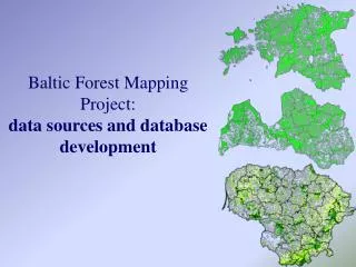
Baltic Forest Mapping Project: data sources and database development
Baltic Forest Mapping Project: data sources and database development. Data sources and BFM database development. Lithuania. Forest stand attribute database, containing descriptions of over 1.3 mil. stands. Stand level GIS database.

Baltic Forest Mapping Project: data sources and database development
E N D
Presentation Transcript
Baltic Forest Mapping Project:data sources and database development
Data sources and BFM database development Lithuania Forest stand attribute database, containing descriptions of over 1.3 mil. stands. Stand level GIS database GIS database of Lithuanian forest resources at a scale 1:50000, covering the whole territory of the country NATURA 2000 database “Capercaillie leks” database, being developed by the Lithuanian Ornithological Society Data on long living nests of some important bird species
Data sources and BFM database development BFM database development in Lithuania was organized in the following way: 1. Every forest stand of the country’s forests was checked, if it does meet any of BFM primary and supplementary criteria and forest family and type was defined. Protection status of the stand according to the proposed nomenclature was assigned to the stand either. 2. Forest stands, meeting one or more primary or supplementary criteria and representing one of BFM forest types, were selected for subsequent studies. 3. In the case stand level GIS information was available, corresponding stand boundary polygons were selected. 4. Most of the databases were provided to the BFM project in their original content and format 5. To carry out all the data filtering and calculations a special Arc Macro Language based module was developed 6. It was not always possible to trust the data from Forest Inventory and Management institute
Data sources and BFM database development Three levels of detail have been used Level 1 database was developed for those areas, where stand level GIS database was available to the moment of calculations. Level 1 database is developed for Latvia and Estonia Level 2 database includes aggregated characteristics for forest block. It was developed for Latvia and Lithuania Level 3 database was developed for all 3 countries
BFM criteria BFM type Protection status Attribute component of BFM database Level 1 Level 2 Level 3
The share of BFM uneven-aged, multi-layer stands with large amount of over-mature trees (criterion 17) in 25 ha cell