Download
1 / 29
290 likes | 418 Vues
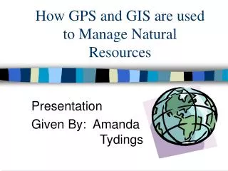
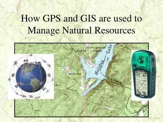
How GPS and GIS are used to Manage Natural Resources. GPS – Global Positioning System What is it?. GPS consists of satellites which continuously orbit the Earth. There is a network of ground stations used for monitoring and control of the satellites.

E N D
GPS – Global Positioning System What is it? • GPS consists of satellites which continuously orbit the Earth. • There is a network of ground stations used for monitoring and control of the satellites. • GPS provides users with accurate information on position, velocity, and time anywhere in the world.
BASIC INFORMATION • PROVIDED BY GPS RECEIVERS . . . • YOUR CURRENT POSITION • COORDINATES (LATITUDE & LONGITUDE, UTM, MGRS, ETC.) • ELEVATION (APPROXIMATE) • DIRECTION TO SPECIFIED WAYPOINTS (“MARKERS”) • (0R BETWEEN WAYPOINTS) • DISTANCE TO SPECIFIED WAYPOINTS • (0R BETWEEN WAYPOINTS) • YOUR SPEEDOF TRAVEL • YOUR DIRECTIONOF TRAVEL
. . . AND OFTEN MUCH MORE MAPS TIME OF DAY ESTIMATED TIME OF ARRIVAL COORDINATES OF CITIES & TOWNS AREA MEASUREMENT ETC.
MILITARY AUTOMOTIVE SURVEYING AGRICULTURE FORESTRY ENVIRONMENTAL PUBLIC SAFETY HUNTING NATURE STUDY FISHING BOATING BIKING SKIING SNOWMOBILING SOME GPS APPLICATIONS
The NAVSTAR System from GPS Land Navigation by Michael Ferguson
Satellites • There are 24 satellites that continuously orbit the Earth at an altitude of 11,000 miles • Radio signals are sent from the satellites and are picked up by the GPS receivers. • GPS receivers must lock on to at least 3 satellite radio signals to properly navigate.
THE EARTH: Latitude & Longitude from GPS Land Navigation by Michael Ferguson
ACCURACY STANDARD CIVILIAN RECEIVERS (Selective Availability OFF) The accuracy of the receivers is dependent on the number and quality of the signals from the satellites. HORIZONTAL ACCURACY TO 0.25-15 METERS (49.2’) OR BETTER VERTICAL ACCURACY (altitude) TO 1-100 METERS
ERROR SOURCES Multipath interference Atmospheric/Ionospheric Geometric DOP Human Error! LINE OF SIGHT from GPS Land Navigation by Michael Ferguson
MAP DATUMS • WGS84 World Geodetic System 1984 Default datum on Garmin and most other GPS receivers. Most accurate datum, but not yet in wide use on maps. • NAD27 (NAD27CONUS) North American 1927 Older datum used on most USGS topographic maps. (We will be using this datum for the workshop) • NAD83 North American Datum 1983 Very similar to WGS84. Used on newer USGS maps. • and hundreds of others!
COORDINATE SYSTEMS • LATITUDE / LONGITUDE(ANGULAR) DEGREES - MINUTES - SECONDS • UTM / UPS (RECTANGULAR, METRIC) UNIVERSAL TRANSVERSE MERCATOR(WE WILL BE USING UTM IN OUR FIELD EXERCISES) UNIVERSAL POLAR STEREOGRAPHIC
Garmin eTrex Models with Area Measurement Capability “eTrex+” Venture$149.00 Legend $209.00 Vista $285.00
AREA MEASUREMENT USING “ACCESSORIES” 1. On Menu page, enter Accessories 2. Enter Area Calc. (area calculation triangle). 3. Highlight and press Start (stop will appear). 4. Travel perimeter of the tract, then press Stop. 5. Record and save (as a track) if desired. 6. Clear the track log. Area and perimeter measurements can be displayed in in a variety of units.