Download
1 / 10
100 likes | 268 Vues
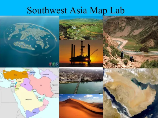
Southwest Asia Political and Physical Map (Cut-away boxes PowerPoint). Sarah Johnston. 4) Explain the importance of the Suez Canal, the Bosporus Strait, and the Strait of Hormuz as choke points.

E N D
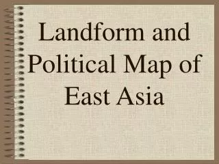
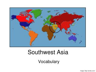
Southwest Asia Political and Physical Map(Cut-away boxes PowerPoint) Sarah Johnston
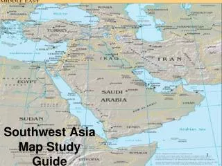
4) Explain the importance of the Suez Canal, the Bosporus Strait, and the Strait of Hormuz as choke points. • The Suez Canal is important because it is used to transport goods from Asia to ports in Europe and North Africa. • The Bosporus Strait is important because it is a highly desirable location for controlling transportation and trade to the both Russia and the interior of Asia. • The Straits of Hormuz is important because they are the only waterways that lead to the huge oilfields of Saudi Arabia, Iraq, and Kuwait.
4) Pictures/Maps of the Suez Canal, the Bosporus Strait, and the Strait(s) of Hormuz
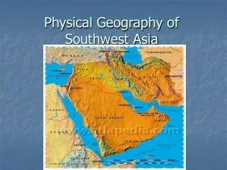
5) Explain the important uses of the Tigris and Euphrates Rivers. • The land near the Tigris and the Euphrates Rivers are important because they are well watered and very fertile, which makes them great for agriculture. This supports and has supported many river valley civilizations.
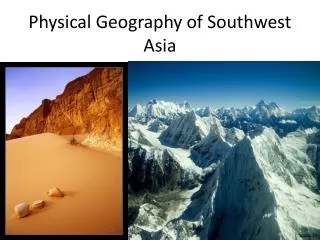
6) How has the arid climate impacted Southwest Asia? • The semi arid climate is suitable for the growth of crops that include cotton and wheat, along with some grasses and low-growing shrubs. The land also offers good pasture for animals such as goats. The goats' hair is then exported and/or used to make fabric, which is also an exported good.
9) Describe the social importance of the city of Jerusalem. • Jerusalem is a city that is very important to those who practice various religions. • To the Jewish, Jerusalem is important because it is not only the center of their homeland (and has been for many centuries), but is also where some of the religions’ earliest temples were housed. Examples of these are the First and Second Temples. • As for those who follow Christianity, Jerusalem is a sacred location, for it is where Jesus' final suffering and crucifixion took place. Annually, thousands of Christians visit places such as the Church of the Holy Sepulchre and the Mount of Olives. • For the Islamic, Jerusalem also plays an important role. It is considered the third most holy city in the world (after Mecca and Medina). There is a shrine there called Dome of the Rock, and it is believed that their prophet Muhammad rose into heaven there. It is also believed that it is where Abraham got ready to sacrifice his son Isaac to God.
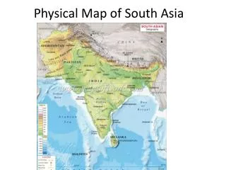
10) Using the population density map on page 528, explain where people live in Southwest Asia and why they live there. • The population density map shows that many of the people of Southwest Asia live ear the coastlines. This is because the land more towards the center is a lot more arid and it is more difficult to obtain water. The uninhabited areas are usually areas with extremely harsh living conditions.
Citations • http://images.google.com/images?hl=en&source=hp&q=suez+canal&gbv=2&aq=0&oq=Sue&aqi=g10 • http://images.google.com/images?hl=en&source=hp&q=bosporus&gbv=2&aq=0&oq=bosp&aqi=g10 • http://images.google.com/images?gbv=2&hl=en&sa=1&q=strait+of+hormuz&aq=0m&oq=hormuz&aqi=g-m1&start=0 • http://images.google.com/images?gbv=2&hl=en&sa=1&q=tigris+and+euphrates+rivers&aq=1&oq=tigris&aqi=g10&start=0 • http://images.google.com/images?gbv=2&hl=en&sa=1&q=jerusalem+temple&aq=2&oq=jerusale&aqi=g10&start=0 • http://images.google.com/images?gbv=2&hl=en&sa=1&q=jerusalem&aq=f&oq=&aqi=g10&start=0