Download
1 / 27
350 likes | 730 Vues
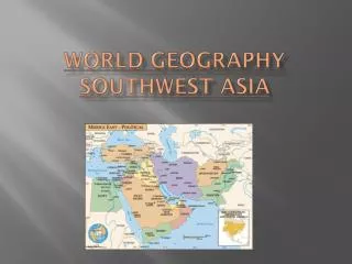
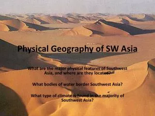
Physical Geography of Southwest Asia. Chapter 21 Section 1, 2 & 3. Physical World. Political World. Historical Overview. The Fertile Crescent, stretching from modern Iraq to Israel, was the birthplace both of agriculture and civilization.

E N D
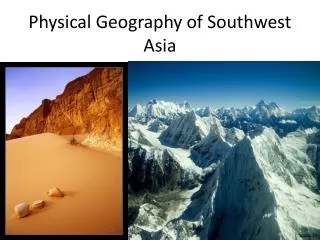
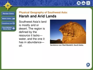
Physical Geography of Southwest Asia Chapter 21 Section 1, 2 & 3
Historical Overview • The Fertile Crescent, stretching from modern Iraq to Israel, was the birthplace both of agriculture and civilization. • Here, hunters and gatherers first began to raise plants and animals for food about 8000 B.C. in a process known as the agricultural revolution.
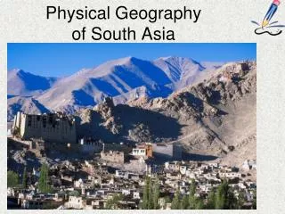
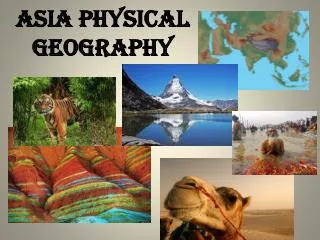
People sometimes picture Southwest Asia as region of sand dunes & land areas with an oasis, but the land actually range from seas, green coastal plains to snow-peaked mountain. • It forms a land bridge that connects Asia, Africa, & Europe.
It is situated at the edge of a huge tectonic Plate, Arabian Plate, Eurasian Plate, Turkish-Aegean Plate, & African Plate.
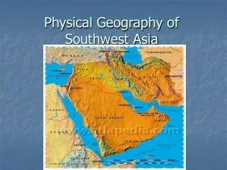
Section 1: Landforms & Resources • Landforms Divide the Region • 1. Arabian and Anatolian peninsulas; • Arabian bounded by the Red Sea (leading to the Suez Cana) and the Persian Gulf; Straits of Hormuz; Anatolian bounded by the Black Sea and the Mediterranean Sea; Bosporus Strait and Dardanelles Strait. • Goods from Asia flow through this canal to ports in Europe and North Africa.
Plains and Highlands • 2. Most of the Arabian Peninsula is covered by plains, which are mostly barren lands with wadis, riverbeds that are usually dry; Hejaz Mountains on southwest corner. Most of Iran is a high, sandy, stony desert; • People living here have adapted to the harsh conditions by living nomadic lives in search of water. • Anatolian Peninsula is also a plateau. The Northern Plain of Afghanistan is a well-watered agricultural area. • Some areas are productive for agriculture, while other areas support flocks of grazing animals such as sheep and goats.
Mountains 3.Rugged mountains divide the land and countries. Afghanistan is mountainous and includes the Hindu Kush. Afghanistan is landlocked and mountainous, so contact w/outside world is difficult. The Elbuz Mountains and Zagros Mountains help create isolation or block clear passage in Iran. The Taurus Mountains separate Turkey from the rest of Asia. In spite of these physical barriers, people, goods and ideas still move through the region. One way is through water.
Water • 4. Southwest Asia is almost completely surrounded by bodies of water. But rivers can go dry during the year or will not flow because of the arid area. • The Tigris and Euphrates supported ancient civilizations and still help with agriculture. It flows through Turkey, Syria, and Iraq. • Empties into the Persian Gulf. • The Jordan River is a precious source of water; Its also serves as a natural boundary between Israel and Jordan. • The Jordan River flows into the Dead Sea which is a landlocked salt lake. The high salt content makes the sea’s waters nearly uninhabitable for plant and animal life.
Resources for a Modern World: It is almost impossible to think about resources without including oil. • 1. Major oil fields are located in the Arabian Peninsula, Iran, and Iraq. About two-thirds of the world’s oil reserves are in Southwest Asia.(66%) • 2. Most important resource is water, which is relatively plentiful in Turkey, Iran, Lebanon, and Afghanistan but scarce elsewhere. Also coal, metallic minerals such as potash and phosphates are plentiful. Around the Dead Sea are salts such as chloride.
Section 2: Climate and Vegetation • 1. Sandy Deserts: Rub al-Kahli and An-Nafud desert on Arabian Peninsula; Also Syrian Desert and the Negev, which does produce some crops • 2. Salt Deserts: Iran has two salt deserts, or salt flats, the Daht-e Kavir and the Dasht-e Lut • 3. Semiarid lands: on the edge of deserts with enough rainfall to support some grass and crops and to pasture animals • 4. Coastal lands: Adequate rainfall along Mediterranean Coast allows crops to grow year round
1. Oasis: Desert area where vegetation can grow because underground springs supply water • 2. Salt flat: flat, dry area in the rain shadow of a mountain range where chemical salts create a salt flat
Human-Environment Interaction • 1. Dams: the series of dams Turkey is building will provide water and electricity for some parts of the country while causing people downstream from the dam to lose water. • 2. Irrigation systems: the National Water Carrier project in Israel carries water from the north to use as drinking water and for agriculture, but the pipeline is a source of international conflict as it passes through other countries but is used only by Israel. • 3. Drip Irrigation: uses small pipes that drip water just above ground to conserve water for crops.
4. Desalinization: removes salt from ocean water but is costly and cannot meet all water needs. • 5. Fossil water: water pumped from underground aquifers; this exhausts a precious resource
Oil resources • 1. remains of plants and animals changed overtime and transformed by pressure and heat • 2. first in 1908 in Persia; in 1938 on Arabian Peninsula and Persian Gulf; in 1948, in one of the world’s largest oil fields in Saudi Arabia • 3. Crude oil must travel to a refinery through pipelines or tankers or both. • 4. Risk of oil spills, especially from ocean-going tankers.