Download
1 / 29
290 likes | 458 Vues
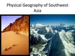
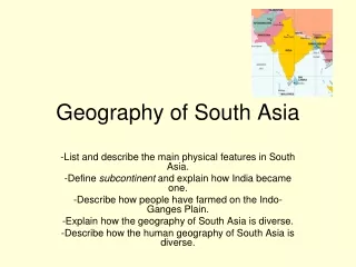
Physical Geography of South Asia. Land Features. I. A SEPARATE LAND. *South Asia is about ½ the size of the continental United States at 1.7 million square miles. *it is separated from the rest of Asia by its ???????

E N D
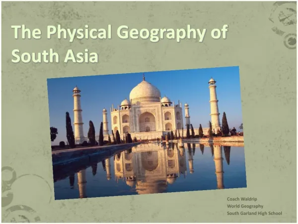
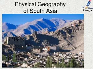
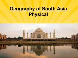
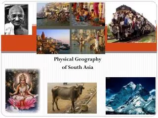
Physical Geography of South Asia
I. A SEPARATE LAND *South Asia is about ½ the size of the continental United States at 1.7 million square miles
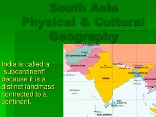
*it is separated from the rest of Asia by its ??????? *South Asia is called a subcontinent (large distinct landmass that is joined to a continent) *it is bordered by . . . -W = ???? -S = ???? -E = ???? -N = ????
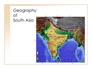
II. A LAND OF GREAT VARIETY *in the north, you find the world’s highest sharp, icy peaks that rise above the desert plateaus and rich valleys *in the south, you find lower, eroded mountains and flat plateaus
A. Himalaya -South Asia was part of Africa 60 million years ago *broke off and collided with the southern edge of Asia *collision created . . . Himalaya and Hindu Kush *Mt. Everest in Himalaya = 29,035 feet (highest peak in the world)
B. Other Northern Landforms 1. Khyber Pass *historically, invaders from north could enter this region through a few narrow crossing passes, such as Khyber Pass (in Hindu Kush between Pakistan and Afghanistan) *How do you think this pass impacted early life in this region?
2. Ganges Plain *lies at foot of Himalaya *watered by Indus, Ganges, and Brahmaputra Rivers *1/10 of population lives in this area – India’s most densely populated area *world’s longest alluvial plain
3. Chota Nogpur Plateau *high tableland of forests in northeast India
C. Central Landforms (Vindhya Range) -formed by collision between Indian subcontinent and Asia *divides India into northern and southern physical and cultural regions (we will look more at this with culture)
D. Southern Landforms 1. Eastern and Western Ghats *form a triangle of rugged hills (eroded mountains)
2. Deccan Plateau *between Eastern and Western Ghats *very rich, black soil, because once covered by volcanic ash *Western Ghats prevent yearly rainy winds from reaching the plateau (leaves it arid)
3. Karnataka Plateau *receives the plentiful rainfall from above (#2) *hills are lush and green (rainforest located here) *good for growing crops
III. MAJOR RIVER SYSTEMS *rivers are the key to life here – provide drinking water, transportation, alluvial soil, fishing, and hydroelectric power to the people of this region
A. Indus River -flows mainly through Pakistan -important transportation route and irrigation source to orchards in the region -Indus River Valley = the cradle of ancient Indian civilization (one of the earliest in the world)
B. Brahmaputra River -joins the Ganges River in Bangladesh -major waterway for ships to sail inland from the Bay of Bengal (navigable) -also provides Bangladesh with 50% of its power (hydroelectric power)
Varanasi C. Ganges River -most important river of South Asia *named after Hindu goddess, Ganga – Hindus consider the river sacred -during the summer monsoon, heavy rains cause devastating floods along the Ganges
IV. NATURAL RESOURCES *South Asia depends on a variety of natural resources for its livelihood A. Energy Resources -some petroleum reserves, but mainly dependent on imported oil
B. Minerals -South Asia supplies 90% of the world’s mica (layered rock used in making electrical equipment) -Sri Lanka produces sapphires, rubies, and other precious and semi-precious stones -exporters of silver fir, oak, magnolia, beech, birch, teak, and sandalwood C. Timber
I. SOUTH ASIA'S CLIMATES Directions: Work with a partner to complete the table below.
II. MONSOONS *much of South Asia experiences 3 distinct seasons: -cool (from October to late February) -hot (from late February to June) -wet (from June or July until September)
*these periods depend on seasonal winds called monsoons -cool season – dry monsoon winds blow from north and northeast (from Himalaya)
-hot season – warm temperatures heat the air, which rises and triggers a change in wind direction -wet season – moist ocean air from the Arabian Sea blows in from the south and southwest, bringing monsoon rains
III. NATURAL DISASTERS -high temperatures allow farmers to produce crops, but they can also result in evaporation and dried-out, nutrient-poor soils A. Hot Season
B. Wet Season -rainfall waters crops, but areas outside the monsoon path (Deccan Plateau and western Pakistan) receive little or no rainfall -monsoons may also cause flooding (especially in Bangladesh) which kill livestock and people and destroy homes and crops
C. Cyclones -cyclones often form in this region due to low atmospheric pressure -they bring heavy winds and rain -in 1999, a cyclone struck Orissa, India and killed nearly 10,000 people and caused more than $20 million in damages