Download
1 / 19
250 likes | 1.04k Vues
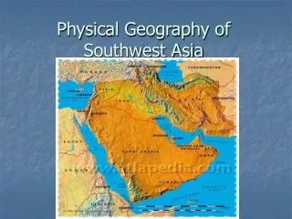
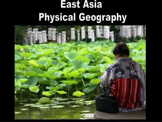
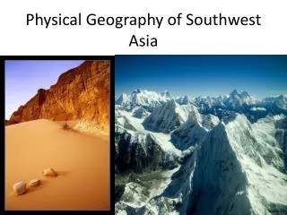
Physical Geography of SW Asia . What are the major physical features of Southwest Asia, and where are they located? What bodies of water border Southwest Asia? What type of climate is found in the majority of Southwest Asia? . Southwest Asia. Introduction to Southwest Asia.

E N D
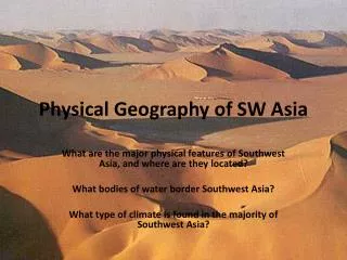
Physical Geography of SW Asia What are the major physical features of Southwest Asia, and where are they located? What bodies of water border Southwest Asia? What type of climate is found in the majority of Southwest Asia?
Introduction to Southwest Asia Southwest Asia is bordered by the Mediterranean Sea, the Caspian Sea, southern Europe, northeastern Africa, the Red Sea, the Arabian Sea, Black Sea, and mainland Asia. Countries in Southwest Asia include Jordan, Israel, Saudi Arabia, Turkey, Iran, Iraq, and Afghanistan. Map of many of the nations of Southwest Asia. Sudan and Egypt are not a part of Southwest Asia. On what continent are these two countries located?
The Arabian Peninsula A large part of Southwest Asia consists of the Arabian Peninsula. The Arabian Peninsula is located between the Red Sea and the Persian Gulf, and it is bordered to the south by the Arabian Sea. The Arabian Peninsula is an arid region covered by numerous deserts.
Climate The majority of Southwest Asia has an arid (desert) climate. As a result of the arid climate, the majority of Southwest Asia is covered by numerous deserts. Mediterranean, highland, semi-arid, and temperate climates are also found in Southwest Asia.
Deserts Southwest Asia is home to numerous deserts. These deserts include the Arabian Desert, the Rub’ al Khali, and the Negev Desert. Because so much of Southwest Asia is covered by deserts, water shortages and droughts are very common in the region.
Rivers---Tigris and Euphrates Rivers The two major rivers or Southwest Asia are the Tigris and Euphrates Rivers. These two rivers begin in the mountains of southeastern Turkey and flow south until emptying into the Persian Gulf. They are the majorfreshwatersource for many of the people of Southwest Asia. The lands between the two rivers are some of the most fertilelands in all of Southwest Asia.
Tigris River Tigris River--- Dam on the Tigris is southeastern Turkey Tigris River--- The Iraqi city of Baghdad is located on the Tigris River
Euphrates River Euphrates River--- The Ataturk Dam in Turkey is located on the Euphrates River. Euphrates River--- The Euphrates River flowing through eastern Syria.
Rivers---Jordan River The Jordan River begins north of the Sea of Galilee and flows south before emptying into the DeadSea. The river flows through the modern day nations of Israel, Jordan, and Syria. The river forms the modern day border between Israel and Jordan. The river is a major source of freshwater for the people of these nations.
Seas--- The Arabian Sea The Arabian Sea is located between the Indian Ocean and the ArabianPeninsula. It has been a majortransportationroute for thousands of years and continues to be used today.
Seas--- Mediterranean Sea A The Mediterranean Sea is located on the western borders of Israel, Lebanon, and Syria and on the southern border of Turkey. Like the Arabian Sea, the Mediterranean Sea is an importantshippingroute for modern trade. D C E B Eastern Mediterranean seen from space Turkey (A), Israel (B), Lebanon (C), and Syria (D) Mediterranean Sea (E)
Seas---Red Sea The Red Sea is located between the Arabian Peninsula and eastern Africa. The Red Sea is a major shipping route for goods and resources traveling to and from Europe and Asia. The RedSea and the MediterraneanSea are connected by the man-made SuezCanal. Red Sea (A) Eastern Africa (B) Arabian Peninsula (C) B A C
C The Suez Canal B The Suez Canal is a man-madewaterway that connects the Red and Mediterranean Seas. It is located in the African nation of Egypt. The Suez Canal was built to shorten travel distances between Europe and southern and eastern astern Asia. The ships that travel the Suez Canal carry numerous goods and resources including food and fossil fuels. A Red Sea (A), Suez Canal (B), Mediterranean Sea (C)
The Suez Canal Commercial sea traffic on the Suez Canal. Satellite Image of the Suez Canal Suez Canal (A), Mediterranean Sea (B), Red Sea (C) B A C
Persian Gulf and the Strait of Hormuz The Persian Gulf is located between the ArabianPeninsula and the modern day nation of Iran. The Persian Gulf is a major shipping route and home to the world’slargest known oilreserves. The Strait of Hormuz links the PersianGulf to the ArabianSea (via the Gulf of Oman).
Persian Gulf Large Japanese oil tanker on the Persian Gulf Persian Gulf (A), Saudi Arabia (B), Iran (C), Strait of Hormuz (D), Gulf of Oman (E) C A D E B
Strait of Hormuz The Strait of Hormuz is a narrow waterway that connects the Persian Gulf to the Arabian Sea The Strait of Hormuz seen from space Strait of Hormuz (A), Persian Gulf (B), and Arabian Sea (C) A B C
Gaza Strip The Gaza Strip is a territory that is bordered by Israel, Egypt, and the MediterraneanSea. Gaza Strip