Download
1 / 10
180 likes | 583 Vues
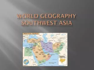
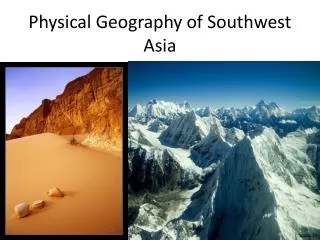
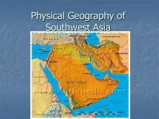
Physical Geography of Southwest Asia . Arabian Peninsula . Separated from Africa by the Red Sea and the rest of Asia by the Persian Gulf . The colored areas make up the Arabian Peninsula. Suez Canal . Goods from Asia flow from this canal to ports in Europe and North Africa .

E N D
Arabian Peninsula • Separated from Africa by the Red Sea and the rest of Asia by the Persian Gulf The colored areas make up the Arabian Peninsula
Suez Canal • Goods from Asia flow from this canal to ports in Europe and North Africa Suez Canal website
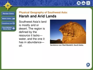
Plains and Highlands • Much of the Arabian Peninsula is covered by plains and highlands • Causes dry, sandy and windy conditions • Wadis- riverbeds that remain dry for most of the year except during rainy season
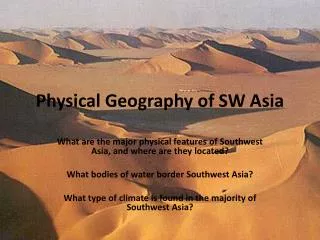
Climate • Southwest Asia is extremely arid • Most areas receive less than 18 inches of rain per year • Covered with rough, dry terrain that varies from huge tracts of sand dunes to great salt flats
Deserts • The most famous desert in this region is the Rub al-Khali • Know as the “Empty Quarter” • The size of Texas and located on the Arabian Peninsula • Locally called “place where no one comes out”
Scarcity • Water is the most scarce resource in the region. • It’s availability determines where people live, their economic activities, even their diet and health.
2 Most Important Rivers • Tigris and Euphrates • Supported several ancient river valley civilizations in an area called the fertile crescent • Flow parallel to each other for hundreds of miles before joining at Shatt al Arab
Abundant Resources • Oil • One-half of the world’s oil reserves are found in Southwest Asia, along the coast of the Persian Gulf