Download
1 / 14
180 likes | 749 Vues
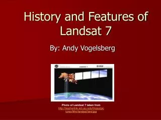
History and Features of Landsat 7. By: Andy Vogelsberg. Photo of Landsat 7 taken from http://teacherlink.ed.usu.edu/tlnasa/pictures/litho/landsat/land.jpg. History of Landsat Program. The Landsat program was inspired by Apollo moon bound missions.

E N D
History and Features of Landsat 7 By: Andy Vogelsberg Photo of Landsat 7 taken fromhttp://teacherlink.ed.usu.edu/tlnasa/pictures/litho/landsat/land.jpg
History of Landsat Program • The Landsat program was inspired by Apollo moon bound missions. • William Pecora proposed the idea of having remote sensing satellites in space in 1964. • Eight years later, his proposal became reality, and the Landsat program had begun. • Landsat 1 was launched on July 23, 1972. Since then, six other satellites have been launched. • Landsat 7 is the most recent satellite we have launched, providing us the most technological data possible.
Landsat 7 • Landsat 7 was launched on April 15, 1999 from Vandenberg Air Force Base in California and was built to last at least 5 years. • The purpose of Landsat 7 is to replicate the capabilities of other launches, as well as provide new information. • Landsat 7 can provide more information than any of the previous Landsat satellites at a lower cost. • 532 images a day can be produced by Landsat 7. • Landsat 7 orbits the earth at an altitude of 705 Kilometers and covers a swath width of 185 km. • The satellite covers the whole earth in 15 days or 232 orbits. • Landsat 7 weighs 1973 kg. • The observing instrument on board Landsat 7 is the Enhanced Thematic Mapper Plus (ETM+).
Enhanced Thematic Mapper Plus(ETM+) • The ETM+ was also used on Landsats 4 and 5. • Landsat 7’s ETM+ has features that other satellites did not. • These features make Landsat 7 a more useful component for studies in global change, monitoring of land cover, and mapping large areas. Image of Landsat 7 ETM+ taken from: http://landsat.usgs.gov/project_facts/history/images/ETM+instrument.jpg
Components of Landsat 7 A drawing of Landsat 7 taken from: http://directory.eoportal.org/images/LS7_Auto4.jpeg
Advantages of Landsat 7’s ETM+ Landsat 7’s ETM+ is different from previous thematic mappers because it offers: • a panchromatic band with 15m spatial resolution • on-board, full aperture, 5% absolute radiometric calibration • a thermal IR channel with 60m spatial resolution • an on-board data recorder (Bulleted data taken directly from http://landsat.gsfc.nasa.gov/about/landsat7.html)
Malfunction on Landsat 7 • On May 31, 2003 Landsat 7 experienced its first problems. • The Scan Line Protector (SLC) on board Landsat 7 failed. The problem created narrow bands on images formed by Landsat 7 to be missing. • These narrow bands were caused because image scanning in the SLC was at an angle instead of being parallel. • To this day, the malfunction of the SLC is still affecting images acquired by the satellite. • Landsat 7 loses approximately 22% on each image it acquires because the SLC is not operable. • Methods are being done by the USGS to duplicate all missing data due to the malfunction of the SLC.
Affects of No SLC • The SLC’s job was to compensate for the forward motion of Landsat 7. • Without it, a zig zag motion is created. (bottom left) • The photo on the right shows the affected area created without no SLC. Images taken from http://landsat.usgs.gov/data_products/slc_off_data_products/slc_off_background.php
Major Advantages of Landsat 7 • Landsat 7 continues to give us high-quality data with the ETM+ which dates back to Landsat 4 in 1982. Since data looks similar, global change is easy to detect from pre-existing archives. • Data acquisition is optimum, because Landsat 7 takes all photos in sun lit conditions. Information from NOAA is also used to keep images cloud cover minimal. • Landsat 7 can obtain and store more data faster than any other form of remote sensing instrument. • The data collected by the satellite is easy to get through the USGS or EROS at an affordable price. • The Landsat 7's ETM+ has been called "the most stable, best characterized Earth observation instrument ever placed in orbit." (Taken from http://landsat.gsfc.nasa.gov/about/landsat7.html) • Landsat 7’s ETM+ has also set the standard on accuracy for all other remote sensing systems. The ground accuracy acquired through Landsat 7’s data is second to none.
Controllers of Landsat 7 • The Flight Operations Team (FOT) is in charge of command control as well as telemetry operations for Landsat 7. • All controls of the sattelite take place in the Mission Operation Center in the Goddard Space Flight Center which is located in Greenbelt Maryland. • Data is captured from the sattelite in both Sioux Falls SD, as well as Alice Springs Australia. • Backup sites are also located in Poker Flat Alaska and Svalbard Norway.
Mission Operations Center http://ls7pm3.gsfc.nasa.gov/mainpage.html http://ls7pm3.gsfc.nasa.gov/mainpage.html
Images Taken by Landsat 7 Top Left:Cap Canaveral Launching Site Middle:Flooding in South Africa Top Right:Flooding in New Orleans due to Hurricane Katrina medias.obs-mip.fr/.../en/systemes/landsat.html landsat.usgs.gov/gallery/detail/411/ gisdata.usgs.net/.../categories.asp?catid=10
Composite Images of Landsat 7 • Left Image: True Color Composite (Bands 321) • Middle Image: Near Infrared Composite (Bands 432) • Right Image: Short-wave Infrared Composite (Bands 742) chesapeake.towson.edu/data/all_composite.asp
References • National Aeronautics and Space Administration, Landsat 7, World Wide Web URL: http://landsat.gsfc.nasa.gov/about/landsat7.html • Wikipedia, The Free Encyclopedia, Landsat 7, World Wide Web URL: http://en.wikipedia.org/wiki/Landsat_7 • National Aeronautics and Space Administration, Landsat 7 Science Data Users Handbook, World Wide Web URL: http://landsathandbook.gsfc.nasa.gov/handbook.html • National Aeronautics and Space Administration, SLC-off Products: Background, World Wide Web URL: http://landsat.usgs.gov/data_products/slc_off_data_products/slc_off_background.php • Landsat 7, Supplying data users worldwide with low cost, multi-purpose, land remote sensing data into the next century, World Wide Web URL: http://geo.arc.nasa.gov/sge/landsat/l7.html • Landsat 7 Home Page, World Wide Web URL: http://ls7pm3.gsfc.nasa.gov/mainpage.html