Download
1 / 35
350 likes | 544 Vues
Riparian Floodplain Regulations. Amy Shatzkin Elizabeth Borden April 27, 2004 Local Land Use Law and Policy . Major riparian Systems in the continental U.S . . www.mhhe.com. U.S. FLOOD FACTS Floods are the most common natural disaster.

E N D
Riparian Floodplain Regulations Amy Shatzkin Elizabeth Borden April 27, 2004 Local Land Use Law and Policy
Major riparian Systems in the continental U.S. www.mhhe.com
U.S. FLOOD FACTS • Floods are the most common natural disaster. • Yearly, almost 200 Americans lose their lives in floods. • 90 % of all presidential declarations of emergency or major disaster area involve flooding. • Flood hazard areas exist in almost every American community. 7.4 million buildings are located in flood hazard areas. • On average, flood damages throughout the nation annually exceed $3 billion. • Direct and indirect costs of flood recovery are borne by all American taxpayers - not just flood victims. http://www.dcr.state.va.us
Floodplains are flat, alluvial tracts of land adjacent to rivers defined by 100-year flood What is a Floodplain ?
How Do Floodplains Differ? Floodplains vary depending on geographic region and: • Topography • Development • Seasonal vs. flash flood events Factors that exacerbate flooding: • Wetland infilling • Impervious surface cover
States: Not Flooded Equally www.fema.gov
Why is This Natural Phenomena a National Disaster? • Centuries of commercial, industrial and agricultural development along floodplains has increased impervious surface cover and infilling of wetlands. • These activities “channelize” rivers and increased flood water volume and speed. • Flooding causes disastrous financial consequences, and loss of life and property due to our patterns of floodplain settlement. • The purpose of floodplain management is to curb losses, and not to preserve natural resources
‘Stages’ of Floodplain Regulation Eras of floodplain regulation: • Pre - 1968 • 1968 - National Flood Insurance Program (NFIP) • Post - 1993 flooding • 1994 - National Flood Insurance Performance Act established the Community Rating System (CRS) www.fema.gov
National Flood Insurance Program (NFIP) 1968 Congress enacted this program to: • Better indemnify individuals for flood losses through insurance; • Reduce future flood damages through State and community floodplain management regulations; and • Reduce Federal expenditures for disaster assistance and flood control. Main program components include: • Floodplain identification and mapping • Floodplain management • Floodplain insurance THIS PROGRAM WAS LARGELY INEFFECTIVE UNTIL. . . US ARMY CORPS OF Engineers
52 people died 74,000 people displaced 47,650 homes damaged or destroyed 15,600 square miles flooded $15 billion in financial loss A daily highlight on the evening news Floods of 1993
The Galloway Report (1993 - 1995) recommended initiatives to increase federal, state and local government collaboration. • In 1994, as part of the National Flood Insurance Reform act, FEMA established a Flood Mitigation Assistance grant program to assist states and communities to develop mitigation plans to reduce future flood damages • Codified Community Rating System, which rewards communities that adopt floodplain regulation ordinances with insurance discounts In the Wake of 1993
Regulatory Cascade 1.Federal Government FEMA provides insurance, mapping help, disaster relief 2. State Governments States are mandated to adopt NFIP’s floodplain ordinances and ensure the compliance of municipalities and counties. States can adopt stricter provisions. 3. Local Governments Counties or municipalities adopt their own, specified floodplain ordinances, or adopt the state standard
1002 communities will participate by May 1, 2004. Reduces flood insurance premiums for properties in participating communities All communities must implement FEMA approved elevation certificates for new buildings. Repetitive loss communities must adopt, implement, and update a comprehensive flood plan Communities ranked on list of 18 criteria - only a handful are concerned with local regulations The % of reduction depends upon the suite of flood protection measures implemented A Class 1 rating provides a 45%premium reduction. A Class 10 provides no reduction. Community Rating System (CRS)
Community Rating System Criteria Communities can participate in any of the 18 activities in the following 4 categories: • Public Information Activities • Mapping and Regulatory Activities • Flood Damage Protection Activities • Flood Preparedness Activities - CRS credits activities undertaken in any town ordinance • A high CRS rating does not = environmentally-oriented standards - Some very environmentally-oriented communities do not participate in CRS
CRS Minimum Requirements: Just Keeping Heads Above Water Basic Tenets of CRS Regulations: • Mapping to delineate floodplains • Regulations concerning floodplain development • No floodway residential development • Floodplain development highly regulated • Flood water displacement regulations • Lowest floor lever 1 ft – 3 ft about Base Flood Elevation
All CRS communities have strict restrictions on floodplain development But is this innovative? How do communities distinguish themselves? No Adverse Impact Provisions (Lincoln, NE) Regulations to protect natural resources imbedded in ordinances(Pima, AZ) No floodplain development (Cary, NC) Innovative Ordinances: Streams of Thought
Lincoln, Nebraska (7):No Adverse Impact • Geography • Lower Platte South NRD • Creek River Watershed • High development potential
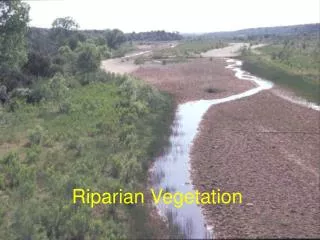
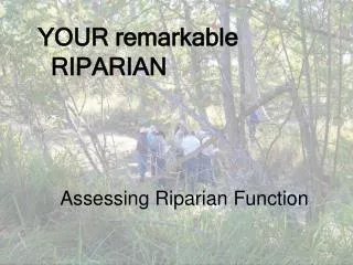
Innovative Regulations No Adverse Impact • Flood stages (height) • Velocity • Flows (volume) • Erosion or sedimentation Larry Larson, CFM Executive Director Association of State Floodplain Managers
Floodplains and Development are Dynamic Larry Larson, CFM Executive Director Association of State Floodplain Managers
Pima County, AZ (6):Regulations to Protect Natural Resources
Santa Cruz River Floodplain development and groundwater pumping have since lowered these water tables, which has significantly altered the biologically rich and diverse riparian corridors of Eastern Pima County Endangered Rivers and Water Tables
Considered by some to be the best country-wide conservation plan Chuck Huckleberry, Pima County Administrator is prime advocate Floodplain regulations come under its umbrella. Sonoran Desert Conservation Plan (SDCP)
Natural Resource Management and Preservation • 16.04.020 • Contents and purpose of provisions. • A. Floodplain management must be seen in perspective, not only as flood hazard minimization, but as one element of an integrated program of natural resource management and flood and erosion hazard reduction. • B. The floodplain management board recognizes that it is both necessary and desirable to maintain a balanced and cooperative relationship between human communities and the land and resources which sustain them. Maintaining the stability, health, diversity and natural flora and fauna of the environment is essential.
Cary, NC: Prohibit Floodplain Development • Located near Raleigh & Durham. The headwaters of the Neuse and Cape Fear Rivers flow through town • Prohibit all floodplain development • 200% population growth between 1990 – 2000 • Want to retain high water quality • Headwaters of 2 major rivers • Protect watershed for municipal drinking supply • No longer participate in CRS • From sign laws – stormwater, everything in town is highly regulated
Cary, NC 14.2.3. Development Restrictions and Related Standards in and near Flood Hazard Areas. (a) Development Restrictions. In general, no development is allowed in the 100-year floodplain unless one or more of the following are met: a major special use is approved; the property/use is exempted from this requirement; and/or the development is for roads, greenways, pedestrian crossings, park related equipment, public utilities and facilities such as waste water, gas, electrical, and water systems that are located and constructed to minimize flood damage
Change Agents Events: • Specific flood disasters, water quality problems • Fear of encroaching development Infrastructure: • Progressive environmental regulations – part of a municipality/county’s holistic approach • Funding mechanism for regulatory agency
Methods Web site information, e-mails, personal conversations from: • Association of State Floodplain Managers (ASFPM) - State Representatives • FEMA - NFIP State Coordinators • FEMA - CRS Ratings • City and county administrators
Final Thoughts Regulations Are Not Sink or Swim • Federal structure encourages uniformity in regulations • Regulatory innovations are often a matter of degree, not radical new approaches • Many innovative ideas are outside ordinances and are found within comprehensive plans and other community initiatives • The most “environmental” communities oversee floodplains in conjunction with watershed, stormwater, and water quality management