Download
1 / 24
740 likes | 2.16k Vues
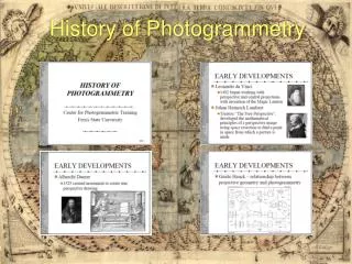
History of Photogrammetry. History of Photogrammetry. History of Photogrammetry. History of Photogrammetry. History of Photogrammetry. History of Photogrammetry. History of Photogrammetry. History of Photogrammetry.

E N D
The material for the above presentation was gathered from RobertBurtch at Ferris State University, through the Ferris State website.
The P.L.S.S. http://www.nationalatlas.gov/articles/boundaries/a_plss.html
Types of Land Survey Boundary surveyA survey for the express purpose of locating the corners and boundary lines of a given parcel of land. This involves record and field research, measurements, and computations to establish boundary lines in conformance with the Professional Land Surveyor Act. Easement lines may also be located and/or established with this type of survey. Cadastral Survey Cadastral survey is the name for the original survey, resurvey of the lands belonging to the public under the Public land survey system for the purpose of the re-establishment of the property lines. Construction SurveyConstruction staking of improvements shown on improvement plans for control of construction on developments for roads, buildings, pipelines, etc. Control SurveyPrecise location of horizontal and vertical positions of points for use in boundary determination, mapping from aerial photographs, construction staking, and other related purposes.
Types of Land Survey Court Exhibit or Judicial Survey This survey is useful in the court room for the purpose of registration. This survey involves the analysis of the various legal descriptions and maps; it also involves the cross checking of the different fields located in the description and the actual, the monuments and the physical aspects of the place and all this information has to be presented in a visual exhibit so that it could be used in the court room with ease. Elevation or Floodplain Survey This survey is conducted to estimate the altitude of the various sections of the building or the land. The results derived from this survey are often used in building plans and it also helps in determining whether the property is in flood zone or not. Hydrographic and Underwater Surveys These surveys collect data on the water bodies, they provide details regarding depth of water, the contours, the direction and the velocity of the current, the place where the immovable objects are located in the under waters.
Types of Land Survey Geodetic Survey Survey that takes into account the curvature of the Earth. Surveys over large areas require this method. Plane SurveySurvey where the mean surface of the Earth, for a given area is measured as a plane. Curvature of the Earth is not significant enough to account for in surveys of small areas. Subdivision Survey The subdivision of a tract of land into smaller parcels, showing monumentation and survey data on a map, in conformance with local ordinances and the Subdivision Map Act. Lot Split Survey These surveys are needed when a piece of land has to be divided in two or three pieces. Source http://www.articlesbase.com/business-articles/types-of-land-surveys-716398.html
Instruments of Land Survey Theodolite
Instruments of Land Survey Total Station Source Wikipedia
Instruments of Land Survey A GPS receiver determines its position by using the signals that it observes from different satellites. Since the receiver must solve for its position (X,Y,Z) and the clock error (x), four SVs are required to solve receiver's position using the following four equations: R12 = (X - X1)2 + (Y - y1)2 + (Z - z1)2 + x2 R22 = (X - X2)2 + (Y - y2)2 + (Z - z2)2 + x2 (3) R32 = (X - X3)2 + (Y - y3)2 + (Z - z3)2 + x2 R42 = (X - X4)2 + (Y - y4)2 + (Z - z4)2 + x2 where (x1,y1) (x2,y2) (x3,y3) and (x4, y4) stand for the location of satellites and R1, R2, R3, R4 are the distances of satellites from the receiver position (Figure-3). Hence solving the four equations for four unknowns X,Y, Z and x, the position or location of the station is calculated.
Instruments of Land Survey fig. 3: Calculating locations using GPS Source: http://www.gisdevelopment. net/technology/gps/ techgp0038.htm
Instruments of Land Survey A Level is used for differential leveling
For Future Studies Make sure to check out the wicki at: http://gipwest.wikispaces.com/. An entire manual of Survey with chapters on Survey Trig. Videos on a wide range of things including commercial photogrammetry.
Organizations • American Congress on Surveying and Mapping (ACSM) • American Society for Photogrammetry and Remote Sensing (ASPRS) • Association of American Geographers (AAG) • Cartography and Geographic Information Society (CAGIS) • Geospatial Information Technology Association (GITA) • GIS Certification Institute (GISCI) • International Association of Assessing Officers (IAAO) • Management Association for Private Photogrammetric Surveyors (MAPPS) • National States Geographic Information Council (NSGIC) • University Consortium for Geographic Information Science (UCGIS) • Urban and Regional Information Systems Association (URISA)