Photogrammetry
Photogrammetry. Lecture 5-b. What is Photogrammetry. Photogrammetry is the art and science of making accurate measurements by means of aerial photography: Analog photogrammetry (using films: hard-copy photos) Digital photogrammetry (digital images)


Photogrammetry
E N D
Presentation Transcript
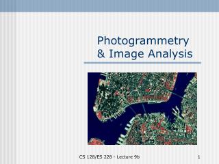
Photogrammetry Lecture 5-b
What is Photogrammetry • Photogrammetry is the art and science of making accurate measurements by means of aerial photography: • Analog photogrammetry (using films: hard-copy photos) • Digital photogrammetry (digital images) • Aerial photographs were the first form of remote sensing imagery. • Differences between photogrammetry and Remote Sensing are that photographs are: • Black and white (1 band) or color (blue, green, red, and IR) • Wavelength range of 0.3-1.0 m • Use cameras • One type of remote sensing imagery
Types of vantage points to acquire photographs • Vertical vantage points • Low-oblique vantage points • High-oblique vantage points
Vertical Aerial Photography Goosenecks of the San Juan River in Utah Jensen, 2000 Most are vertical aerial photography
Low-oblique Aerial Photography Low-oblique photograph of a bridge on the Congaree River near Columbia, SC. Jensen, 2000
High-oblique Aerial Photography High-oblique photograph of the grand Coulee Dam in Washington in 1940 Jensen, 2000
Color Science additive • Additiveprimary colors: • Blue, Green, and Red • Subtractiveprimary colors(or complementary colors): • Yellow, Magenta, and Cyan • Filters (subtract or absorb some colors before the light reaches the camera): • Red filter (absorbs green and blue, you can see red) • Yellow (or minus-blue) filter (absorbs blue, allows green and red to be transmitted, which is yellow) • Haze filter (absorbs UV) Subtractive
Types of photographs • Black and white photographs • Panchromatic (minus-blue filter used to eliminate UV and blue wavelengths) • IR (IR-sensitive film and IR only filter used to acquire photographs at 0.7- 1.0 m ) • UV (at 0.3-0.4 m, low contrast and poor spatial resolution due to serious atmospheric scattering) • Color photographs • Normal color (Haze filter used to absorb UV and create true color 0.4-0.7 m, or blue, green, red) • IR color (Yellow filter used to eliminate blue and create IR color (or false-color infrared) of 05-1.0 m, or green, red, and IR) • 4 bands (blue, green, red, and IR)
Normal color False-color infrared
False-color infrared Normal color
Scale of photographs • Image size/ real world size : • S = ab/AB • Focal length/ altitude above ground: • S = f / H
Scale (2) In real world In the image 1’ = 12 ” S = f / (H-h) S = 0.012/ (6 x 12) = 1/6000 Max scale, minimum scale, and average or nominal scale
Digital Cameras • Use an area array of solid-state charge-coupled-device (CCD) detectors. The detectors are arranged in a matrix format with m columns and n rows. • Analog (continuous) signals (voltage) are converted into (discrete) digital brightness value (DN)
Orthophotographs and digital orthoimagery • An aerial photograph that has all the distortions due to camera tilt, scale, oblique, and surface relief. • Photograph after corrected by ground control points (x, y, z) or digital elevation model (DEM), namely orthorectification, called orthophotograph, orthophoto, or digital orthoimagery. • Not as photographs, they have different scales in different terrain relief, orthophotos have only one scale, no distortion, and have true distance, angle, and area. Orthophotos can be directly input into GIS as basemap or for interpretation.
Extraction of Building Infrastructure based on orthophotographs
Orthorectification of SIMBA camera photos in assisting ASPeCt sea ice observations PhD student Blake Weissling in SIMBA Oct-Nov. 2007 Orthorectified photo Blake et al. to be submitted
Satellite photographs • Extensive collections of photographs have been acquired from manned and unmanned Earth or Mars-orbiting satellites. • Beginning in 1962, USA acquired photographs of moon for Apollo mission • 1995, USA declassified intelligence satellites photographs of Sino-Soviet acquired 1960-1972 at 2-8 m resolution. • 2000, Russia launched satellites acquired photographs of 2 meter resolution • 1999, Mars Orbiter Camera (MOC) onboard the Mars Global Surveyor (MGS) of NASA acquires Mars photographs with 1.2 – 12 m resolution • 2003, High Resolution Stereo Camera (HRSC) on board the ESA Mars Express acquires Mars photographs with 10 m resolution, selected areas will be imaged at 2 meters resolution. • 2005, High Resolution Imaging Science Experiment (HiRISE) on board NASA MRO (Mars Reconnaissance Orbiter) acquires Mars photographs with up to 25 cm resolution.