Download
1 / 20
200 likes | 287 Vues
Online Hazard tools for the Pacific Northwest. Jennifer Davey MHA, MSEM Children’s Hospital and Regional Medical Center Seattle WA Jennifer.davey@seattlechildrens.org. Goal. Planning/Preparedness

E N D
Online Hazard tools for the Pacific Northwest Jennifer Davey MHA, MSEM Children’s Hospital and Regional Medical Center Seattle WA Jennifer.davey@seattlechildrens.org
Goal • Planning/Preparedness • Understand that all things are connected, especially with hazards—one can cause another or exacerbate existing hazards • Find out the impacts to the organization • Risk to staff • Risk to community • Risk to business
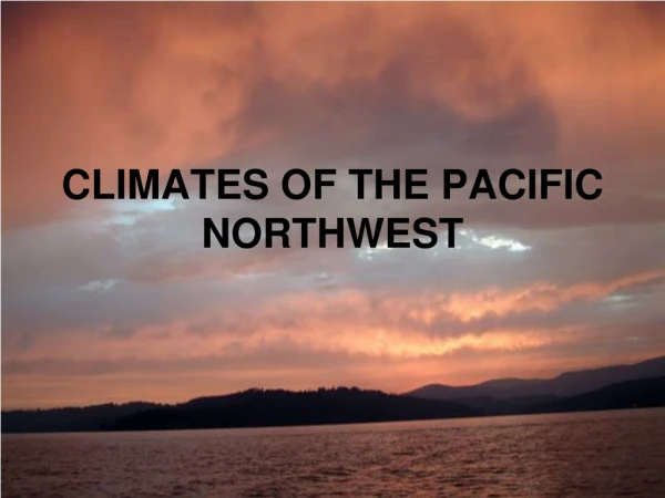
National Weather Service • Weather advisories • http://nws.noaa.gov • Monitor for extreme weather events, warnings/advisories
Climate • NOAA National Climatic Data Center • http://www.ncdc.noaa.gov/oa/ncdc.html
VOLCANOS • Cascades Volcano Observatory • http://vulcan.wr.usgs.gov/home.html • Alaska Volcano Observatory • http://www.avo.alaska.edu/ • Other volcano resources • http://volcano.und.edu/
Volcano Location • Question: Where are active volcanoes?
Volcano Questions • What are the risks (beyond Lava flows)? • http://vulcan.wr.usgs.gov/Hazards/framework.html
Population Risk • Which populations are at risk? • Hazard zones? • Mount Rainier designated most dangerous volcano in continental North America • More than 100,000 people live on debris from past lahars
Mitigation/Preparedness • Living with volcanoes segment from USGS • http://vulcan.wr.usgs.gov/LivingWith/framework.html
Additional Volcano Questions • What is the warning system? • What is the volcano alert level? • Volcanic eruption prediction? • How would a volcanic eruption affect me if I don’t live in a volcanic zone?
Earthquakes • US Geological Survey Earthquake Hazards Program • http://earthquake.usgs.gov/ • Pacific Northwest Seismic Network • http://www.pnsn.org/welcome.html • Earthquake Information Network • http://www.eqnet.org/
Tectonic/Geography • Earthquake snapshot: 05/07/2007 • Clearly shows plate tectonics in motion • How are earthquakes related to volcanoes?
Earthquake questions • Who is at risk from Earthquakes? • What are the risks? • What warning systems (if any) are in place? • Can we predict Earthquakes?
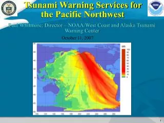
Tsunami • Vents Program Acoustic Monitoring • Ocean Seismic Activity • http://www.pmel.noaa.gov/vents/acoustics.html • Tsunami • http://tsunami.gov • http://www.tsunami.noaa.gov
Tsunami • What causes a tsunami? • Does any earthquake cause a tsunami? • Are tsunami’s caused by anything other than earthquake? • Where do they originate? • What can communities do to prepare? • Who is at risk?
http://nws.noaa.gov • http://www.ncdc.noaa.gov/oa/ncdc.html • http://vulcan.wr.usgs.gov/home.html • http://www.avo.alaska.edu/ • http://volcano.und.edu/ • http://earthquake.usgs.gov/ • http://www.pnsn.org/welcome.html • http://www.eqnet.org/ • http://www.pmel.noaa.gov/vents/acoustics.html • http://tsunami.gov • http://www.tsunami.noaa.gov • http://gldims.cr.usgs.gov/qfault/viewer.htm • http://geomaps.wr.usgs.gov/pacnw/lifeline/eqhazards.html