Download
1 / 27
270 likes | 293 Vues
Explore ORNL DAAC's Web Tools for MODIS land product subsets, model products, and regional/global studies in environmental sciences. Revolutionize research with easy access to comprehensive terrestrial biogeochemistry data.

E N D
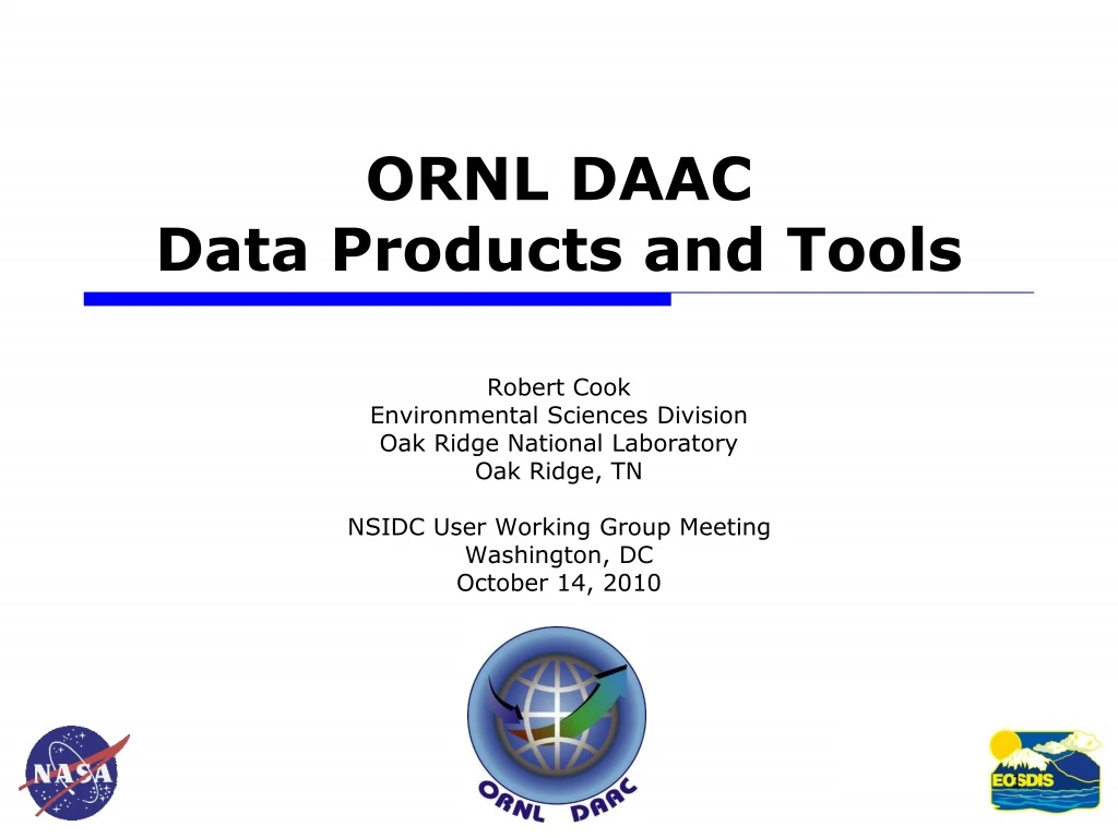
ORNL DAAC Data Products and Tools Robert Cook Environmental Sciences Division Oak Ridge National Laboratory Oak Ridge, TN NSIDC User Working Group Meeting Washington, DC October 14, 2010
ORNL DAAC • Archive data products produced by projects within NASA’s Terrestrial Ecology Program • Mission: • assemble, distribute, and provide data services for a comprehensive archive of terrestrial biogeochemistry and ecological dynamics observations and models to facilitate research, education, and decision-making in support of NASA’s Earth science. ORNL DAAC’s Web Site www.daac.ornl.gov
ORNL DAAC by the numbers • Staff: 12 Full time equivalents • Environmental scientists, computer scientists, and GIS specialists • Data Holdings • 877 data sets; ~1 Tb volume • Data set volume: Median = 500 KB; Mean = 500 MB • Files per data set: Median = 2; Mean 263 files; Max = 92,000 files • Data orders: 620,000 products ordered by 8,200 users in FY 2009 • ~50% have numeric IP • Remaining user domains are foreign, commercial, educational, and government • User Working Group: 15 Scientists and NASA Program Manager
Land Validation • MODIS Subsets • FLUXNET • NPP • BigFoot In-situ Observations Remote Sensing ? 1. Field Campaigns (670) • FIFE • OTTER • SNF • BOREAS • LBA • SAFARI 2000 BOREAS LBA LBA LAI/fPAR NPP LAI/fPAR NPP S2K S2K ORNL DAAC: Data Collections Total Data Sets = 877 2. Validation of Land Products (21) 4. Model Products (9) 3. Regional and Global Studies (176) • Benchmark Models • IBIS, BIOME-BGC, LSM • Manuscript Models • PNeT, Century, Biome-BGC • Climate • Soils • Vegetation • Hydroclimatology
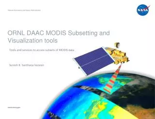
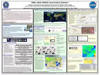
Center Pixel Mean Value of Pixels Percent of Pixels that meet QC Criteria MODIS Land Product Subsetting Tools • In a scale and format (text, GeoTIFF) useful for field researchers Three methods to obtain subsets • Tool for 1,147 selected sites • Tool for any user selected location on demand • User selects product, time period, location, and area (1 x 1 km up to 200 x 200 km) worldwide and for user-selected time periods • WebService • Programmatically obtain MODIS subsets for any land location, time period and area (from 1 pixel up to 201 x 201 km) using a standards based SOAP Web Service EVI in Southern California December 2003 fire 1,147 field sites for MODIS Collection 5
First tool: MODIS Land Product Subsets Key Features: • Data is available for 12 MODIS land products (Collection 5) • Time resolution is 8-day, 16-day, or annual • Spatial resolution is 250 m, 500 m or 1000 m • Subsets are available for the entire period of MODIS record (2000-Present) • Provides direct input into text editor or MS Excel • User can filter data by QC flags • Small file size
LTER site in Minnesota: Cedar Creek Natural Resources Area Google Earth, Google Map and LandSat views of site MODIS Article in LTER Newsletter http://intranet.lternet.edu/modules.php?name=UpDownload&req=getit&lid=700
Center Pixel Mean Value of Pixels Percent of Pixels that meet QC Criteria LTER site in Minnesota: Cedar Creek Natural Resources Area
Second Tool: Global Tool for any Location on Earth What we offer: • MODIS land product subsets of any size (Maximum: 201- x 201-km) • MODIS land product subsets for any period for a product • Subsets are in ASCII and GeoTIFF format • MODIS Collection 5 data How it works: • User inputs the coordinates for the site or selects from a picklist of sites • User chooses the areal extent and the time period • Processing of subsetted product (selection of tiles, mosaicing, generating time series data file and graphs) takes 10 to 60 minutes for most products (depends on area, time period, and product) • The tool will send an email message containing a URL where the output can be accessed
Second Tool: Global Tool for any Location on Earth Example Site in Rondonia -10.185, -63.67
Center Pixel Mean Value of Pixels Percent of Pixels that meet QC Criteria Stackable time series
Grid Visualization for Nov 1-16, 2001 White: Filtered pixels Black: Center pixel
NDVI / Phenology NDVI for site near Richmond, VA
Land Cover Dynamics (Phenology)(MOD12Q2)Site near Richmond Day of the Year
Demonstration of Global Tool http://daac.ornl.gov/glb_viz_2/12Oct2010_14:01:46_460165200L55.88L-98.48S3L3_MOD15A2_CA-NS1/index.html
Third Tool: MODIS Web Service Get MODIS Subsets through machine to machine interaction • SOAP (Simple Object Access Protocol) based • Retrieve Subsets using: • Command line ( Perl) • Workflows (Kepler) • JAVA desktop software
MODIS Next Steps • Offer next re-processing (Collection 6) in 2011 • Offer both C5 and C6 at the same time • Offer subsets of 1-day products LST and Reflectance • Offer subsets up to 1000 km x 1000 km
What is the Scientific Impact of the ORNL DAAC? • Question from Charlie Vorosmarty, UWG Member • Metric: Evaluate how many DAAC data sets have been used in papers.
Scientific Impact of the ORNL DAAC • Metric: Evaluate how many DAAC data sets have been used in papers, dissertations, or policy reports • Citations to published / archived DAAC data • Chambers, J.Q., E.S. Tribuzy, L.C. Toledo, B.F. Crispim, N. Higuchi, J. dos Santos, A.C. Araujo, B. Kruijt, A.D. Nobre, and S.E. Trumbore. 2009. LBA-ECO CD-08 Tropical Forest Ecosystem Respiration, Manaus, Brazil. Data set. Available on-line [http://daac.ornl.gov] from Oak Ridge National Laboratory Distributed Active Archive Center, Oak Ridge, Tennessee, U.S.A. doi:10.3334/ORNLDAAC/912. • Notify data providers of data publication and ask them to add citation to CV • Sponsors, P&T Committees can evaluate data publication productivity
Example of paper that cites DAAC data Strack, J.E., G.E. Liston, and R.A. Pielke. 2004. Modeling snow depth for improved simulation of snow-vegetation-atmosphere Interactions. Hydrometeorology 5:723 - 734.
Estimating Scientific Impact: Steps Taken • Ask users for reprints of publications based on data sets obtained from the ORNL DAAC • When they order the data and one year after they ordered data • Review on-line services (e.g., Web of Science, Elsevier’s Science Direct) to see if ORNL DAAC or DAAC Projects are mentioned or if data have been cited in papers • full text search, citation indices • Added Digital Object Identifiers (DOI) for each data product to facilitate tracking use of ORNL DAAC data in the literature
ORNL DAAC http://daac.ornl.gov/ MODIS Tools http://daac.ornl.gov/MODIS/modis.shtml Bob Cook cookrb@ornl.gov`
Provide tutorial on “Best Practices for Preparing Ecological Data to Share” • Cook et al. 2001 Bulletin ESA 82: 138 – 141 • Best Practices include: 1. Assign Descriptive File Names 2. Use Consistent and Stable File Formats 3. Define the Parameters 4. Use Consistent Data Organization 5. Perform Basic Quality Assurance 6. Assign Descriptive Data Set Titles 7. Provide Documentation • Update on-line: http://daac.ornl.gov/PI/pi_info.html Best Practices for Preparing Ecological and Ground-Based Data Sets to Share and Archive Robert B. Cook, Richard J. Olson, Paul Kanciruk, and Leslie A. Hook Environmental Sciences Division Oak Ridge National Laboratory