Chapter: Earth’s Changing Surface
Table of Contents. Chapter: Earth’s Changing Surface. Section 1: Weathering and Soil. Section 2: Shaping the Landscape. Section 3: Groundwater. Section 4: Geologic Time. Weathering and Soil. 1. Weathering.

Chapter: Earth’s Changing Surface
E N D
Presentation Transcript
Table of Contents Chapter: Earth’s Changing Surface Section 1: Weathering and Soil Section 2: Shaping the Landscape Section 3: Groundwater Section 4: Geologic Time
Weathering and Soil 1 Weathering • Weathering is an example of physical and chemical processes that involve the interaction of air, water, and rock over time. • Weathering is the process of physical or chemical breakdown of a material at or near Earth’s surface. • Factors that influence weathering include the agent, such as water or air, the nature of the material being weathered, climate, and time.
Weathering and Soil 1 Mechanical Weathering • Forces that can cause mechanical weathering include impact, expansion or contraction of materials, and biological effects. • Variables that control mechanical weathering include the nature of the material being weathered, climate, and time. Of these variables, time is the least noticeable.
Weathering and Soil 1 Prying Rock Apart • When water freezes, it expands. This forces the cracks apart and ultimately forces the rock apart. • This type of weathering is called frost wedging.
Weathering and Soil 1 Prying Rock Apart • Rocks can also act as impact agents. • The figure illustrates what happens when a large object breaks apart.
Weathering and Soil 1 Prying Rock Apart • As a large particle breaks into smaller particles, the amount of surface area increases. More surface area compared to volume increases the likelihood that a material will be attacked by chemical agents.
Weathering and Soil 1 Chemical Weathering • The process of chemical weathering forms new compounds and releases elements into the environment. • Water and oxygen are the key agents of chemical weathering, along with naturally occurring acids.
Weathering and Soil 1 Soil • Soil is a mixture of weathered rock, organic matter, water, and air that is capable of supporting plant life. • Soil originates from weathering of the bedrock beneath it or from materials transported from another location.
Weathering and Soil 1 Soil Horizons • The figure shows a complete set of horizons, designated as O, A, E, B, C, and R from the surface to bedrock. • The O horizon, for organic, and the A horizon often are referred to as topsoil.
Weathering and Soil 1 Soil Horizons • The E horizon is a zone in which finer sediments and soluble materials are transported downward. • The B horizon collects the materials from above and is usually darker than the E horizon.
Weathering and Soil 1 Soil Horizons • The C horizon is partially crumbled and weathered bedrock. The R horizon is unweathered bedrock.
Weathering and Soil 1 Soil Types • Climate often is used as a basis to characterize many different types of soil.
Weathering and Soil 1 Soil Types • They are separated according to composition and physical properties. • The amount of precipitation and the temperature range of a region, together with the type of parent material, affect the soil that forms.
Weathering and Soil 1 Soil Conservation • Soil depletion is a serious agricultural problem in many regions. • Soil depletion is most often corrected by the addition of fertilizers containing nitrogen, phosphorous, or potassium. • Most soil lost to erosion occurs because the vegetative cover has been removed or because the land is overly steep.
Section Check 1 Question 1 Which is NOT an agent of mechanical weathering? A. contraction B. expansion C. impact D. oxygen
Section Check 1 Answer The answer is D. Oxygen is an agent of chemical weathering.
Section Check 1 Question 2 Which mineral, present in rocks, turns a brownish-red color? A. calcite B. feldspar C. hematite D. silicon
Section Check 1 Answer The answer is C. Hematite is often mined to obtain iron for steel production.
Section Check 1 Question 3 Which horizons combine to form topsoil? A. A and O B. E and H C. B and C D. C and R
Section Check 1 Answer The answer is A. Plants get most of their nutrients from topsoil.
Shaping the Landscape 2 Erosion, Transport, and Deposition • Erosion is the removal of surface material through the process of weathering. • Sediment transport is the movement of eroded materials from one place to another by water, wind, and/or glaciers. • When a transporting agent drops its load of eroded material, deposition occurs.
Shaping the Landscape 2 Running Water • An important agent of erosion that exerts a downward force on slopes is running water. Drainage Basins • In most river systems, small streams called tributaries flow into larger streams, which in turn flow into even larger streams. • All of the land area that gathers water for a major river is the river’s drainage basin.
Shaping the Landscape 2 Channel Development • As surface water flows downhill under the influence of gravity, water erodes the surface, creating its own path or following existing paths called channels. Stream Deposits • When running water slows down, it drops part of the sediment load it is carrying, largest particles first.
Shaping the Landscape 2 Floodplains • Floodplains are part of a river, but they are only submerged during floods. Deltas • As the mouth of a stream that empties into a body of water, a fan-shaped sediment deposit called a delta will form.
Shaping the Landscape 2 Glaciers • Valley glaciers form at the top, or head, of river valleys in mountainous regions. They move down slope, usually following the path of the preexisting valleys. • Continental glaciers, which occupy huge land areas, cover all but the highest peaks. Ice moves away in all directions from where it accumulates.
Shaping the Landscape 2 Glaciers • Glaciers become effective agents of erosion as they move either down slope as in valley glaciers or under their own weight as in continental glaciers.
Shaping the Landscape 2 Erosional Features • Valley and continental glaciers leave behind deep grooves or striations, which give clues about the direction the ice was moving. • Glacial ice exerts pressure to the sides as well creating the distinct and easily recognized U-shaped valley.
Shaping the Landscape 2 Glacier Deposits • Till is composed of random sediment sizes ranging from tiny clay particles to house-sized boulders. • The large ridges of till that accumulate at the edge of a glacier are called moraines.
Shaping the Landscape 2 Wind Erosion by Wind • The removal of small particles by wind, leaving heavier particles behind is called deflation. Wind Deposits • As wind velocity decreases, the load of sediment is dropped. • The shapes and sizes of landforms that form depend on how constant the wind velocity is and on the supply of sediment.
Shaping the Landscape 2 Wave Action • Longshore current occurs when waves approach a shoreline at an angle and are refracted. • The backwash returns to the sea perpendicular to the shoreline.
Shaping the Landscape 2 Deposition by Wave Action • Longshore currents move sediment along the shore. • Where this current slows, sediments are deposited as offshore sand ridges or bars. • Sandbars run parallel to the shore. • Spits are sand bars that project into the water from land and curve back toward land in a hook shape.
Shaping the Landscape 2 Mass Wasting • Mass wasting occurs when erosion occurs primarily as a result of gravity, whether triggered by an influx of water, by earthquakes, or by human activity. • Wasting erosion caused by mass wasting is dependent upon the type of event and the type of materials involved: slumps, landslides, rockslides, or mudflows. • Mass wasting events tend to dump their material in disorganized masses.
Section Check 2 Question 1 _______ is the removal of surface material through the process of weathering. A. Deposition B. Erosion C. Sediment D. Transport
Section Check 2 Answer The answer is B, erosion.
Section Check 2 Question 2 _______ form when wind moves sand-sized particles into distinct forms. A. Cirques B. Dunes C. Glaciers D. Waves
Section Check 2 Answer The answer is B. The shapes and sizes of dunes that form depend on how constant the wind velocity and on the supply of sediment.
Section Check 2 Question 3 Bowl-shaped basins called _______ form by erosion at the start of a valley glacier. A. arêtes B. bowls C. cirques D. horns
Section Check 2 Answer The answer is C. Valley glaciers form at the head of a river valley in mountainous regions.
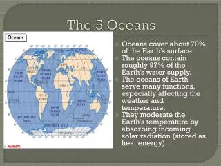
Groundwater 3 The Water Cycle • Freshwater supplies are constantly being replenished through the water cycle. • A lesser amount enters the cycle through transpiration. • The energy to power both evaporation and transpiration comes from the Sun.
Groundwater • Infiltration is the process by which water enters Earth to become groundwater below the surface. 3 The Water Cycle
Groundwater 3 Groundwater • The region near the surface where water can infiltrate freely is the unsaturated zone. • The region below that is the saturated zone. • The water table is the boundary separating these two zones.
Groundwater 3 Groundwater Storage • A rock unit that can transmit water through its pore space is called an aquifer. • A rock that slows or stops infiltration is an aquitard.
Groundwater 3 Porosity and Permeability • The combined volume of these shapes defines the material’s porosity. • Permeability is a measure of how well a fluid can pass through a material.
Groundwater 3 Water Resources Obtaining Groundwater • Wells are holes dug or drilled into Earth. • Much like surface water, groundwater flows downhill.
Groundwater • Pollutants that are spilled or dumped on the ground enter groundwater through infiltration, as shown. 3 Pollution and Groundwater Resources
Section Check 3 Question 1 What is illustrated in this figure? A. carbon cycle B. nitrogen cycle C. oxygen cycle D. water cycle
Section Check 3 Answer The answer is D. The water cycle continually redistributes Earth’s water.
Section Check 3 Question 2 What is an artesian well? Answer Wells drilled into aquifers that are under sufficient natural pressure to force water up into a well are called artesian wells.
Section Check 3 Question 3 Which is not formed as a result of groundwater? A. caves B. sinkholes C. springs D. wells