Download
1 / 36
360 likes | 490 Vues
Assessing the Consequences of Land Use Change in the Upper Potomac. Robert H. Gardner with Jason Julian, Andrew J. Elmore, Todd R. Lookingbill, Marcella Suarez-Rubio. Appalachian Laboratory University of Maryland Center for Environmental Science. The Appalachian Laboratory.

E N D
Assessing the Consequences of Land Use Change in the Upper Potomac Robert H. Gardner with Jason Julian, Andrew J. Elmore, Todd R. Lookingbill, Marcella Suarez-Rubio Appalachian Laboratory University of Maryland Center for Environmental Science
The Appalachian Laboratory To “… determine the effects of natural and human-induced changes on organisms, landscapes, and biogeochemical and hydrological cycles.”
Outline • Importance of land-use and land-cover (LULC) change in the Potomac River Basin • The challenge of determining effects • An integrated approach for prediction
1. Importance of LULC change • LULC is accelerating and is global in extent • Directly linked with declines in • Biodiversity • Water quality and availability • Ecosystem productivity (especially economically important species) • LULC may also • Accelerate climate change • Enhance the spread of disease (new pandemics)
The Potomac River Basin • Basin: 38,000 km2 • Mainstem: 617 km (170 km tidal) • 6 physiographic provinces • Climate boundary
Key attributes of the PRB • Located in one of most rapidly urbanizing areas in the US • 5.3 million people w/n basin • Coal mining affects Appalachians • Agriculture in Ridge and Valley • Piedmont and Coastal Plain continue to be urbanized • The 617 km river main stem has relatively unregulated flows
History of LULC change • Not glaciated – but glacial runoff produced coastal plain & Chesapeake Bay • Frontier stage – (17th century) • natural resource use, local deforestation • Agricultural Expansion – (18th century) • Pops of 380,000 • 20-30% of forests cleared • Sediment accumulation in Bay affect navigation http://www.chesapeakebay.net/history.htm
More history • Industrialization – (late 18th century) • Urban corridor formed • Population of 2.5 million, raw sewerage in Bay • Railroads consume 15-20 million acres of Eastern Deciduous Forest • Population expansion – (19th century) • Beginning of environmental legislation and control (Clean Air Act, etc.)
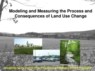
Effects of LULC within the Potomac • Hardened surfaces result in buried streams with increased throughput • Nutrient retention declines, export increases • Population growth increases water demands • From Upper Potomac to Lower • Ecosystem recovery from wide variety of disturbances remains unknown • New invasives impact terrestrial and aquatic habitats
Low flow frequency Low flow demand Low-flow correlated with high demand 112 year record shows 13% of years have extremely low flows Lookingbill et al., in press
Invasive organisms are here to stay • Gypsy moth • Hemlock wooly adelgid • Chestnut blight • New (potential) • Emerald ash borer has been found in MD • Sirex noctilio – wasp (horntail) kills pines • Sudden oak death • Asian long horned beetle (in MD)
2. Determining effects Landscapes are composed of many “elements” including … • roads • agricultural “units” • forests of diverse types and ages • urban & suburban development And diverse economic conditions
We know that the spatial arrangement of “elements” is critical • Riparian buffers effectively reduce sediment and nutrient export • While development selectively removes headwaters ecosystems* • No single sub-watershed is representative of the Potomac • Small critical areas (wetlands) are most effective nutrient and sediment filters *Elmore and Kaushal, 2008
Effects of LULC are not additive • If linear then effects of change are additive • we can extrapolate using mean value(s) • landscape assessment can be produced by simple summation (spread sheet) • or by sampling extremes (boundaries) and interpolating for each set of unique conditions
The problem of scale “Many challenges remain in extending our understanding of how hydrologic processes within small catchments scale to larger river basins.”
Critical thresholds: Brook trout density and impervious cover Stranko et al. 2008
Disturbance induces time lags • Disturbances are not simple transient events? • History of change is important • We may not be able to predict the future from the past • Forest harvesting has altered age and species distribution of flora • Decline (possibly permanent declines) in oak and pine abundance
Significant effects on nutrient cycling Eshleman et al. 2005
3. An integrated, predictive approach Understanding -> prediction But this requires: • Spatial and temporal characterization of weather patterns • Determination of trends in land use change • A process-based representation considers interactive effects of multiple changes • Estimation of unknowns and uncertainties
Interactive effects are important? • Flood potential – is a combined effect of LULC and climate change • Denitrification – depends on the location of critical habitat placement • Sources and sinks • Effectiveness of restoration • Meeting water quality demands • A moving target: growth, development, LULC and climate change
SLEUTH: a model of land-use change • USGS sponsored development • Slope, Land use, Exclusion, Urban extent, Transportation, Hillshade – Clark (1998) • Being explored and widely used w/n Chesapeake Watershed • A pattern-based model • Uses a fine-scale, gridded landscape • Projects urban growth
Historical records are necessary • Required GIS layers • Urban growth (3-4 layers) • Roads (2 layers) • Exclusion (1 layer) – protected lands • Hillshade (1 layer) • Slope (1 layer) • Land use (1 layer) – current
Empirical (best fit) of 5 growth parameters govern probability of urbanization • Spontaneous dispersion – formation of new urban locations • Growth (increase in size) of new urban locations • Growth of old (established) locations • Road gravity – increased growth rates near roads • Slope resistance – decreased growth with increasing slope Dietzel (2007)
Calibration first • Brute force calibration (inefficient) • Parameters varied over broad range • Monte Carlo techniques applied • Subset (“best fit”) determined by spatial comparison to history of change
Prediction requires • Current land use maps for initialization • Urban extent • Transportation network • Exclusion layer • Future scenarios performed by varying • Exclusion layer (e.g., streams, etc.) • And exclusion “rules” • Constraints on transportation network
Baltimore-Washington projections (Jantz et al. 2003) • Three scenarios for piedmont & coastal plain of Maryland and Northern Virginia • Variable exclusion layers developed • By state and land use type • Scenarios: A. Current trends B. Managed growth C. Ecological preservation
Summary • Moderate “exclusions” have large effects on patterns of LULC change • Population trends continue to drive change • Model improvements always desirable • Local policies not yet implemented • Linkage of land use projections with ecosystem models urgently needed • Water, nutrients, sediments as a function of land-use change • Biotic effects of land-use change
Our efforts for the Potomac • We have spent ~1 year on data acquisition, verification • Calibration has been performed • Simulations begun on development scenarios in the Upper Potomac • Focus on effects of habitat change on bird community (Ph.D. thesis)
Next steps • This summer • Plans for a workshop at Appalachian Lab • Include relevant parties using SLEUTH w/n Chesapeake • Share “mutual” resources (data layers) • Apply uniform methods for calibration and prediction – for cross-comparisons • Shared effort – data enhancement, model improvement
Special thanks Sujay Kaushal Walter Boynton Tom Fisher Larry Sanford Jeff Cornwell Bill Dennison Clair Jantz