Enhancing Environmental Management through NASA's Applied Remote Sensing Training Program
The Applied Remote Sensing Training Program (ARSET) aims to increase the utilization of NASA data in decision-making for environmental management across public and private sectors. Led by Dr. Ana Prados and hosted at the University of Maryland, the program provides inclusive workshops to empower end-users with hands-on technical skills. Since its inception in 2008, ARSET has trained over 500 individuals worldwide, fostering long-term partnerships and promoting the effective application of NASA's observational and modeling data for air quality, water resources, and disaster management.

Enhancing Environmental Management through NASA's Applied Remote Sensing Training Program
E N D
Presentation Transcript
NASA Applied Remote Sensing Training Program (ARSET) Dr. Ana. I. Prados Joint Center for Earth Systems Technology (JCET) University of Maryland Baltimore County NASA GSFC Code 614, Atmospheric Chemistry and Dynamics Laboratory NASA AQAST Meeting, June 13-15, 2012
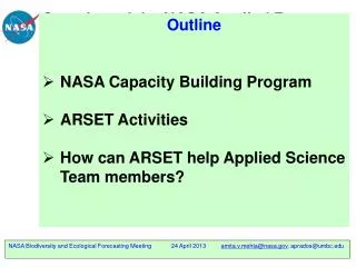
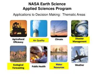
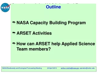
Applied Sciences: Capacity Building NASA sponsored activities and resources that build capability and skills to utilize NASA data for policy and environmental management in both the public and private sectors
NASA Applied Sciences: Capacity Building Programs • SERVIR • DEVELOP • Gulf of Mexico Initiative • Applied Remote Sensing Training
Applied Remote Sensing Training (ARSET) GOAL: Increase utilization of NASA observational and model data for decision-support • Objectives: • Provide end-user communities and institutions with professional hands-on technical workshops • Build long term partnerships with end-user communities and institutions in the public and private sectors ARSET disseminates the usage of existing NASA data, web tools, Decision Support Systems and applied research, in addition to collaborating with other capacity building programs within NASA
ARSET Timeline Health (Air Quality) (AQ)http://airquality.gsfc.nasa.gov/ • 2008 – present • 25 Trainings • +500 end-users • Water Resources and Disasters http://water.gsfc.nasa.gov/ • April 2011 – present • Ecological Forecasting • Est. 2013 • Other Health and Disasters Application Areas • Est. 2014
ARSET Team Members Project Lead Dr. Ana Prados (GSFC/UMBC) • Other Support • Marines Martins (GSFC/SSAI) • Annelise Carleton-Hug (Trillium A./Evaluation) • Students • Maria Stenborg (UMCP) • Alison Hoy (UMCP) • Air Quality • Pawan Gupta (GSFC/GESTAR) • Richard Kleidman (GSFC/SSAI) • Yang Liu (Emory University) • Jacquie Witte (GSFC/SSAI) • Water & Disasters • Amita Mehta (GSFC/UMBC) • Tom Painter and Chris Mattmann (JPL/Caltech) • Cindy Schmidt (AMES/Baeri)
ARSET Trainings at a Glance Number of NASA online or hands-on trainings per state. Trainings have also been conducted in Costa Rica, Colombia, Canada, Italy, Australia, Singapore, and Vietnam
ARSET Trainings at a Glance: International Trainings have also been conducted in Costa Rica, Colombia, Canada, Italy, Australia, Singapore, and Vietnam and at the World Bank (Washington D.C)
ARSET Trainings by Societal Benefit Area 2009 – March 2013
On Different Sides of the Fence NASA Earth Science Decision Support ARSET Different language, expectations, and sometimes technical capacity
Barriers to NASA Data Utilization • Knowledge gaps • Cost: Not aware that NASA data are free • Data Access: Not aware of resources available for easy access(e.g. web to order data) • Benefits: Not aware of potential applications of NASA data to environmental management activities • Lack of institutional capacity: Prioritization, lack of man-power and needed technical expertise Question 1
ARSET Best Practices • 1. Trainers first: Skill building for NASA Scientists • 2. Leveraging of multiple NASA resources • - Applied Sciences Program PIs and applied research • - NASA Data Centers • - Other Capacity Building Programs • 3. Gradual learning approach • - ABCs of NASA Data: What and what for ? • - Access and analysis • - Application to decision-support • 4. Heavily focused hands-on learning • 5. Continued/ongoing interaction with end-users • 6. Workshop Surveys • 7. Ongoing Project Evaluation Plan
Gradual Learning Approach ARSET Applied Sciences Workshops Basic Training: • Individuals and institutions new to • remote sensing • Trainings at professional conferences Online Training (WebEx) • Overview of products to prepare for advanced training Advanced Trainings • Focused on a specific application/problem: for example impact of snow melt in California on stream flow • Requires Base of WebEx training
Who is ARSET Training ? • Public Sector: U.S EPA, USDA, BLM, NOAA, regional, state, county agencies, Tribal Nations, water resources managers, watershed and reservoir managers • Private Sector: • Industry, agricultural sector, NGOs • Attendees at Professional Conferences • Participants of NASA Campaigns • End-User Feedback: • Positive reviews from ‘Training customer • satisfaction surveys’. • Continued requests for follow-up • trainings: California Air Resources Board, • LADCO • Increase in number of end-users trained • per year since 2008 • Students Becoming Teachers as trainers ! NASA Training for California Air Resources Board, Sacramento, CA December 2011 Seeking to better engage the NGO community, industry and Tribal Nations in 2012+
ARSET Training for Lake Michigan Air Directors Consortium (LADCO) • A three day in-person training on the use of NASA satellite data for air quality applications reached 20 attendees from federal agencies in the U.S and Canada and 6 state agencies in the U the mid western and central • Co-sponsored by the NASA Applied Sciences Program and the Lake Michigan Air Directors Consortium (LADCO) • Attendees learned how to apply NASA satellite data, imagery and web tools to air quality management problems in their region. • Collaboration between LADCO member states and AQAST: AQAST presentations held during the training. • The workshop built basic skills on image access and interpretation. • Participants prepared and presented air quality case studies of their choosing and provided feedback to NASA instructors on the utility of NASA resources. NASA training in progress at the University of Wisconsin Madison facility. The course had 20 attendees from the Lake Michigan Air Directors Consortium (LADCO), Minnesota Pollution Control Agency, Michigan Department of Environmental Quality (DEQ), Wisconsin Department of Natural Resources, Idaho DEQ, Oklahoma DEQ, Indiana Department of Environmental Management, US Environmental Protection Agency (EPA) Region 5, Michigan Tech Research Institute and Environment Canada. End-user feedback from a NASA air quality online course held in February 2012 was used to tailor this training event to mid-western environmental management issues and to refine the agenda to focus on 1) less NASA products in greater detail and 2) inter-comparisons between NASA data and air quality model output.
http://airquality.gsfc.nasa.gov/ Publicly available Modules Case Studies Upcoming trainings
ARSET Training Workshop Lifecycle • Advertise via list-serv and Webpage • Collaborate with NASA Applied Science PIs • Collaborate with NASA Data Centers • Work with Advisory Group • Attend professional conferences Conduct Training : Online Presentations Hands-on activities Case Studies Identify Host Institution End-user Needs Assessment Adapt training modules Project Evaluation: Surveys and Feedback
NASA Remote Sensing Training Program Evaluation • Objectives: Provide the NASA Applied Sciences Program with ongoing feedback on: • 1) ARSET project impact on end-user decision-making • activities and changes in data utilization • 2) End-user needs and barriers to utilization of NASA • resources (in conjunction with parallel NASA AQAST • project- Bryan Duncan/Ana Prados). • 3) Type of environmental management activities • where NASA resources are being integrated Question 7 & 10
ARSET/AQAST Collaborations • ARSET can bring help you (AQAST PIs) disseminate applied • research results and methodologies. • Get involved in the planning of future ARSET trainings • Other ideas ?
AQAST Tiger Team Project (Duncan) • Creating an Objective “AQAST Recommendations for Air Quality Satellite Missions” Document for NASA Mission Planners Bryan Duncan, PI • NASA GSFC • Code 614, Atmospheric Chemistry and Dynamics Laboratory Ana. I. Prados, co-I Joint Center for Earth Systems Technology (JCET) University of Maryland Baltimore County and NASA GSFC Code 614, Atmospheric Chemistry and Dynamics Laboratory
Tiger Team Project Overview • Long Term Objective • Inform a NASA AQAST mission recommendations document by leveraging ARSET end-user interactions and program evaluation surveys
ARSET Training Workshop Lifecycle • Advertise via list-serv and Webpage • Collaborate with NASA Applied Science PIs • Collaborate with NASA Data Centers • Work with Advisory Group • Attend professional conferences Conduct Training : Online Presentations Hands-on activities Case Studies Identify Host Institution End-user Needs Assessment Adapt training modules Project Evaluation: Surveys and Feedback Tiger Team: Missions Recommendations Document NASA PI Surveys
Tiger Team Project Overview • Short Term Objectives • Identify Data Needs: What do end-users see as their most pressing near-immediate data needs for: • regulatory activities • health applications • other policy formulation • NOx, ozone or PM2.5 monitoring, better emissions inventories, • model evaluation ? • Identify Barriers to Data Utilization: why are NASA resources not being used or why weren’t they used in the recent past (prior to ARSET or another intervention) • Possible barriers • Lack of knowledge of data availability • Problems with data access data • Lack of suitability of data for applications • Institutional/organizational barriers that inhibit use of NASA data • Recommendations for overcoming noted barriers
Methodology and Timeline • 1) Establish end-user parameters (Summer 2012): Defining the population sample (include ARSET advisory group members). • Federal/state/local/Tribal • Private sector (for profit) • NGOs • 2) Identify +8 key informants (Summer 2012) (OMB restriction) • Both end users who ARE and who ARE NOT using NASA resources • Interviews with informants will be conducted by ARSET external evaluator AnneliseCarleton-Hug • Interview responses will be used to inform subsequent online survey questions for ARSET and Tiger Team project • 3) Prepare interview guide and conduct interviews (Summer 2012) • Both end-users and NASA scientists • 4) Provide interim report to AQAST (Fall 2012).
Methodology and Timeline 5) Develop online survey (Fall 2012) 6) Survey +500 ARSET attendees after OMB approval (Winter 2013) 7) Final report to AQAST(Winter/Spring 2013).
Methodology: Sample End-users QuestionsConducted by external evaluator • Are there critical data missing? Describe the kind of data you would like to have available that would help you do your job more efficiently and effectively. • Now let’s focus on your experience with the NASA data products. Can you describe for me how you (or others in your office/agency) are currently using NASA data products? • [for interviewees who are not using NASA data] If you’re not currently using NASA data, please explain the reasons for not using the data. We are very interested in learning about the barriers or challenges that prevent you from using the data, so please be specific. • Do some AQ professionals consider that the NASA data is not suitable for their applications? Can you explain in what ways the data might not be suitable? What are some suggestions to improve the suitability of the data?
Methodology: Sample ScientistQuestionsConducted by Bryan Duncan and Ana Prados • Interview key NASA civil servants** involved with satellite data • product development and mission planning (e.g. Aura, Earth Venture). • ***No OMB limit for civil servants !!! **** • Potential questions: • 1) What are the key challenges in using satellite data for AQ applications? • 2) What are the barriers/impediments to utilization of NASA data products among AQ applications end-users ? • 3) Are the current planned missions (NASA, ESA, or other) adequate for meeting the needs of the AQ applications end-users ?
Collaboration with other Tiger Teams • DISCUSSION ?
Case Studies and Hands-On Activities Exercises with Step-by-Step Instructions • Access to NASA imagery • Access to other data: model, in-situ, etc. 3) Utilization of image analysis tools 4) Assessment: Precipitation propagation and its geographical impacts. Question 1: scientific/technological & question 3
Cartagena, Colombia Water Training November 28-29, 2011 GEOSS Hydrological and Space network of Information for Latin American and the Caribbean (CIEHLYC)) • Representatives from South and Central America and the Caribbean. • Colombian Floods in May 2011: TRMM rain rate, AIRS clouds, MERA winds. • Climate variability and El Niño/Niña over south America: TRMM rain rate, AIRS Sea Surface Temperature (SST). • Access to snow cover imagery in Chile and Argentina from MODIS and MERRA (model).