Download
1 / 21
230 likes | 619 Vues
Navigation Latitude & Longitude. Reference. From the Ground Up Chapter 7.1: Latitude & Longitude Pages 177 - 179. Introduction.

E N D
Reference From the Ground Up Chapter 7.1: Latitude & Longitude Pages 177 - 179
Introduction • The earth is an oblate spheroid that needs a grid system to be navigable. Lines of latitude and longitude are used to determine points on the surface for navigation. • Pilots need to know these systems in order to fly from one point to another using various navigation methods.
Outline • Navigation Types • Latitude and Longitude • Co-ordinates • Time and Longitude • Great Circles and Rhumb Lines • Headings, Bearings, Tracks • One-in-Sixty
Navigation Types • Pilotage • Referencing only the ground and landmarks • Dead Reckoning • Using predetermined vectors and tracks • Radio Navigation • Using radio aids • Inertial Navigation • Using self-contained airborne gyroscopic and electronic equipment to measure speed and direction • Satellite Navigation • Using satellites to triangulate position (GPS) • Celestial Navigation • Measuring angles to heavenly bodies (sun, moon, stars)
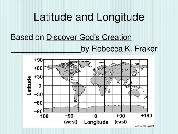
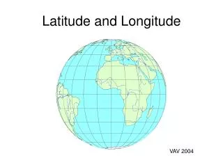
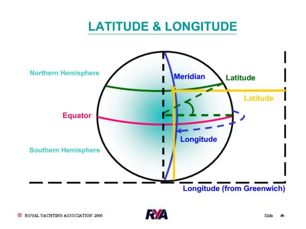
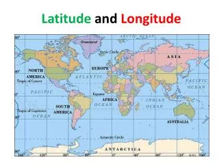
Latitude • Parallels of Latitude • Circles whose plane lie parallel to equator • Equator is great circle at 0° • Parallels run 90° north and south of equator
Longitude • Meridians of Longitude • Semi great circles joining true or magnetic poles (true/magnetic meridians) • Measured 0° to 180° east and west of prime meridian (0°) • International Date Line is 180°
Co-ordinates • Locations on Earth can be located by a latitude and longitude intersection • Example: • Toronto, Canada = 43°39′N 79°23′W • Sydney, Australia = 33°51′S 151°12′E • Units: • Degrees (°), Minutes (’), Seconds (”) • 1° = 60’ • 1’ = 60”
Time and Longitude • Solar Day • Interval between two successive transits of the sun • Divided into 24 hours • Sun travels 360° around earth, therefore 15° per hour • Conversions: • 1 hour = 15 degrees longitude • 1 min = 15 minutes longitude • 1 sec = 15 seconds longitude • 360 degrees longitude = 24 hours • 1 degree longitude = 4 min • 1 minute longitude = 4 sec • 1 second longitude = 1/15 sec • Coordinated Universal Time (UTC) is time at prime meridian. Also known as Zulu (Z) time.
Great Circles • Circle on Earth’s surface whose plane passes through the center of the earth (“cuts” earth in half) • Great Circle Route (or Arc) is shortest distance between two points • Opposing meridians and Equator are great circles
Rhumb Line • Curved line on Earth’s surface cutting all meridians at the same angle • Parallels are rhumb lines
Headings and Bearings • Directions measured degrees clockwise from north(0° or 360°) • Heading • Direction aircraft nose (longitudinal axis) is pointing • True heading uses true north • Magnetic heading uses magnetic north
Headings and Bearings • Bearing (AKA Azimuth) • Position of object relative to your aircraft • Measured clockwise from longitudinal axis through 360° • Not related to aircraft heading
Tracks • Track (AKA Intended Track or Required Track) • Direction airplane intends to travel over ground • Drawn on map as straight line from point A to point B • Can be True, Magnetic or Compass Track • Track Made Good • Actual path traveled by airplane over ground • Drift Angle • Angle between airplane heading and track made good • Expressed as degree left/right
One-in-Sixty • One-in-Sixty rule - An error in the track of one degree will cause an error in position of about one nautical mile in a distance of 60 nautical miles 8 NM 4 NM 4 deg A B 60 NM 60 NM
Next Lesson 5.2 – Navigation Earth’s Magnetism From the Ground Up Chapter 7.2: The Earth’s Magnetism Pages 179 - 185