Download
1 / 41
410 likes | 635 Vues
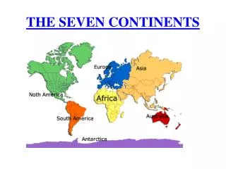
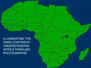
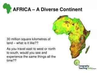
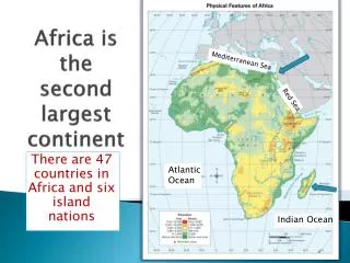
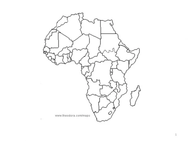
Africa: the Plateau Continent. The physical geography of Africa. Vocabulary. Basin Nile River Rift Valley Mount Kilimanjaro Escarpment. Plateau. plateau covers most of Africa. narrow strip of coastline. Throughout the plateau there are several basins.

E N D
Africa:the Plateau Continent The physical geography of Africa
Vocabulary • Basin • Nile River • Rift Valley • Mount Kilimanjaro • Escarpment
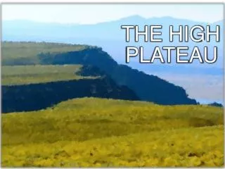
Plateau • plateau • covers most of Africa. • narrow strip of coastline. • Throughout the plateau there are several basins. • Basins – depressions where river systems usually drain. • Imagine a bowl 5000 ft deep 625 + miles across
Why is there no basin here? Notice the plateau outline.
The Congo Basin • The Congo Basin • second largest tropical forest, • 700,000 square miles in six countries, • quarter of the world’s remaining tropical forest. • over 10,000 species of plants, • 1,000 species of birds, • 400 species of mammals. • 24 million people, • depend on the forest for their livelihoods.
Rivers • Since water travels downhill flows into, and through basins. • Basins contain giant (size of Texas) swamps • Lots of water-borne diseases • As the rivers cut through the edge of basins toward the sea, they fall over the edge of the plateaus in a series of waterfalls and rapids through narrow gorges. • not useful for navigation because of these cataracts
The origin of the Nile, where it leaves Lake Victoria and begins its journey northward.
A cataract is a part of the river that is impassable to ships.
Distinctive African Landforms • Rift valley – a long thin valley created by the splitting of the continental plates. Photo of the Great Rift Valley from the International Space Station
The volcanoes are at the edges of the plates. When do you expect Africa to be ripped completely apart?
Mountains • Mount Kilimanjaro- • Africa’s highest mountain. • volcanic • Escarpment – a steep slope with a nearly flat plateau on top. • The Great Escarpment • Southern edge of the continent
Ol Doinyo Lengai volcano, Tanzania
Minerals and Resources • Africa produces • 80% of the world’s platinum • 30% of the world’s gold • 42% of the world’s cobalt • Much of the worlds oil is located in North Africa • Africa possesses a huge amount of the world’s minerals • Why are they still so poor?
Africa in the Early Twentieth Century Minerals attract others • Europeans colonized Africa in late 1800s. • Shipped riches back to Europe • Left Africa poorer
Resources • Oil and Coffee are the most profitable commodities in Africa. • Commodity is something that can be sold (specifically agricultural or mining) • Lumber is another important commodity. • 66% of Africans earn their living from farming. • Subsistence agriculture is the single most important economic activity in Africa.
Africa: A Land of Extremes Climate and Vegetation
Deserts • Sahara-largest desert in the world • 3000 miles from Atlantic to Red Sea • 20% sand (erg) • 80% rock formations, gravelly plains (reg) • 136° to below freezing • Kalahari Desert in the south • Namib Desert in the southwest • Aquifers-underground water • Oasis-where water comes to the surface
Tropics • Between the Tropic of Cancer and the Tropic of Capricorn • No noticeable difference between seasons • Day length equals night (12 hours day, 12 night) • 90% of Africa is in the tropics • Cooler at night
Rainforest • Congo Basin • Madagascar • Nearly destroyed through slash and burn farming • Canopy • Uppermost layer of branches • 150 feet above the forest floor
Sunshine and Rainfall • Congo Basin rainforest receives rain year round • The rest of the continent has either no rain or two seasons – wet and dry
Tropical Grassland • Serengeti Plain • Northern Tanzania • Hard soil and dry climate prevent trees but are good for grass • Lots of animals (think Lion King)
Africa: Human Environment Interaction
Desertification of the Sahel Desertification • An expansion of dry conditions into moist areas next to deserts Before After
Causes of Desertification • Human factors • Over grazing of livestock exposes soil • Animals trample soil • Farming • Increased population
Result of Desertification Loss of grasslands and farm areas
Stopping Desertification • Very difficult to slow this process • Tree planting • More efficient use of farm and forest lands To fight soil erosion of the land during the dry season, these women in Burkina Faso prepare the ground by pounding it and terracing it in order to catch the water when the rains finally come.UN Photo #167616 by J. Isaac
Harming the Environment in Nigeria • Oil discovered here in 1956 • 80-90% of national income • Most of it purchased by U.S. • High oil prices in 1970’s made Nigeria one of wealthiest nations in Africa
So, why are they poor now? • Government mismanagement and corruption • Poor planning • Decline in oil prices
Destroying the Land and People • 4,000 oil spills in the Niger Delta in the past 4 decades • Slow & non-existent clean-up • Fires resulting from spills have caused acid rain, massive deposits of soot • Increased respiratory diseases
This type of oil spill is widespread in the Niger Delta. Amukpe is near a major city of Sapele and therefore attracted attention of the public. In rural areas, such spills would go on for months before any action is taken. The Federal Government of Nigeria owned the facilities from which oil gushed into River Ethiope. Note the immediate impact of the spill on plants. The spill's impact on fish life was probably tremendous. But it remains unmeasured. "PPMC's ruptured pipeline empting P.M.S. (Premium Motor Spirit) into Okpe river for over one month. Amukpe community, Sapele L.G.A., Delta State, Nigeria."
Pipeline Exploitation • “Bandits” and corrupt government officials (is there a difference?) drain the pipelines and resell the oil • Villagers collect spilled oil in small cans and resell it
Oil emptied into the Okpe River just above the Niger Delta for a month before any effort was made to stop it. This spill only took 1 month to stop because it took place in a larger community A man washed soot from his face in Lagos, Nigeria, after a gas pipeline ruptured by thieves exploded. At least 260 people were killed in the blast, which spewed fire and black smoke. It was the latest oil-industry disaster in Nigeria, Africa’s largest petroleum producer. December 27, 2006
Controlling the Nile • Aswan High Dam was built in 1970 with Russian help. • Created Lake Nassar
Problems With the Dam • Relocation of people; altering of traditional lifestyles • Removal of ancient artifacts and cultural treasures • Loss of ancient artifacts (now at the bottom of Lake Nasser) • Decreased soil fertility • Loss of silt deposits • Use of chemical fertilizers • Increased rates of malaria