
Exploring Global Positioning: Latitude and Longitude Lesson Plan for Grades 5-6
This engaging lesson plan, designed for 5th and 6th-grade students, introduces the concepts of latitude and longitude through interactive activities. Students will learn how to identify their geographical location using GPS technology and understand the significance of the equator and prime meridian. The one-week project culminates in a treasure hunt, where students create a map for the National Geographic Society that highlights hidden treasures around the globe. This lesson enhances spatial awareness and geographical skills in a fun and hands-on way.

Exploring Global Positioning: Latitude and Longitude Lesson Plan for Grades 5-6
E N D
Presentation Transcript
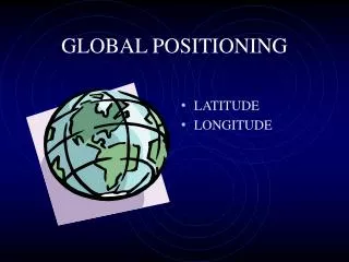
GLOBAL POSITIONING • LATITUDE • LONGITUDE
LATITUDE • THE ANGLE IN DEGREES NORTH AND SOUTH OF THE EQUATOR
WALT DISNEY MAGNET WALT DISNEY MAGNET Engaged Learning Lesson Plan Template Project Title: GLOBAL POSITIONING Date:August 13, 2001 Teacher(s):Pamela Persons Grade Levels:5 & 6 Length of Lesson: 1 week Engaged Learning Lesson Plan Template Project Title: GLOBAL POSITIONING Date:August 13, 2001 Teacher(s):Pamela Persons Grade Levels:5 & 6 Length of Lesson: 1 week LONGITUDE • THE ANGLE IN DEGREES EAST AND WEST OF THE PRIME MERIDIAN
GPS RECEIVER • A HAND-HELD DEVICE THAT RECEIVES DATA DIRECTLY FROM OVERHEAD SATELLITIES
TREASURE HUNT CREATE A MAP FOR THE NATIONAL GEOGRAPHIC SOCIETY SHOWING HIDDEN TREASURES ALL OVER THE WORLD.