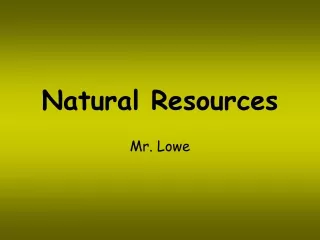
Natural Riparian Resources
420 likes | 555 Vues
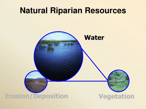
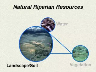
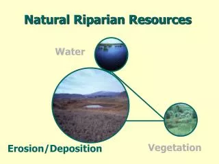
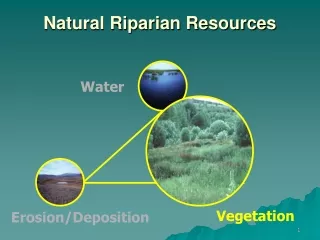
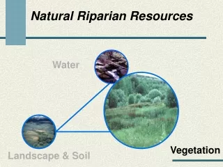
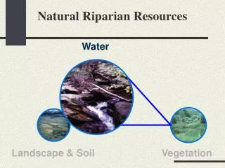
Natural Riparian Resources. Water. Landscape & Soil. Vegetation. Water. Part of all physical and biological processes Weathering process Energy Material Transport Deposition Essential for all plants and animals. Hydrologic Cycle. Watershed or Catchment. Geographic Area

Natural Riparian Resources
E N D
Presentation Transcript
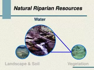
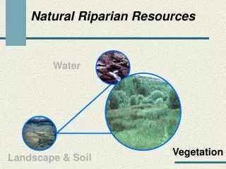
Natural Riparian Resources Water Landscape & Soil Vegetation
Water • Part of all physical and biological processes • Weathering process • Energy • Material • Transport • Deposition • Essential for all plants and animals
Watershed or Catchment • Geographic Area • Catches precipitation • Drains water • Has a single outlet or stream
Area Shape Orientation Slope Geology Drainage Pattern Elevation Climate Fixed Watershed Variables
Management Influenced Watershed Variables • Impervious Area • Soils • Drainage Density • Vegetation • Channel Features
1) Floodplain above bankfull is inundated in “relatively frequent” events Terrace Bankfull Floodplain
Discharge at bankfull stage creates & maintains channels Moves sediment Forms or removes bars Forms or changes bends and meanders Results in the average geomorphologic channel characteristics Recurs every 1 to 2 years
Bankfull Indicators • Deposition Features • Top of point bars • Change in Vegetation • Especially lower limit of continual line of perennial species, at least 1 ft.
Bankfull Indicators • Change in particle size of bank material • Boundary between cobble/boulder and fine grained sand or silt • Undercut banks • Usually slightly below bankfull stage • Stain lines or lower extent of lichens on boulders (Usually in large rivers)
Floodplain Terrace Terrace Floodplain • Level area near a stream channel • Constructed by the stream • In the present climate • Flooded during moderate events • Should not be confused with “terraces” (abandoned floodplains) 1994 Leopold
Should this stream type have a floodplain? • How wide should it be? • How wide is it? • Is the stream channel incised or over sized? • Has widening begun? • Are most terrace walls sloped indicating widening has stopped? • Is there an up stream reservoir?
Should this stream type have a floodplain? • How wide should it be? • How wide is it? • Is the stream channel incised or over sized? • Has widening begun? • Are most terrace walls sloped indicating widening has stopped? • Is there an up stream reservoir?
2002 • Should this stream type have a floodplain? • How wide should it be? • How wide is it? • Is the stream channel incised or over sized? • Has widening begun? • Are most terrace walls sloped indicating widening has stopped? • Is there an up stream reservoir?
2) Where beaver dams are present, they are active and stable • Beaver must be present or the dam is causing hydrologic effects • Sufficient building materials must be present • Sufficient food supply must be present • Usually a single dam is subject to high storm events
Are beaver dams currently acting as hydrologic modifiers? • Are beaver present? • Are beaver actively maintaining the dam? • Is there sufficient food to support the beaver? • Is the dam self-sustaining, e.g., significant vegetation is rooted in the dam? • Is the beaver dam a single large dam? • Are the beaver dams in a complex?
Are beaver dams currently acting as hydrologic modifiers? • Are beaver present? • Are beaver actively maintaining the dam? • Is there sufficient food to support the beaver? • Is the dam self-sustaining, e.g., significant vegetation is rooted in the dam? • Is the beaver dam a single large dam? • Are the beaver dams in a complex?
Are beaver dams currently acting as hydrologic modifiers? • Are beaver present? • Are beaver actively maintaining the dam? • Is there sufficient food to support the beaver? • Is the dam self-sustaining, e.g., significant vegetation is rooted in the dam? • Is the beaver dam a single large dam? • Are the beaver dams in a complex?
1995 1992
3) Sinuosity, width/depth ratio, and gradient are in balance with the landscape setting (i.e., landform, geology, and bioclimatic region) • Question has three parts • Sinuosity • Width/Depth ratio • Gradient • All three must be “yes” for the answer to be “yes” • Must be appropriate for the site
Is the stream actively eroding and building point bars? • Are there indications of channel straightening? • Does the sinuosity appear to be appropriate for the valley bottom type?
Is the stream actively eroding and building point bars? • Are there indications of channel straightening? • Does the sinuosity appear to be appropriate for the valley bottom type?
“most streams cross-section are not parabolic or semicircular (dish-shaped) in shape along the straighter reaches” Leopold 1994 “Rather, they are usually trapezoidal in shape with distinctly developed streambanks” Leopold 1994
Overwidened bankfull inidcators • Bank slumping and shearing • Woody species growing within the channel • Dish-shaped banks
Width/DepthRatio • Is the stream channel dish-shaped? • Are the streambanks barren or dominated by increaser or colonizing species? • Are streambanks undercut and/or slumping? • Are the streambanks jagged (like a saw blade)? • Is the floodplain the appropriate size (see question 1)?
Width/DepthRatio • Is the stream channel dish-shaped? • Are the streambanks barren or dominated by increaser or colonizing species? • Are streambanks undercut and/or slumping? • Are the streambanks jagged (like a saw blade)? • Is the floodplain the appropriate size (see question 1)?
Is the channel incised? • Does the channel appear to be straightened? • Does the sinuosity appear to be appropriate for the valley bottom type?
Is the channel incised? • Does the channel appear to be straightened? • Does the sinuosity appear to be appropriate for the valley bottom type?
4) Riparian-wetland area is widening or has achieved potential extent • Question has two parts • Is riparian/wetland area widening? • As the water table raises, riparian/wetland area can expand outward • As a stream channel narrows, the riparian/wetland areas expands toward the center of the channel • Or, Has it reached potential extent? • Stream in a stable condition
Does the stream have the potential or capability to make a riparian area? • Are riparian species present only because their established roots still reach the water table? • Are riparian/wetland species regenerating? • Are upland species invading the riparian area?
Does the stream have the potential or capability to make a riparian area? • Are riparian species present only because their established roots still reach the water table? • Are riparian/wetland species regenerating? • Are upland species invading the riparian area?
Is the channel narrowing? • Are point bars increasing in size? • Is the floodplain fully developed? • Is upland vegetation such as sagebrush dying? • Is the channel incised?
Is the channel narrowing? • Are point bars increasing in size? • Is the floodplain fully developed? • Is upland vegetation such as sagebrush dying? • Is the channel incised?
5) Upland watershed is not contributing to riparian degradation • Is there riparian/wetland or water quality degradation coming from the uplands • Watch wording carefully • Not contributing “Yes” • Contributing “No”
Are there major changes in the watershed above this point such as logging, mining, agriculture, high road density, or vegetative manipulation? • Is there sufficient precipitation to cause increase flow as a result of these changes?
Are there major changes in the watershed above this point such as logging, mining, agriculture, high road density, or vegetative manipulation? • Is there sufficient precipitation to cause increase flow as a result of these changes?
Is there evidence of channel degradation because of increased flow from the watershed? • Is there evidence of sediment from the upland degrading the riparian area?
Is there evidence of channel degradation because of increased flow from the watershed? • Is there evidence of sediment from the upland degrading the riparian area?
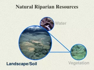
Natural Riparian Resources Water Vegetation Landscape & Soil