Download

1 / 21
220 likes | 509 Vues
Implement Basins on Arc Hydro now for a region of interest Examine new environment-wide modeling approaches for specific constituents e.g. Mercury, bacteria. Arc Hydro for EPA Basins. David R. Maidment, University of Texas at Austin Dean Djokic, ESRI, Redlands. Hydrologic Modeling.

E N D
Implement Basins on Arc Hydro now for a region of interest Examine new environment-wide modeling approaches for specific constituents e.g. Mercury, bacteria Arc Hydro for EPA Basins David R. Maidment, University of Texas at Austin Dean Djokic, ESRI, Redlands
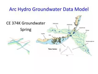
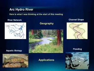
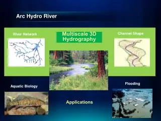
Hydrologic Modeling Hydrologic Information System Arc Hydro Geodatabase
Arc Basins – Builds on core Arc Hydro landscape representation Provides additional feature datasets and tables to store Basins data Arc Hydro Extension for EPA Basins Arc Hydro Feature classes Basins feature classes
Arc Basins as two related databases Connect these two databases using relationships Geodatabase stores geographic feature classes Relational database stores purely tabular information
National Water Information System Web access to USGS water resources data in real time
Arc Hydro Toolset Ver 1.0 Provides tools for processing raster and vector data and populating the attributes of the Arc Hydro data model
Arc Hydro Framework dataset for USA at 1:500,000 scale Built from USGS and National Weather Service data HydroPoints are active USGS stream gaging stations Arc Hydro USA
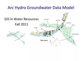
Drainage System Hydro Network Flow Time Time Series Hydro Features Channel System ArcGIS Hydro Data Model
Streams Drainage Areas Hydrography Channels Terrain Surfaces Rainfall Response Digital Orthophotos Thematic Layers supporting the Arc Hydro data model (from Michael Zeiler “Modeling Our World” Volume 2)
Data Model Based on Behavior Follow a drop of water from where it falls on the land, to the stream, and all the way to the ocean.
Integrating Data Inventory using a Behavioral Model Relationships between objects linked by tracing path of water movement
Hydrologic Information System Hydrologic Analysis and Modeling Arc Hydro Geodatabase
Other Arc Hydro Implementations • USGS • Stream Stats • HEC • GeoRAS • GeoHMS Streamstats
Conclusions • Chief innovations of ArcGIS • Network, geodatabase, object modeling • Chief innovations of ArcHydro so far • HydroNetwork • New raster tools and methodology • HydroID – relationships • Integration of Time and Space in a single system • Geodatabase – convenient for working with large vector datasets (use larger packaging units than 8-digit HUC’s)
Implement Basins on Arc Hydro now for a region of interest Examine new environment-wide modeling approaches for specific constituents e.g. Mercury, bacteria Arc Hydro for EPA Basins David R. Maidment, University of Texas at Austin Dean Djokic, ESRI, Redlands