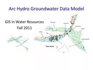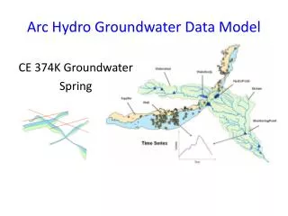
Arc Hydro Groundwater
Arc Hydro Groundwater. Gil Strassberg (Aquaveo) Norm Jones (Brigham Young University) David Maidment (University of Texas) Steve Grise (ESRI). Morning Schedule. 8:30-10:00: Introduction Opening and Arc Hydro overview: David Maidment

Arc Hydro Groundwater
E N D
Presentation Transcript
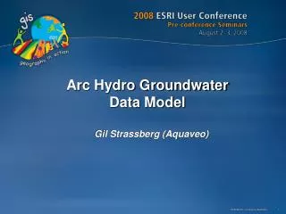
Arc Hydro Groundwater Gil Strassberg (Aquaveo) Norm Jones (Brigham Young University) David Maidment (University of Texas) Steve Grise (ESRI) UC2008 Pre-conference Seminars
Morning Schedule 8:30-10:00: Introduction • Opening and Arc Hydro overview: David Maidment • Introduction to data models and geodatabase design: Steve Grise • Overview of the Arc Hydro Groundwater Data Model: Gil Strassberg 10:00-10:30: Break 10:30-12:00: Groundwater Data Model • Demonstration of the Groundwater Data Model components and Basic Toolkit: Gil Strassberg • Implementation strategies and geodatabase design tools: Steve Grise 12:00-13:30: Lunch Break UC2008 Pre-conference Seminars
Afternoon Schedule 13:30-15:00: • Overview of the MODFLOW Data Model: Norm Jones • Tool demonstration: Modflow Analyst and Subsurface Analyst: Norm Jones and Gil Strassberg 15:00-15:30: Break 15:30-17:00: • Development plans for the coming year: Norm Jones • User survey results: Norm Jones • Open Discussion UC2008 Pre-conference Seminars
Linking GIS and Water Resources Water Resources GIS Pre Conference Seminar
Arc Hydro An ArcGIS data model for water resources Arc Hydro toolset for implementation Framework for linking hydrologic simulation models Arc Hydro: GIS for Water Resources Published in 2002, now in revision for Arc Hydro II The Arc Hydro data model and application tools are in the public domain Pre Conference Seminar
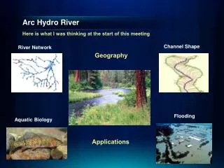
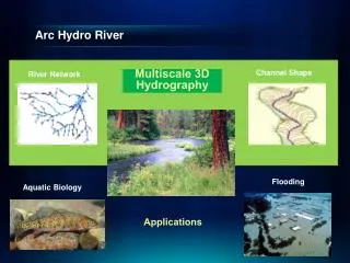
Arc Hydro —Hydrography The blue lines on maps Pre Conference Seminar
Arc Hydro —Hydrology The movement of water through the hydrologic system Pre Conference Seminar
What Makes Arc Hydro different? ArcGIS: All features are labeled with a unique ObjectID within a feature layer Arc Hydro: All features are labeled with a unique HydroID across the geodatabase HydroID to …. IDRelationships link neighboring features and help to trace water movement Arc Hydro is a unique “flavor” or style of doing GIS Pre Conference Seminar
What Makes Arc Hydro different? Arc Hydro connects space and time: HydroFeatures are linked to time series Flow HydroID Time FeatureID Time Series HydroFeatures Pre Conference Seminar
Challenges in developing Arc Hydro • ArcGIS is a very successful static, 2D or 2.5D system • For surface water resources we need • Close connection between raster terrain and vector stream data • Linkage to time varying water data observations stored at gages • Access to precipitation and evaporation data “fields” • For groundwater resources we need • 3D representation of boreholes and hydrogeologic units • Integration with groundwater models, especially Modflow, which has become the ArcInfo of groundwater Pre Conference Seminar
Websites • ESRI Data Model Website: www.esri.com/datamodels • Arc Hydro Groundwater Website (wiki): www.archydrogw.com • Contact: • Norm Jones (njones@byu.edu) • Gil Strassberg (gstrassberg@aquaveo.com) • David Maidment (maidment@mail.utexas.edu) • Steve Grise (sgrise@esri.com) Pre Conference Seminar