Comprehensive Overview of Soils and Hydroponics Management in Agricultural Practices
820 likes | 953 Vues
This unit explores the crucial role of soils and plant growing media in agriculture, detailing the characteristics, formation, and management of soil for optimal plant growth. It covers the composition of soils (mineral, organic matter, air, and water), the classification of land use, the impact of living organisms, and various growing media, including hydroponics. The unit also emphasizes the importance of land capability and improvement practices necessary for sustaining agricultural productivity. Understanding these elements is vital for effective agricultural management and resource conservation.

Comprehensive Overview of Soils and Hydroponics Management in Agricultural Practices
E N D
Presentation Transcript
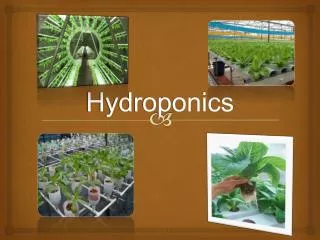
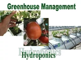
Soils and Hydroponics Management Unit 9 AgriScience 1
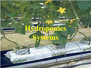
Media definition: material that provides nutrients and support through plant root systems. Plant Growing Media
Soil Defined: • Soil is the mineral and organic matter that supports plant growth and is a mixture of rock particles, organic matter, living forms, air and water. Air Mineral matter- 45% Water OM5%
Soil- Planet Earth Land- 33.3% Water- 66.7%
Soil- Agricultural land Crops- 2.9% Non Ag 24.4% Non Ag 24.4% Grazing-5.7% Ag – 8.6% Water- 66.7% Water- 66.7%
Soil- Land Use in IOWA Forest 4.9% Pasture- 12.7% Minor 2.7% Land in US- 6.2% Grazing-5.7% Transportation 3% Iowa- .1% All Land- 93.7% Crop- 74.3%
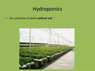
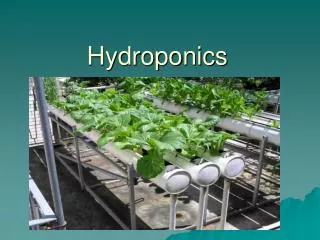
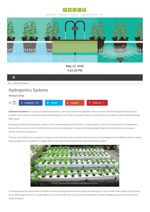
Soil-less Media • Media Mixes • Perlite • Vermiculite • Peat moss • Sphaghnum moss • Sand • Compost • Wood chips, barks • Water- Hydroponics
Soil Formation Climate Living Organisms Parent Material Topography Time Weathering
Climate • Temperature • Chemical reaction rates • Growth of fungi, bacteria, plants Rainfall Increases erosion rate Increases leaching
Living Organisms Decomposers- fungi and bacteria- aid in organic matter breakdown. Plants- add organic material to soil Earth worms- help create soil structure and breakdown plant residue.
Parent Material Residual Mineral Igneous Sedimentary Metamorphic Organic Peat Transported Glacial till-ice Alluvial- water Loess- wind blown Colluvium- gravity added by water Lacustrine- lake deposits
Time Organic matters decreases and more leaching occurs Organic matter builds up soil becomes more productive Young to old soils
Identifying Land Areas and Capability Legal description-location Old-Use a Soil Survey NEW-Digital Map resources
Legal Description • A legal method of describing property for recording on deeds. • 2 major systems used • Metes and Bounds • Rectangular survey
Metes and Bounds • Used in the East and Southwest in early settlement. • Uses major landmarks as a marking system. • Many disputes when landmarks changed.
Rectangular Survey • Adopted in 1875 • Latitude and longitude based. • Baselines and principal meridians • 5th meridian is our principle meridian.
Townships • Laid out starting at the intersection of principle meridian and baseline. • 6 miles square • 50 feet shorter on the north boundary. • Correction lines every 24 miles
Townships • 36 square miles • 1 mile square each • numbered
Sections • 1 square mile • 640 Acres • further subdivided and described by halves and quarters
Build a Legal Description • Start with smallest fraction • section • township • county • State
Land is more than soil • Natural and artificial characteristics of an area to be used for agricultural or other purposes • Includes renewable and nonrenewable resources plus improvements
Land • The surface of the earth not covered with water • Maybe temporarily or permenently covered with water • A pond for aquaculture is considered land
Cropland • Used for growing crops • Crops grown typically improve the tilth of the land
Arable land • Land that can be used for row crops • Can be tilled • Alternatives include pasture and forest crops
Major Characteristics of Cropland • Soil - Large impact on productivity. Soil texture, nutrients and internal structure • Climate - average of water conditions over a long time • Topography - form or outline of the surface of the earth • Water supply - amount of water available for crops
Subsurface conditions - Soil textures, hardpans • Pollution - can prevent plant growth
Alternative Uses • Best land use is determined by how the land will give the most benefits to people. • Which use will give the highest returns • What will happen if productive cropland is used for other purposes?
Land Improvement • Four common practices to improve arable land • Irrigation • Erosion Control • Drainage • Forming (land forming)- surface is smoothed or reshaped.
Capability Factors • Characteristics of land that determine its best use • Surface texture • proportion of sand, silt, clay down to about 7 inches • three major classifications • sandy • loamy • clayey
Soil Tilth • Physical condition of the soil that makes it easy or difficult to work • Poor tilth has hard clod • Maybe very wet or very dry
Internal drainage • Permeability- movement of water and air through soil • Directly related to nutrient content • Classified as very slow, slow, moderate and rapid • water quickly soaks into sandy soil with high permeability • soils with clay have slow permeability
Soil Depth • Thickness of the soil layers • Requirement depends upon type of crop to be produced • Four soil depths are used • very shallow - less than 10 inches • shallow - 10 to 20 inches • moderately deep - 20 to 36 inches • deep - over 36 inches • Shallow soils are often the result of erosion
Erosion • Loss of topsoil by wind or other forces • Four categories • very severe erosion- 75% or more and large gullies are present • severe erosion - 75% of soil has eroded but no large gullies present • moderate erosion- 25 to 75% of soil has eroded with small gullies present • none to slight erosion - less than 25% of soil has eroded and no gullies are present
Slope • The rise and fall of the elevation of the land • Measured in percents • Important in determining the best use of the land
Surface Runoff • Water from rain, snow, or other precipitation that does not soak into the ground • Can be reduced by conservation practices • chopping stalks • terraces • ground cover
Land Capability • Suitability of land for agricultural uses. • Usage should not cause damage to the land although nutients maybe removed
Land Capability Classes • Assigning a number to land • Eight classes used • I to VIII with I being the best arability • Class I to IV can be cultivated • V to VIII tend to have high slope or low and wet
Classes • Class I - Very good land • Very few limitations • deep soil and nearly level • can be cropped every year as long as land is taken care of • Class II - Good land • has deep soil • may require moderate attention to conservation practices
Class III - moderately good land • crops must be more carefully selected • often gently sloping hills • terraces and stripcropping are more often used • Class IV - fairly good land • lowest class cultivated • on hills with more slope than class III • Class V - Unsuited for cultivation • can be used for pasture crops and cattle grazing, hay crops or tree farming • often used for wildlife or recreation areas
Class VI - Not suited for row crops • too much slope • usually damaged by erosion with gullies • can be used for trees, wildlife habitat, and recreation • Class VII - Highly unsuited for cultivation • has severe limitations • permanent pastures, forestry, wildlife • slope is usually over 12 percent • large rock surfaces and boulders may be found • very little soil present
Class VIII • Cannot be used for row crops or other crops • often lowland covered with water • soil maybe wet or high in clay • aquatic crops maybe grown there • used for waterfowl habitat
What is a Soil Profile?- a view of a cross section of soil • 0 Horizon-located on surface, mostly O.M. • A Horizon-Called Topsoil, good amounts of O.M. and minerals. • B Horizon- Known as Subsoil, Less O.M. • C Horizon- Mostly parent material, does little for plant growth. • R- bedtrock
Soil Profile- • Differences in layers based on: • Organic matter • Texture • Color • Structure