Download
1 / 12
120 likes | 288 Vues
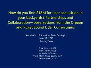
How do you find $18M for lidar acquisition in your backyards? Partnerships and Collaboration—observations from the Oregon and Puget Sound Lidar Consortiums. Association of American State Geologists June 11, 2012 Austin, Texas. Craig Weaver, USGS Brian Sherrod, USGS Ian Madin , DOGAMI

E N D
How do you find $18M for lidar acquisition in your backyards? Partnerships and Collaboration—observations from the Oregon and Puget Sound Lidar Consortiums Association of American State Geologists June 11, 2012 Austin, Texas Craig Weaver, USGS Brian Sherrod, USGS Ian Madin, DOGAMI Phyllis Mann, Kitsap County EMD Diana Martinez, PSRC
The stage is set for partnership • 1995—Cascadia Regional Earthquake Workgroup, private-public partnership incorporates, USGS EHP, DOGAMI • 1996—National Tsunami Hazard Mitigation Program is formed as a true state-federal partnership, USGS EHP, DOGAMI • 1997-2000—Project Impact collaborations in Seattle, King-Pierce County, Kitsap County and Benton County, OR, leads to many new contacts, USGS EHP • 2000—lidar survey of Bainbridge Island shows clear evidence of Seattle fault—first time fault scarp can be touched. USGS Earthquake Program develops regional strategy for lidar acquisition across Puget Sound—area based, not fault based.
Multiple Choice: Where would you look for $$$ • Geologists • Emergency managers • Public Works/Transportation • Tribes • Environmental agencies and groups • Cities • Utilities and land management agencies • Private sector • Other Correct answer: all but A
Why Consortiums—an extremely brief history • 2000: Kitsap County PUD flew a lidar survey of Bainbridge Island for surface water management, clear image of the Seattle fault! • 2000: Seattle Project Impact pushes for lidar survey over the Seattle fault • 2000: Kitsap County Commissioners take need for survey to Washington, DC • 2001: $500K of federal funding matched by $240K of local funds, Puget Sound Lidar Consortium formed • Kitsap County Emergency Management does financial • Puget Sound Regional Council—scheduling, QA/QC • 2003-2005: Many agencies fund Portland surveys • 2007: OLC issues first RFP
What you need to make it work • Organizer(s)—who is interested, who has money, who has needs (USGS EHP, DOGAMI often do this) • Financial arm (Kitsap County EMD, DOGAMI) • Bundle funding from multiple sources • Strict accounting • Ease of transfer—not USGS—interagency transfer agreements • Contractor management—one point of contact for managing lidar vendor and informing clients (PSRC, DOGAMI) • Consortiums often have multiple jobs with multiple clients • Flight conditions change causing change in survey plans • QA/QC—most clients have no idea (PSRC, DOGAMI)
What has the PSLC done? In Washington, the PSLC has now surveyed about 9000 square miles or partnered with other agencies to build dense coverage over nearly all of central and southern Puget Sound. Total funding across the entire state is about $7M, and about 50 partners.
The Oregon Lidar Consortium: What it has done To date, a total of 26,825 mi2 (68,000 km2) of data is in hand or in progress in Oregon, with an additional 1900 mi2 (4,900 km2) in other states. All of the data is high resolution and high accuracy, and is consistent from project to project. (about 26% of the state) New Madrid 2012
The Oregon Lidar Consortium: Partners To date, 44 OLC partners have provided $11 million in funding for lidar acquisition That’s a big hat!
The Key to the Consortiums • Price agreement defining fixed products and unit cost (the larger the area, the lower the price) • Funding pooled from project-specific groups of partners—lowers cost • Careful management of operations and finances—control when to fly • Rigorous quality control and agreement that all partners meet consortium data standards
Why the Consortiums Work • Clients know in advance what they will get and how much it will cost • Clients find it easier to contract with the consortiums than directly with the private sector, most local jurisdictions can use a short interagency purchase agreement to transfer funds. Most jurisdictions have a poor understanding of technical aspects of lidar • The consortiums enhance the value of each client’s contribution by finding additional funding partners • Clients know that they will get good data • Data is collected where it is most needed, defined by the willingness of clients to pay. • Despite poor economy, funds for local lidar keep showing up • Focused workshops on potential projects helps #6 and #5