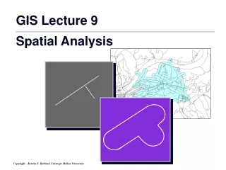
GIS Operations and Spatial Analysis
GIS Operations and Spatial Analysis. Turns raw data into useful information by adding greater informative content and value Reveals patterns, trends, and anomalies that might otherwise be missed Provides a check on human intuition by helping in situations where the eye might deceive


GIS Operations and Spatial Analysis
E N D
Presentation Transcript
GIS Operations and Spatial Analysis • Turns raw data into useful information • by adding greater informative content and value • Reveals patterns, trends, and anomalies that might otherwise be missed • Provides a check on human intuition • by helping in situations where the eye might deceive • Thousands of techniques exist…
Map of Cholera Deaths by John Snow • Provides a classic example of the use of location to draw inferences • But the same pattern could arise from contagion • if the original carrier lived in the center of the outbreak • contagion was the hypothesis Snow was trying to refute • today, a GIS could be used to show a sequence of maps as the outbreak developed • contagion would produce a concentric sequence, drinking water a random sequence
Map Algebra • C. Dana Tomlin (1983…) • implemented in many grid analysis packages, including ArcGrid, Idrisi, MapII, ArcView Spatial Analyst • Four classes of operations: • local • focal • zonal • incremental DEMO
Local Functions • work on single cells, one after another, value assigned to a cell depends on this cell only • examples: • arithmetic operations with a constant, or with another grid: • also logical operations, comparisons (min, max, majority, minority, variety, etc.) 2 0 1 2 4 0 3 1 6 0 3 6 12 0 9 3 2 0 1 2 4 0 3 1 1 5 3 4 4 3 2 5 6 2 0 3 8 16 0 6 6 * 3 = = *
Polygon Overlay, Discrete Object Case B A In this example, two polygons are intersected to form 9 new polygons. One is formed from both input polygons; four are formed by Polygon A and not Polygon B; and four are formed by Polygon B and not Polygon A.
Focal Functions • assign data value to a cell based on its neighborhood (variously defined) • uses: • smoothing - moving averaging • edge detection • assessing variety, etc. • examples: • focal sum - adds up values in cell neighborhood, and assigns this value to the focal cell • focal mean - averages values in neighborhood,and assigns the result to the focal cell • also: logical functions, other mathematical
Shapes of Neighborhoods 1 1 3 4 6 3 6 4 4 5 1 2 5 1 2 3 4 6 3 4 6 3 4 4 3 4 4
Kinds of Neighborhoods • Neighborhood: a set of locations each of which bears a specified distance and/or directional relationship to a particular location called the neighborhood focus (D. Tomlin) • distance and directional neighbors • immediate and extended neighbors • metric and topological neighbors • neighbors of points, lines, areas...
Neighborhood Operations some function 1 3 4 6 X 4 Functions: Total: X = 18 Variety: X = 4 Average: X = 4 Median: X = 4 Minimum: X = 1 Deviation: X = 0 Maximum: X = 6 Std. dev.: X = 2 Minority: X = 1 (or 3, or 6) Proportion: X = 40 Majority: X = 4 . . .
Neighborhood Statistics • In Spatial Analyst you can specify: • shape of neighborhood: | Circle | Rectangle | Doughnut | Wedge • size of neighborhood: radius (circle), inner and outer radius (doughnut), radius, start and end angles (wedge), width and height (rectangle) • operation: | Minimum | Maximum | | Mean | Median | Sum | Range | Standard Dev. | Majority | Minority | Variety |
Buffer: a Typical Neighborhood • Buffers and offsets • Buffers in vector form • either a chain of “sausages” • or a Voronoi network • Buffers in raster form • a two-step operation: (1) create a map of distances from the object; (2) reclassify it into a binary map
Buffering Polyline Polygon Point
Applications of Buffers • Exclusionary screening / ranking - in site selection studies • Environmental regulations Main question: how wide?? -depends on a variety of political / social / economic / cultural circumstances, often difficult to formalize... differs by states and counties
Zonal Functions • assign values to all cells in a zone, based on values from another map zonal grid + values grid => output grid 2 0 0 2 4 0 3 4 1 2 3 4 5 6 7 8 9 4 6 6 4 9 6 7 9 max again, many types of functions are available
Global (incremental) Functions • cell value for each cell depends on processing the entire grid • examples: • computing distance from one cell (or group of cells) to all other cells • distance can be weighted by some impedance factor => cost-distance surfaces • uses: • diffusion modeling • shortest path modeling, distance-based site selection • visibility analysis • connectivity and fragmentation in habitat analysis, etc.
Rules of Map Combination • Dominance • selects one value from those available, other values ignored; an external rule is used for selection • Contributory • values from each map contribute to the result, typically combined with some arithmetic operation, ignoring interdependence of factors (each value contributes without regard to others) • Interaction • interaction between factors is accounted for, more flexible design +
1 1 0 0 0 0 1 0 0 1 1 1 1 1 1 0 0 1 0 0 0 1 0 1 0 1 0 1 0 0 1 0 0 1 0 0 0 0 0 0 0 1 0 1 0 0 1 0 Dominance Rules: Excl. Screening • Exclusionary screening • selects one value from the available set, ignoring others, usually by an externally specified rule • exclusionary screening(“one strike and you’re out”) • binary (yes/no) • typically an iterative process (two risks: either too much area left, or too much excluded) and ==> in map calculator, with 0/1 themes, can simply multiply them
1 2 1 2 3 3 1 3 1 3 1 2 1 1 1 2 3 1 1 1 2 1 3 3 1 1 2 1 1 1 1 3 3 2 1 2 3 3 3 3 1 3 2 2 1 1 1 3 Dominance Rules: Excl. Ranking • for ordinal data => take min, or max • common for land resource assessment • for example: encode areas with most severe limitation by any of the factors (max) and ==>
6.1 7.5 6.7 8.1 3.1 2.4 7.6 6.6 6.5 7.5 8.2 9.1 3.3 6.5 7.7 6.2 5.3 6.2 6.7 8.1 1.1 1.4 5.6 6.6 6.5 7.4 8.2 9.1 3.3 5.5 7.7 6.2 6.1 7.5 6.2 7.1 3.1 2.4 7.6 5.6 6.3 7.5 8.0 5.1 2.3 6.5 5.7 5.2 2 2 1 1 2 2 2 1 1 2 1 1 1 2 1 1 Dominance: Highest Bid/Bidder • apply to ratio data • examples: • max profit for a site => highest bid • activity/developer providing the maximum profit => highest bidder highest bid and highest bidder Factor 1 Factor 2
1 1 0 0 0 0 1 0 0 1 1 1 1 1 1 0 0 1 0 0 0 1 0 1 0 1 0 1 0 0 1 0 1 2 0 0 0 1 1 1 0 2 1 2 1 1 2 0 Contributory: Voting Tabulation • how many positive (or negative) factors occur at a location (number of votes cast) • applies to nominal categories + ==> also, can produce the most frequent/least frequent value, etc. … is an area excluded on two criteria twice as excluded as area excluded on one factor?...
1 1 0 0 0 0 1 0 0 1 1 1 1 1 1 0 0 1 0 0 0 1 0 1 0 1 0 1 0 0 1 0 3 8 0 0 0 5 3 5 0 8 3 8 3 3 8 0 Contributory: Weighted Voting • weights express relative importance of each factor, factors are still 0 and 1 3 x 5 x + ==> weights of factors
1 2 1 2 3 3 1 3 1 3 1 2 1 1 1 2 3 1 1 1 2 1 3 3 1 1 2 1 1 1 1 3 4 3 2 3 5 4 4 6 2 4 3 3 2 2 2 5 Contributory: Linear Combination • each factor map is expressed as a set of site rankings • these rankings are added up for each cell + ==> consider this: 2 = 1 + 1 3 = 1 + 2 = 2 + 1 4 = 1 + 3 = 2 + 2 = 3 + 1 5 = 2 + 3 = 3 + 2 6 = 3 + 3 this is what happens when you add up ordinal data. Perhaps, convert them to ratio (dollars)?
1 2 1 2 3 3 1 3 1 3 1 2 1 1 1 2 3 1 1 1 2 1 3 3 1 1 2 1 1 1 1 3 Contributory: Weighting and Rating • factor maps composed of rankings, weights externally assigned • a rather problematic, though very popular method 18 11 8 11 19 14 18 24 8 14 13 11 8 8 8 21 3 x 5 x + ==> weights of factors Also, there is Non-linear combination (like USLE) - particularly sensitive to errors, zero values...
How to Assign Weights • Delphi techniques • to aid decision-makers in making value judgments; elicit and refine group judgments where exact knowledge is unavailable • rounds of “blind’ individual ratings by professionals • rounds of open discussion of differences • re-evaluations • often: categories and their sets are redefined • task: to obtain a reliable consensus • Binary comparisons
1 2 1 2 3 3 1 3 1 3 1 2 1 1 1 2 3 1 1 1 2 1 3 3 1 1 2 1 1 1 1 3 3 4 1 4 8 7 3 9 1 7 2 4 1 1 1 6 Interaction Rules 1 • “Gestalt”, or Integrated Survey • a field team is sent out to produce an integral map... • Factor combination • all possible combinations are considered and rated 1 : 1 & 1 2 : 1 & 2 3 : 1 & 3 4 : 2 & 1 5 : 2 & 2 6 : 2 & 3 7 : 3 & 1 8 : 3 & 2 9 : 3 & 3 and ==> legend number of potential categories rises quickly, but fortunately just a small fraction survive
Interaction Rules 2 • Interaction tables • values of one factor determine weights of other factors, then weighting/rating scheme is applied • Hierarchical rules of combination • Binary comparisons NOTE THAT ALL THESE METHODS - Dominance, Contributory, Interaction - APPLY TO OVERLAY, NEIGHBORHOOD OPERAITONS, ZONAL OPERATIONS, etc. - everywhere where you need to combine values