Download
1 / 20
200 likes | 369 Vues
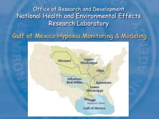
Office of Research and Development National Health and Environmental Effects Research Laboratory. Gulf of Mexico Hypoxia Monitoring & Modeling. Water Quality Issues in the Gulf of Mexico. Reduce coastal nutrient loads Reduce hypoxia in northern Gulf Improve water quality Restore wetlands

E N D
Office of Research and DevelopmentNational Health and Environmental Effects Research Laboratory Gulf of Mexico Hypoxia Monitoring & Modeling
Water Quality Issues in the Gulf of Mexico • Reduce coastal nutrient loads • Reduce hypoxia in northern Gulf • Improve water quality • Restore wetlands • Preserve habitats Sources: Gulf Alliance, draft report NCCR2, 2005 Hypoxia Action Plan, 2001
Office of Water Needs Office of Science & Technology National Nutrient Criteria Office of Wetlands, Oceans & Watersheds MS River/Gulf of Mexico Watershed Nutrient Task Force 2001 Hypoxia Action called for reassessment in 5 years – assess progress towards goals and revise if needed SAB will conduct assessment of Gulf hypoxia science (beginning in 2006) - SAB will require information update (GED lead for Hypoxia Science Symposium) MS River Basin and Gulf receiving water focus for EcoProtection MYP revision Nutrient criteria recommendations for freshwater systems by ecoregion released in 2001 - States are working to revise FW criteria OST required to release estuarine nutrient criteria recommendations by 2007 OST required to release nutrient criteria recommendations for wetlands and coastal marine waters by ???
Gulf Hypoxia Monitoring and Modeling MED Field Station Grosse Ile, MichiganRussell G. Kreis Jr. Western Ecology Division Newport, OregonPeter M. Eldridge Office of Water Washington DC Gulf Ecology Division Gulf Breeze, FloridaRichard M. Greene Gulf of Mexico Program Office Stennis, Mississippi
Gulf Hypoxia Monitoring and Modeling Goal: Develop consensus modeling framework targeting Gulf hypoxia to reduce uncertainty and enhance credibility of model estimates of nutrient load reductions required to meet Action Plan goals provide defensible options to guide restoration and decision-making
CENR National HypoxiaAssessment Report (1999) • Primary obstacle to reducing model uncertainties … is lack of a sufficiently comprehensive database • Existing database not designed to quantify load-response relationships – new monitoring approaches needed • Comprehensive monitoring programs alone will not be sufficient for developing, calibrating and validating quantitative WQ models – relevant and targeted research needed • Future modeling should include linkages of WQ/Eutro and hydrodynamics, expansion of spatial domain, and refinement of temporal and spatial resolution – new integrated, multimedia modeling constructs needed
ORD Objectives • Establish an integrated multimedia, mathematical modeling framework that incorporates monitoring, condition assessment, diagnosis, and research • Support the framework with a statistically-based, seasonal field monitoring design and targeted research • Integrate physical, chemical, biological components with external and internal nutrient loads • Establish stressor-response relationships for nutrient loads & concentrations, Chl a, and DO • Develop predictive capability to forecast the benefits of risk reduction options and the time to realize the benefits • Examine stressor-response relationships using forecasting to provide bases for biologically-based, nutrient criteria for ambient nutrients, Chl a, and DO • Provide managers with defensible methods, tools, and options to aid and guide the environmental decision-making process
ORD Gulf Hypoxia Modeling Framework Meteorological data Computational Transport Surface Wave Model Atmospheric Transport Model Hydrodynamic Model Advective/ Dispersive Transport Wave direction, height, period Deposition Fluxes Mass Balance Sediment Transport & Diagenesis Model Water Quality Model Dissolved Oxygen Model (water/sediment) Eutrophication Model Constituent Mass loadings
Atmospheric Hydrodynamic/ Meteorological Sediment transport, fate, and diagenesis Water Quality/ Eutrophication/ Dissolved Oxygen Framework Models Model Components Partners CMAQ, CTM, MM5 IAS NCOM IPX-MT and CE-QUAL-ICM hybrid WASP and CE-QUAL-ICM hybrid ORD/NERL USN, NRL ORD/NHEERL ORD/NHEERL
Establish a defensible nutrient loading target necessary to reduce the areal extent of hypoxic bottom waters in the Gulf Develop eco-forecasting capabilities to evaluate nutrient management strategies and timelines to achieve results Conceptual Relationship Between Maximum Hypoxic Zone Size and Load Reduction Hypoxia Recovery Scenarios Under Gradual Nutrient Reductions and Hydrologic Variability
Gulf Hypoxia Monitoring Surveys Characterize the spatial and temporal variability in oceanographic state and process variables, including resolution of the seaward and down-plume boundary conditions of the model domain Quantify key processes influencing hypoxia to improve predictive models Develop geo-referenced database to support model development
Gulf Hypoxia Monitoring Surveys Station Sampling Summary CTD CTD+Water Benthic 17 19 0 29 36 6 26 25 7 28 42 9 0 22 4 24 42 10 Surveys Completed Dec 2–15 2002 March 17–31 2003 June 9–23 2003 Nov 5–19 2003 April 2–7 2004 March 21-31 2005 Sept 26 – Oct 9, 2005 Map shows transect stations and depth contours
Parameter Water Sediment Gulf Hypoxia Monitoring Data – discrete waters samples collected at minimum of 2 and maximum of 6 depths depending on water column structure and depth
Water column stratification and Hypoxic Region June 9 – 19, 2003 D kg/m3 Surface Chlorophyll a and Hypoxic Region June 9 – 19, 2003 µg/L
Resolving Seaward Boundary Conditions Salinity distributions along transect D showing oceanic conditions seaward June 2003 Depth (m) March 2003 Transect Distance (km)
Continuous Surface Mapping Array MS River to Fourchon Start Stop Cruise track Surface salinity and PO43- Mixing zone Not baseline corrected
Project Timelines FY ‘06 FY ‘07 FY ‘08 FY ‘02 FY ‘03 FY ‘04 FY ‘05 Planning Field Monitoring Sample/Data Analysis Database Development Model Development & Application APMAPMAPM Cruise WQ Dbase Report Trends