Download
1 / 6
60 likes | 178 Vues
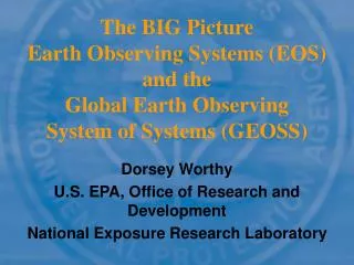
The BIG Picture Earth Observing Systems (EOS) and the Global Earth Observing System of Systems (GEOSS). Dorsey Worthy U.S. EPA, Office of Research and Development National Exposure Research Laboratory. EOS and GEOSS.

E N D
The BIG PictureEarth Observing Systems (EOS) and theGlobal Earth Observing System of Systems (GEOSS) Dorsey Worthy U.S. EPA, Office of Research and Development National Exposure Research Laboratory
EOS and GEOSS EOSenvironmental remote sensing systems can provide near-continuous monitoring of the earth The GEOSS"system-of-systems” of remote and ground-based sensors and monitoring activities will enable unprecedented access to and use of earth resources data and information global
Data Air Quality Integrated System Solutions EARTH SYSTEM MODELS Aerosol Transport: • DAO GoCART , DECISION SUPPORT TOOLS CMAQ CMAQ ( C ommunity M ulit - Predictions Global - Regional Assimilations: • VALUE & BENEFITS S cale A ir Q uality modeling RAQMS, CMAQ system) Reduce lung - related • Assess emissions control • Atmospheric Chemistry: • GEOS - diseases & premature CO & CH Atmospheric • strategies and develop SIPs CHEM, CMAQ 2 4 death Concentration (State Implementation Plan) Projections Emissions: • SMOKE Reduce hospital • Assess compliance Global Atmosphere State • • admissions & use of Meteorology: • MM5 Seasonal Forecasts Waivers to air standards medicines • Local & Global Long - • Air Trajectories: • NOAA - Hysplit4 Range Prediction of Quantify voluntary Reduce lost workdays • • Global Circulation Models • GISS, PCM Pollutants stationary emission and schooldays *Supported Non - NASA Model reductions Improve visibility and • Total Aerosol Amount • reduce haze for tourism AQI ( A ir Q uality I ndex) Aerosol Properties • Improve resiliency of • Forecast transport of • Atmospheric • crops; increase yields dust/pollutants Temperature Total Column Ozone • Increase confidence in • Actions to reduce source MONITORING & MEASUREMENTS • Ozone Vertical Profile • government emissions Ozone & Precursors • Atmosphere: • Terra, Aqua, TOMS, Improve crop estimates • PM forecasts • 2.5 Land Cover/Use • Aeronet , SAGE III, AIRNow , GOES, Sensitive populations • POES, INTEX, Aura, CloudSAT , Calipso , Cloud Particles & • Linkage of global and regional can change activities Properties OCO, GIFTS, NPP, NPOES APS climate and air quality models Cloud System Structure • Improve global Land: • • Terra, Aqua, Landsat Surface Trace Gas • Incorporate hemispheric • awareness/actions of Concentration transport into regional air global transport Trace Gas Source • quality decision making Observations *Future Mission
0.0 0.2 0.4 0.6 0.8 1.0 0 10 20 30 40 50 60 70 0 15.5 40.5 65.5 150.5 Aerosol Optical Depth Cloud Optical Thickness PM2.5 (ug/m3) Sept 9 Sept 10 4 day sequence showing transport of regional pollution event. Posts show EPA PM2.5 ground-based measuring site. Color contours are MODIS aerosol optical depth (US EPA/NASA, 2003) No EPA sites MODIS fills in Sept 11 Sept 12
Detecting, Monitoring, and Predicting the Exposure and Impact of Smoke from Wildfires