Download
1 / 17
170 likes | 185 Vues
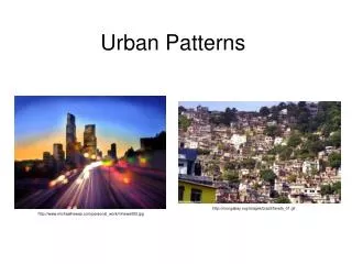
This chapter explores the different models of urban structure, including the concentric zone model, sector model, and multiple nuclei model. It also examines how people are distributed within urban areas, both in North America and in other parts of the world. Additionally, the chapter discusses the distinctive challenges faced by inner cities and suburbs.

E N D
Where Are People Distributed Within Urban Areas? Key Issue #2
Where Are People Distributed in Urban Areas? • Models of urban structure • Are used to explain where people live in cities • Three models, all developed in the city of Chicago • Concentric zone model • Sector model • Multiple nuclei model
Concentric Zone Model • Concentric zone model • Created in 1923 by E.W. Burgess; a city grows outward from a central area in a series of concentric rings
Sector Model • Sector model • Created in 1939 by Homer Hoyt; a city develops in a series of sectors, not rings
Multiple Nuclei Model • Multiple nuclei model • Created in 1945 by C.D. Harris and E.L. Ullman; a city is a complex structure that includes more than one center around which activities revolve.
Where Are People Distributedin Urban Areas? • Applying the models outside North America • European cities-wealthier people cluster along a sector extending out from the CBD and in the inner rings for the city’s amenities • Less developed countries • Colonial cities-followed standardized plans • Cities since independence-focal points of change in LDCs, millions moving for work • Squatter settlements-due to rapid # of poor moving to cities; temporary housing with few services • Also known as barrios, barriadas, favelas
Income Distribution in the Paris Region Figure 13-10
Model of a Latin American City Figure 13-14
Why Do Inner Cities Have Distinctive Problems? Key Issue #3
Why Do Inner Cities Face Distinctive Challenges? • Inner-city physical issues • Most significant = deteriorating housing • Filtering-subdivision of housing for low income rentals • Redlining-banks literally draw lines on a map to identify areas in which they refuse to loan money • Urban renewal-cities identify blighted inner-city neighborhoods, acquire properties, relocate the resident or business, clear the site, build roads, utilities, etc., and sell the land to private or public developers/agencies • Public housing-for low income households, accounts for a high percentage of housing in inner cities, but not in the US as a whole • Renovated housing • Gentrification-middle-class people move into deteriorated inner city neighborhoods and renovate the housing
Racial Change in Chicago Figure 13-16
Why Do Inner Cities Face Distinctive Challenges? • Inner-city social issues • The underclass • An unending cycle of social and economic issues • Homelessness • Culture of poverty • Crime • Ethnic and racial segregation • De jure segregation-based on law (ex. Apartheid, Jim Crow laws) • De facto segregation-based on custom (ex. Little Italy, Chinatown)
Why Do Suburbs Have Distinctive Problems? Key Issue #4
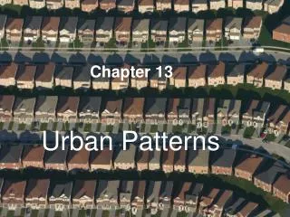
Why Do Suburbs Face Distinctive Challenges? • Peripheral model-developed by Chauncey Harris (creator of the multiple nuclei model) • An urban area consists of an inner city surrounded by a large suburban and business areas tied together by a beltway or ring road • Edge cities -nodes of consumer and business services around the beltway • Density gradient-the number of houses per unit of land decreases as distance from the city center increases • Cost of suburban sprawl-progressive spread of development over the landscape
Peripheral Model of Urban Areas Fig. 13-19: The central city is surrounded by a ring road, around which are suburban areas and edge cities, shopping malls, office parks, industrial areas, and service complexes.