Download
1 / 32
330 likes | 551 Vues
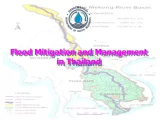
Flood Mitigation and Management in Thailand. Topics. Nature and Extent of Flooding Data Collection and Forecasting Flood Forecasting and Warning Communication of Flood-Warning Information Other Relevant Information. Nature and Extent of Flooding. ร้อยเอ็ด.

E N D
Topics • Nature and Extent of Flooding • Data Collection and Forecasting • Flood Forecasting and Warning • Communication of Flood-Warning Information • Other Relevant Information
ร้อยเอ็ด แผนที่แสดงพื้นที่เสี่ยงต่อการเกิดอุทกภัยระดับต่าง ๆ ในลุ่มน้ำชีและลุ่มน้ำมูล มหาสารคาม ชัยภูมิ อุบลราชธานี Flood Risk Area
Flood from the Central Mekong Basin of Thailand (Northeast) • The Khong Basin (50,000 sq.km.) • Large flood is not existing in the tributaries due to their small basin area. • The flood season from August to September caused by invasion of high backwater of the Mekong river. • A long distance flood protection dike of about 800 km. from the Chaing Khan to the Mun river mouth has been constructed along the Mekong river. • The Chi and Mun Basin (119,000 sq.km.) • Large flood is frequently occurred in the basin due to the heavy rainfall. • The flood season from September to October caused by poor drainage system in the basin. • About 22 barrages are constructed crossing the Chi and Mun rivers. • There are two large reservoirs in the basin, Ubol Ratana dam and Lam Pao dam.
Satellite image in 2002 illustrates inundated area in the northeast of Thailand
Available Data • Hydrological Data • Meteorological Data • Dam Operation Data • Other Data Most of the data are manually recorded and stored in digital form in the computer mainframe of agencies.
Agencies • The Royal Irrigation Department (RID) • The Meteorological Department (MD) • The Electricity Generating Authority of Thailand (EGAT) • The Department of Water Resources (DWR)
RID • Statistical daily data of reservoirs • Statistical daily data of barrages • Daily or hourly or automatic water level data • Daily or hourly or automatic rainfall data • Daily evaporation data Forecasting of flooding condition has been carried out by considering the statistical relationship among data of gauging stations.
MD • Daily or hourly or automatic rainfall data • Daily meteorological data • Rainfall data by radar Forecasting of the rainfall and weather condition has been carried out by super computer.
EGAT • Statistical daily data of reservoirs • Daily or hourly or automatic water level data • Daily or hourly or automatic rainfall data • Daily evaporation data Forecasting of runoff into reservoirs has been carried out by considering the statistical relationship among data of gauging stations.
DWR • Daily or hourly or automatic water level data • Daily or hourly or automatic rainfall data • Daily evaporation data
Data Collection System • Physical data • Land use • Soils • Topography • Transient data from gages • Rainfall • Stramflow • Evaporation • Reservoir level • Other sources of data • Weather forecast • Data Communication / Telemetry System • Radio • UHF/VHF • Satellite • Data Management System • Real-time data acquisition • Data validation • Data processing • Databases • Real-time model updating • Modeling / Forecasting System • Rainfall-runoff model • River hydrodynamic model • Reservoir operation model • River Forecast • Streamflow • Water level • Warning
Schematic Layout of the FFWS FTU CPU I/O
Forecasting/Flood Management/Warning System Satellite Field Station Radar Forecasting Result Operator Disaster Warning Announcement Level 1 Alertness (Automatic) Level 2 Migration Rainfall Forecasting Level 3 Urgent Migration Water Basin Model Rain (Automatic) Water Level Rain Water Level Telemetering System (Automatic) Water management/forecasting System Flood Warning System Reporting to Flood Warning Committee Rainfall Forecasting System
Radio Radio (15-30 Min. Data) (15-30 Min. Data) Leased Line Leased Line Leased Line (Hourly Data) (Hourly Data) (Hourly Data) and Internet, Intranet Leased Line (Hourly Data) Water Basin Data Center Remote St. 1. Salawin Basin Leased Line (Hourly Data) 2. Khong Basin 3. Kok Basin 4. Chi Basin Remote St. Regional Data Center 25. 1. Lumpang Province 2. Saraburi Province 3. Udonthani Province 4. Khon Kaen Province 5. Nakhon Ratcha Sri Ma Province 6. Prachinburi Province 7. Ratchaburi Province Water Operation Center 8. Songkhla Province or Internet, Intranet or Internet, Intranet or Internet, Intranet Data Center Data Center Data Center Royal Irrigation Dept. Meteorological Dept. Other Agencies Telemetering Communication Network
Jumhuui Canal Wha Canal Wadd Canal Tum Canal Rumyaai Canal Sadua Reservoir X.113 X.181 X.44 X.90 X.173 X.112 X.194 Remote Station Repeat Station Remote Station Remote Station Master Station Remote Station
Communication • RID has an existing VHF/HF single side band (HF-SSB) and two radio system that is used within the districts. • EGAT has installed its own microwave communication system from its network of hydropower stations to its central office. • Satellite system allowed to be used by the government departments is “THAICOM”
Flood-Warning Information • There are existing flood preparedness plans and mitigation measures in the basin. • RID or EGAT’s regional office send the flooding information to the provincial officer who has responsibility in performing flood preparedness plan via telephone or radio. • The local emergency teams make preparations to carry out works in areas of likely to be inundated by flooding. • The organization of the teams and their duties are clearly indicated.
Network System of the Thailand Integrated Water Resources Management (TIWRM)