Enhancing Cemetery Accessibility: Custom GIS Search Applications for Public Use
This presentation by Amy Kenum from the City of Huntsville discusses a custom GIS application developed to enhance public access to cemetery data. The application allows users to easily search for and locate cemetery plots at Maple Hill Cemetery, established in 1822 and housing over 80,000 burials. Users can search using specific attributes and access printable maps. The cemetery department regularly updates the database, ensuring accurate and timely information. The system uses advanced spatial data integration, allowing seamless access to burial locations and interment details.

Enhancing Cemetery Accessibility: Custom GIS Search Applications for Public Use
E N D
Presentation Transcript
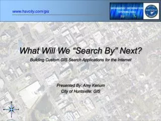
What Will We “Search By” Next? Building Custom GIS Search Applications for the Internet Presented By: Amy Kenum City of Huntsville: GIS
The Problem • Cemetery Department • Application to Search and Locate Cemetery Plots • Make it accessible by the public • Easy to use search commands • Only show specific attributes • Print maps of the cemetery • Have database updated regularly by Cemetery Dept.
History of Maple Hill • Established around 1822, when LeRoy Pope sold 2 acres to the city for a municipal cemetery • Registered by the Alabama Historical Association in 1962 • One of the oldest cemeteries in the state of Alabama • Currently almost 100 acres and over 80,000 burials Pictures By: Felicia Sisk
List of Data Needed • Map showing Spatial Location • Location of Burial Block, Lot and Space • Database • Burial Block • Burial Lot • Burial Space • Interment Last Name • Interment First Name • Interment Middle Name • Person’s Title • Data of Death • Age at Death • Sex • Link • Database • Spatial Location
Digital Data with Attributes • Created Shapefiles • Block Polygons • Lot & Space Polylines • Converted Labels to Points • Created Point Database • Burial Block • Burial Lot • Burial Space Spatial Data Evolution Scroll • Cemetery Layout • Plot Purchaser CAD Drawing • Digital Cemetery Layout
Database Evolution Entered Burial Location and Interment Details into Access Database Record Books Access Database Imported Data into SQL Database SQL Database
Building a Link • Spatial Data (Shapefiles) • Database (SQL Table) Burial Block Burial Lot Burial Space Unique ID to tie tables together B + “Block” + L + “Lot” + S + “Space” Space ID - BCL104S5 Lot ID - BCL104S Block ID - BCLS
Joining Tables • 1 to 1 join • Space ID – BCL104S5 • 1 to Many join • Lot ID BCL104S • Block ID BCLS • Field check records with incomplete data Records are old and don’t always have the full burial location • 52,000 cemetery locations • 28,000 interment records are linked
Creating a Webpage Designed using Active Server Pages (ASP) & GeoMedia Web Map www.hsvcity.com/gis www.hsvcity.com/cemetery
Home Page • Click to • begin Search • Click to view • a printable • map of the • entire layout • of the • cemetery
List of all the results that match the query with attributes Click Map to find the location of the burial plot Search Engine Search 3 Ways Barnes
Tools • Zoom in/out • Go back to the • search window • Print • Help Red Dot marks the location of the burial plot Burial Location And Interment Details Legend and Overview Map Burial Plot
Zoom In/Out of Map The more you zoom, the more detail you get
Maintenance • Cemetery inputs new and updated records into a database interface • ITS Dept. stores and backs up the data through a SQL Server • Unique ID (number) Field • Data Added Field • Date Modified Field • Exports new records into temporary table in the GIS database • Once a week through script (local package) based on date added or date modified • GIS Dept. pulls in new and updated records from temporary table • Creates ID from Block, Lot, & Space to link to spatial point • Once a week through script (local package) • Verify that all records join properly • Website is automatically updated
Other Search Applications • Other Cemeteries in the City (Pending) • Dedicated Tree Locator (Pending) • Bicentennial Park Brick Locator - Created using ArcIMS Home Page
Search Map Brick Locator
Mayor: Loretta Spencer Urban Development Director: Dallas Fanning GIS Manager: Tim Barnes Contributors: Webpage Design: GIS – Tom McDonough Helped with field work: GIS – Erin Dyer DBA: ITS – Sandra Barnes Records: Cemetery – Brenda Webb, Felicia Sisk Software Used: ESRI: ArcInfo, ArcIMS Bentley Microstation GeoMedia Web Map Microsoft SQL Server