Download
1 / 35
390 likes | 660 Vues
Wetlands: Riparian Vegetation. (Riverine, Terrestrial). Wetlands: Aquatic Vegetation. (Riverine, Subaqueous). Riparian Vegetation: Where is it?. Vegetation Map of New Mexico. Riparian Vegetation: Value. Mesquite Harvest to Fuel Smelters (Safford, Clifton, late 19 th century).

E N D
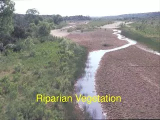
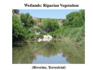
Wetlands: Riparian Vegetation (Riverine, Terrestrial)
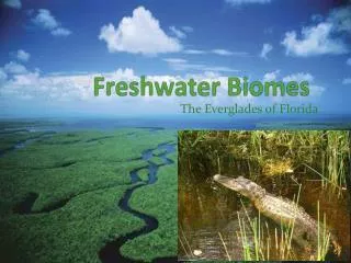
Wetlands: Aquatic Vegetation (Riverine, Subaqueous)
Riparian Vegetation: Where is it? Vegetation Map of New Mexico
Riparian Vegetation: Value Mesquite Harvest to Fuel Smelters (Safford, Clifton, late 19th century)
Riparian Vegetation: Value Soil Stabilization Trap Sediment, Nutrients
Upper Gila Lower Gila Riparian Vegetation: Value Common Black Hawk Willow Flycatcher Peregrine Falcon Abert’s Towhee Bell’s Vireo Gila Woodpecker
“Upper” Gila River in NM Lower Box (Junction of East, West Forks)
“Upper” Gila River in NM Junction of East, West Forks
“Lower” Gila River in NM Lower Box (Gila River, NM)
Elevation Zones of Woody Plants in NM Riparian Zones Fig. 9.1 in Dick-Peddie (1993)
Riparian Zones Terrace Floodplain Terrace
Phreatophyte: Plant Species with Roots in Saturated Zone (= Groundwater)
Water Flow near Yuma, AZ Duncan, AZ
Peak Water Flow: Clifton, AZ (1900-2000) Fig. 17.5 in Webb et al. 2007
Gila River: near Clifton, AZ 1930 Fig. 17.6 A, B in Webb et al., 2007 1964
Gila River: near Clifton, AZ 1980 Fig. 17.6 C, D in Webb et al., 2007 2000
Peak Water Flow: Calva, AZ (1900-2000) Fig. 17.7 in Webb et al. 2007
Gila River: near Calva, AZ 1932 Fig. 17.8a, b in Webb et al. 2007 1964
Gila River: near Calva, AZ 1973 Fig. 17.8c, d, e in Webb et al. 2007 1984 2000
Gila River Tributaries San Carlos River
Diversion of the Gila River (Coolidge Dam (1924-1928) San Carlos Reservoir
Diversion of the Salt River (Roosevelt Dam (1905-1911; 1989-1996) 1911 1996 Water Storage, Flood Control, Power Hydroelectric Plant
Diversion of the Gila River (Gillespie Dam – Gila Bend) 1920s 1993
Diversion of the Gila River (Hohokam Canals – Casa Grande)
Lower Gila River in Arizona Olberg, AZ Near Yuma, AZ
Populus fremontii Fact Sheet • Age at Reproduction: 5-10 Years • Pollen Vector: Wind • Seed Weight: 0.3 – 0.6 mg • Seed Dispersal Vector: Air and Water • Seeds per Tree per Year: 25 Million • Lifespan: Up to ~ 130 Years Source: Stettler et al. 1996. Biology of Populus.
“The Largest Fremont’s Cottonwood” http://www.arizonensis.org/graphics/pictures/LargestCottonwood.jpg