NG911 GIS User Group
230 likes | 265 Vues
Join us for the NG911 GIS User Group Meeting to discuss the GeoMSAG and Geospatial Call Routing Update Project, Imagery Update, NG911 Toolbox Update, and more. Stay informed and engaged in the evolution of NG911 technologies.

NG911 GIS User Group
E N D
Presentation Transcript
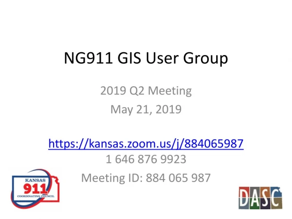
NG911 GIS User Group 2019 Q2 Meeting May 21, 2019 https://kansas.zoom.us/j/884065987 1 646 876 9923 Meeting ID: 884 065 987
Agenda GeoMSAG and Geospatial Call Routing Update Project & Imagery Update NG911 Toolbox Update Wrap up
News Items • 88 PSAPs have switched out their MSAGs for geoMSAGs • We will be asking for a contact to receive error notifications on GIS data submissions. If we do not get one, we will have those notifications sent to the GIS Data Maintainer. • Geospatial Call Routing is coming – Reno scheduled to begin pilot at the end of the month
Going Geospatial • Reno County will transition to geospatial call routing soon, and after a successful 30-day test period other PSAPs will start the transition • PSAPs using geospatial call routing will start using the ESB layers instead of ESNs and ELTs. ESNs will still need to be maintained as they are the backup system for routing failures • ESB DISPLAY field has a reduced character limit. While it is 60 characters in the NENA standard and the Kansas standard, the phone software in the PSAP is limited to the first 32 characters in the field. The toolbox gives a notice on this
Reminder on Unmatched TNs • TNs that did not match GIS data when the geoMSAG was created are still in the 911 database, but they are in a special error status • The address information displays for dispatchers, but they do NOT route properly. • A list of them was sent to Data Maintainers right after each geoMSAG conversion, and many people got them all fixed. • If your county has any remaining, you’ll be getting a new list of them roughly quarterly. Please plan to work on them as soon as possible.
Next Generation 911 Hosted System Deployment status map Other System Utilized Live on System MARC Region In Queue Interest Indicated – no SOR
NG911 Imagery Update • Statewide 1’ resolution, leaf off, color imagery • Imagery formats: • MrSID - USGS 24K tiles - StateplaneN/S • GeoTIFF– USGS 24K quarter, quarter tiles –StateplaneN/S • Valtuspassword protected image service –COMING SOON! • Valtus image server username and passwords will remain the same, no changes
NG911 Imagery Update • Distribution: • DASC notification with instructions on how to download the imagery was sent to NG911 GIS Data Stewards, NG911 GIS Data Maintainers and County Appraiser offices • Do NOT share credentials outside of your organization • If anyone outside of your organization asks how to get a copy of the imagery, please direct them to the DASC data request page
NG911 Imagery Update • DASC data request page • In data catalog, navigate to NG911 High Resolution Orthoimagery • Log in and click on online request form link
NG911 Imagery Update DASC Data Request page
NG911 Imagery Update • Licensing: • According to the 2018 NG911 Imagery Contract’s End User License Agreement (EULA), the following entities are approved users and shall be allowed unlimited access licenses: • All State of Kansas Government Agencies and Regents-level institutions • All Kansas County-level governments • All Kansas Municipal (city) governments • All Kansas Public Safety Answering Points (PSAP) • All Kansas Public School Districts • Any commercial firm or organization doing work on behalf of one of the entities listed above. • Additionally, license agreement shall allow; • Approved users to develop and publish publically-available web applications which utilize ortho-imagery or web map services • Approved users to print and distribute hardcopy format maps that display the ortho-imagery or web map service
NG911 Imagery Update • Local Imagery Buy Up • Still available for 2020 flying season • For more information and pricing • contact Tim Donze, Surdex - TimD@SURDEX.COM
Next Generation 911 • House Bill 2084 • Signed by Governor Kelly • Key takeaways: • Fee increase per subscriber account to $.90 monthly to sustain 911 service and fund future enhancements • Provides the authority to ensureGIS data integrity • Ensures continuation of 2011 Kansas 911 Act legislative mission of migrating Kansas to full NG911 capability
NG911 Toolbox Update Kristen Jordan Koenig
New Version- Late January 2019 • New tool for copying GDB to blank template • Added character length check for ESB DISPLAY • Edited topology “Notices” to “Errors”
ESB/Polygon Topology No gaps, overlaps Are “errors” for the June 2019 submission
How to fix the “gap” on the county boundary • Mark it as an exception in an edit session in ArcMap
Other improvements • Added check for RCLSIDE = N if RCLMATCH has a valid value
Looking Ahead • Removing topology rule that road segments must be inside ESB boundaries (ready if you want a copy) • Other developments depend on… • West’s data testing • Bug reports
Resources reminder • NG911 Portal: • GIS Frequently Asked Questions (FAQs) • Archive of NG911 GIS questions and answers • Submit a question anytime! • DASC website • https://www.kansasgis.org>Initiatives>Next Generation 911 (NG911) • Standards, Tools & Policies tab • Kansas NG911 GIS Post Processing Steps • Check back often - updated as needed! • 2019 NG911 GIS Data Steward and GIS Data Maintainer certification classes • Dates coming soon
NG911 GIS User Group Thank you! Kansas 911 Coordinating Council website http://www.kansas911.org/ DASC - Initiatives>NG911 http://www.kansasgis.org/initiatives/NG911/