Download
1 / 25
250 likes | 456 Vues
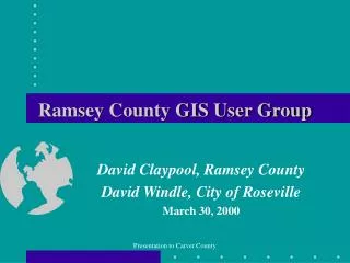
Ramsey County GIS User Group. David Claypool, Ramsey County David Windle, City of Roseville March 30, 2000. Summary. What is a Users Group? Why did we form the Ramsey County Group? How did we form our Users Group? Chronology of events How does our User Group function?

E N D
Ramsey County GIS User Group David Claypool, Ramsey County David Windle, City of Roseville March 30, 2000 Presentation to Carver County
Summary • What is a Users Group? • Why did we form the Ramsey County Group? • How did we form our Users Group? • Chronology of events • How does our User Group function? • What have we achieved? • How to make your Group a successful one Presentation to Carver County
What is a GIS User Group? • An alliance of current and potential users of GIS technology with common interests in its development and use Presentation to Carver County
Why Start a Users Group? • To help each other become more successful in GIS efforts • To support each other through mutually beneficial activities • To share ideas • To share costs • To develop contacts and relationships • Why go it alone? Presentation to Carver County
Don’t operate in a vacuum! • Remember! Public tax dollars have already been spent or will be spent in GIS development. Why not increase the value of the public investment made by sharing ideas, successes, failures, data with others so that everyone can benefit? Presentation to Carver County
Ramsey County GIS Users Group • Who are we? • An alliance of 19 organizations currently using GIS within Ramsey County • Users with a broad background of local government operations: cities, school districts,watershed districts, soil /water conservation district, universities • Links to I-35W Corridor Coalition and MetroGIS Presentation to Carver County
Ramsey County GIS Users Group • Who are we? • Cities:Arden Hills, Falcon Heights, Gem Lake, Lauderdale, Maplewood, Mounds View, New Brighton, North St. Paul, Roseville, Shoreview, St. Paul, Vadnais Heights, White Bear Lake • Township:White Bear • School District:Roseville Mounds View • Watershed District:Ramsey/Washington • Soil/Water Conservation District:Ramsey • Universities: Hamline • Non-Paying Affiliates: Metropolitan Council, Metro East, North Metro I-35W Corridor Coalition, TIES • Paying Affiliate: Mounds View School District Presentation to Carver County
Ramsey County GIS Users Group • Why did we form our Users Group? • To help disseminate County GIS data throughout the community, therefore providing a better service to the public by enabling elected officials and management within a variety of organizations to make more informed and timely decisions. • To enable Users to obtain better datamorecheaply and more efficiently through the sharing of ideas and costs Presentation to Carver County
Ramsey County GIS Users Group • Why did we form our Users Group? • To assist the County in its data base enhancements through: data sharing, cost-sharing and user feedback • To enable GIS newcomers to get up and running more quickly and cheaply • To cooperate with metropolitan and regional organizations • To give organizations the ability to look beyond their own boundaries Presentation to Carver County
Ramsey County GIS Users Group • How did we form our Users Group? • Clearly defined what kind of group we wanted to be (non-software specific, local government focus) • Clearly defined our goals • Ensured active participation from Ramsey County • Identified who would be the “champions” of the Group • Identified all potential members • Invited members to first meeting in May 1995 Presentation to Carver County
Ramsey County GIS Users Group • Chronology of Events: • May 1995: First meeting of User Group • June 1995 to November 1995: Monthly Meetings • November 1995 to March 1996: Drafting of Joint Powers Agreement (JPA) • May 1996: County GIS Data Fair • August 1996: Defining cable pilot project • June 1996 to February 1997: Finalizing of JPA Presentation to Carver County
Ramsey County GIS Users Group • Chronology of Events: (continued) • January to August 1997: Defining cost-sharing for processing aerial imagery • Mid 1997: Commence regular monthly special topic sessions • October 1997: Supply of first CD-ROM with entire County parcel data base • April 1998: Ramsey County GIS Expo held • May 1999: First User Group FORUM held (Public Works) Presentation to Carver County
Ramsey County GIS Users Group • How does the Group function?: • Operates under the JPA which enables each member to be represented by the Group • Operates autonomously from the County but we rely strongly on their support and participation • Group consists of Members and Affiliates (Paying and Non-Paying) • Meeting are open to all public and private individuals and organizations • Meetings held regularly (monthly) • Board meetings held as required by JPA and to resolve other issues as they arise Presentation to Carver County
Ramsey County GIS Users Group • How does the Group function? - Members: • Can be any local unit of government situated in Ramsey County • Pay a one-time $500 membership fee • Pay annual data maintenance fee based on size and type of organization (3 year commitment required) • Have an equal vote at Board meetings • Agree to share any permit data with County and any data derived from County base with County and other Members Presentation to Carver County
Ramsey County GIS Users Group • How does the Group function? - Members: • A Member can be represented by a private sector entity who is undertaking contracted work on behalf of that organization • Private sector entity has no voting rights at Board meetings • Members are covered by liability insurance through MN League of Cities Presentation to Carver County
Ramsey County GIS Users Group • How does the Group function? – PayingAffiliates: • Can be any county, regional, state and federal agency, non-profit organizations, educational institutions with direct or indirect involvement in GIS activities • Pay membership or data access fees • Do not have voting rights • Cannot enter into cost-sharing agreements under the JPA • Operate under the spirit of the JPA (data-sharing etc.) Presentation to Carver County
Ramsey County GIS Users Group • How does the Group function? – Non-PayingAffiliates: • Can be any county, regional, state and federal agency, non-profit organizations, educational institutions with direct or indirect involvement in GIS activities • Do not pay membership or data access fees • Do not have voting rights • Cannot enter into cost-sharing agreements under the JPA Presentation to Carver County
Ramsey County GIS Users Group • Why have fees anyway? • To offset the costs of data supply and storage not for cost of creating data • So Members can access County plotters and GIS workstations • Cost-share in creation/maintenance of non-mandated data (physical features) Presentation to Carver County
Ramsey County GIS Users Group • What have we achieved? • Provided Members with cheap, accurate and useful GIS base information available monthly • Created a strong degree of trust between each other and with the County resulting in each of us providing better information to each other • Established links to other regional and metro-wide organizations ensuring that data standards are considered Presentation to Carver County
Ramsey County GIS Users Group • What have we achieved? • Secured financial assistance from MetroGIS in cable pilot project • Enabled a more rapid growth in the use of GIS within the County than would otherwise have been possible if individual development had occurred • Have educated many elected officials in the value of GIS technology and data Presentation to Carver County
Cost-sharing for topographic data Presentation to Carver County
Ramsey County GIS Users Group • How to make your Group a success • Ensure that there is a core group willing to donate considerable time to operating and promoting the Group • Develop a formal agreement (JPA) or similar legal instrument with each other to enable the Group to negotiate on behalf of its members and for legal recognition of products and working relationships • Regular County GIS attendance is essential to maintain their involvement and support. Presentation to Carver County
Ramsey County GIS Users Group • How to make your Group a success • Member diversity is beneficial to foster creative discussions • Meet regularly to ensure momentum is maintained • Ensure members are willing to form sub-committees as needed to move issues quickly • Share the responsibilities once the organization is established Presentation to Carver County
Ramsey County GIS Users Group • How to make your Group a success • Remember, there is a strong and legitimate role for involvement of the private sector. • Have regular hands-on demonstrations at meetings • Remember that not everyone is a GIS expert • Always have refreshments at meetings • Make sure meetings have a broad appeal • Try to bring examples of “maps and apps” to meetings • Try to include all members/attendees in the discussions Presentation to Carver County
Ramsey County GIS Users Group • How to make your Group a success • Maintain a comprehensive mailing list to keep everyone informed regardless of attendance • Post minutes agendas on a web site or distribute via e-mail where possible Presentation to Carver County