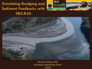
Simulating Dredging with HEC-RAS
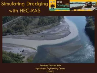
Simulating Dredging with HEC-RAS. Stanford Gibson, PhD Hydrologic Engineering Center USACE. Road Map. Importance of Sediment Feedbacks on Dredged Channels Overview of HEC-RAS Two Examples of Navigation Dredging Simulations New Dredging Capabilities in HEC-RAS 4.2.

Simulating Dredging with HEC-RAS
E N D
Presentation Transcript
Simulating Dredgingwith HEC-RAS Stanford Gibson, PhD Hydrologic Engineering Center USACE
Road Map • Importance of Sediment Feedbacks on Dredged Channels • Overview of HEC-RAS • Two Examples of Navigation Dredging Simulations • New Dredging Capabilities in HEC-RAS 4.2
Importance of Modeling Feedbacks on Sediment Systems Sediment Deposition Channel Geometry Change Dredging
~ ~
HEC-RAS Sediment Transport • Mobile Boundary Hydraulic Model • Captures Sediment-Hydraulic Feedbacks • Cohesive and Cohesionless Transport • Public Domain - 1D Model – Widely Applied • There is probably already an HEC-RAS hydraulic model of your system • Good at Depositional Sediment Modeling • Dredging Capabilities
Classic Dredging Capabilities • HEC-RAS 4.1 followed HEC 6 • Allow user definition of time and extent of dredging configuration. • left/right extent and elevation for each XS • Only rectangular dredging cuts. • Instantaneous Dredging
Ontonagon River Cuyahoga River
Ontonagon River Model and Calibration by Calvin Creech of LRD
Cuyahoga River 3 things
Dredging Option • From Options, click on Dredging
New Dredge Options in Version 4.2
New Dredge Options in Version 4.2
New Dredge Options in Version 4.2
New Dredge Options in Version 4.2
New Dredge Options in Version 4.2
New Dredge Options in Version 4.2
Eulerian Multi-Layer Bed Accounting z z Gradations can then be “layered” Dx Dx Dx Dx Dx Dx Resistant Reservoir Layer Lacustrian Glacial Strata Glacial Outwash Strata Erodibility=f(Density) Density=f(Depth)