Download
1 / 29
290 likes | 431 Vues
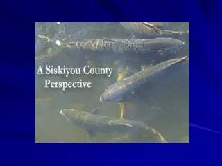
Siskiyou County, covering over 6,300 sq. miles, has a diverse population of 44,301, with 18% aged 65+. The median household income is $29,530, and unemployment in early 2004 was at 14%. The region features significant public land (63%) and diverse topography with steep slopes affecting land use. The climate varies drastically, from average precipitation levels to temperature extremes. With important river systems like the Shasta and Scott Rivers, several challenges related to water temperature, sedimentation, and habitat accessibility are present, necessitating targeted ecological studies.

E N D
Demographics • Population - 44,301 • 18% - Aged 65+ • Household Median Income- $29,530 • Jan.-March 2004 unemployment 14 %
Siskiyou County Land Use • 6,342 sq. miles or 4,058,983 acres • 63% public land and 37% private (Only 6% of all land has buildings) • 45% of private is in TPZ • 42% of private is in farmland • .8% of private land is urban
Shasta River Valley • 795 sq. mile basin - 508,734 acres • 72% private land – 364,729 acres • 50-55,000 irrigated acres
Topography • 0-7% slope – 56% • 7-15% slope – 23% • 15+% slope – 21%
Climate • Average precipitation is 25.71 inches; ranges from 9 to 75 inches • Average temperature ranges from 34˚F in winter to 72˚F in summer • Extremes range from high of 110˚F to low of -11˚F
Shasta River Dams & Weirs • Dwinell dam blocks accessibility to upper reaches of the Shasta River. • Six temporary flashboard dams and several smaller dams exist below Dwinell
Limiting Factors/Issues • Recruitment of spawning gravels • Siltation of gravels • High water temperature • Low dissolved oxygen • Nutrient loading • Difficulty regulating flow • Interception of groundwater/springs
Top 3 Study Needs Shasta CRMP • Model the relationship of flow to rearing habitat • Expand temperature/flow model and habitat/flow models to include all tributaries • Engineering and economic feasibility study for the Klamath Shasta Water Import Project
Scott River Valley • 814 sq. mile basin - 520,968 acres • 61% private land –316,471 acres • 32,443 Irrigated acres
Topography • 0-7% slope – 23% • 7-15% slope – 23% • 15+% – 54%
Climate • Average precipitation is 35.87 inches. West and south side mountains 60-80 inches. Eastside 12-15 inches • Average temperature ranges from 33˚F in winter to 70˚F in summer • Extremes range from high of 110˚F and low of -23˚F
Eastside Westside
Dredger Tailings • The Scott River from Callahan to French Creek was dredged for gold from the 1920s-40s, Large- scale tailings piles remain for about 6 miles.
Snow-fed Systems 420K average annual discharge
Limiting Factors/Issues • Water temperature • Sediment • Accessibility – canyon barriers to spawning and connectivity to summer rearing habitat • Lack of flood plain connectivity • Altered flow regime
Top 3 Study NeedsSiskiyou RCD • Feasibility study for siting of off-stream water storage of about 7-10 K acre feet. • Study to determine the impact of upland consumption by over-stocked trees and junipers on stream flows. • Coho habitat utilization study to determine when 1+yr. leave the tributaries for the mainstem Scott, so connectivity barriers may be addressed.
Salmon River • 751 sq. miles or 480,864 acres • 1% privately owned – 6,232 acres • 205,165 acres or 43% public land in protected status • 250 year round residents
Topography • 0-7% slope – 6% • 7-15% slope – 14% • 15+% – 80%
Climate • Average precipitation is 56.54 inches • Extremes range from high of 112˚F and low of -3˚F
Limiting Factors • Sediment from failing roads, trails and slides • Temperature • Predation • Effects of fire and fire exclusion on the watershed • Invasive species and toxics used for control
Top 3 Study NeedsSalmon River Restoration Council • Understand natural fire regime in the watershed • Understand harvest and hatchery effects on key life stages of Spring Chinook • Find out where Salmon River Spring Chinook go in the ocean
Summary Points • Siskiyou County is a region of ecological transition and diversity on the edge of the range of salmonids • Natural conditions (temperature and precipitation) can be limiting factors • Localized areas of suitable habitat become very important
My Personal Top 3 Studies • Locate where the fish are at their various life stages and describe preferred habitat • Study the relationship of hydrology to areas of suitable habitat and its accessibility • Study the relationship of vegetation (upland and riparian) to altered flow regime