Download
1 / 50
500 likes | 530 Vues
Explore various land changes, hydrology shifts, vegetation variations, and ways to predict change in Northern Alaska ecosystems through coastal pathways, lake basin evolution, and riverine processes. Understand the impact of climate change on the region's diverse ecosystems.

E N D
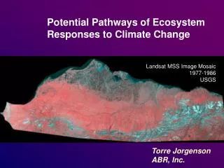
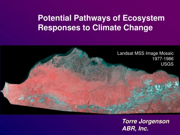
Potential Pathways of Ecosystem Responses to Climate Change Landsat MSS Image Mosaic 1977-1986 USGS Torre Jorgenson ABR, Inc.
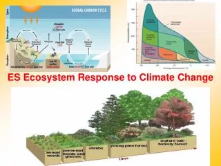
Types of Land Change • Geomorphic processes • Coastal (increased erosion, flooding, salt kill) • Fluvial (changed channel migration rates, sedimentation • Lacustrine (mid-summer drying, bank erosion, tapping, paludification) • Permafrost (ice-wedge degradation, slower permafrost formation) • Hydrology • Earlier snowmelt and spring discharge • Higher spring water levels • Mid-summer lake drying (faster drawdown) • Lower mid-summer river discharge, active channel shrinkage • Decreased glacier meltwater input • Lake tapping and drainage • Vegetation • Longer growing season (more biomass) • Earlier forage quality curve • Shrub expansion (height and infilling), (migration) • Succession after disturbance • Migration (alder, spruce, sphagnum)(corridors) • Microsite moisture shifts (wetter troughs, drier centers) • Leaching and acidification • Paludification (bog meadows, productivity decrease) • Species composition-community shifts
Approaches to Predicting Change • Extrapolate from past changes • Soil/sediment stratigraphy, remote sensing, historical photos • Complex modeling • Comparative ecosystem analysis • North Slope versus Seward Peninsula
Coastal Pathways Higher Tundra Deltas, Basins, Lagoons, Barrier Islands Upland Tussock Tundra Lowland Moist Sedge-Shrub Tundra Lowland Wet Sedge Tundra (swales) sedimentation, less flooding sedimentation, less flooding Lowland Moist Sedge-Shrub Tundra Coastal Dwarf Shrub (willow) Coastal Wet Sedge Tundra (brackish) sedimentation sedimentation Lowland Wet Sedge Tundra Coastal Grass Tundra Coastal Wet Sedge Tundra (saline) sedimentation sand mud flooding, salinization bank erosion Coastal Barrens (including salt-killed tundra) bank erosion Nearshore Water
Mudflat C. subspath. D. fisheri
Lake Basin Evolution Ice-rich Center Ice-rich Margin Erosion of Ice-rich Center
Coastal Plain Pathways Basins Non-basins Upland Tussock Tundra Upland Shrubby Tussock Tundra Upland Tussock Tundra shrub expansion shrub expansion paludification, acidification Lowland Low Birch-Willow Shrub ice aggradation, paludification paludification, acidification shrub expansion Lowland Wet Sedge Tundra Lowland Moist Sedge-Shrub Tundra Lowland Bog Meadows Lowland Moist Sedge-Shrub Tundra ice aggradation, paludification paludification, acidification drying Lacustrine Sedge Marsh Lacustrine Wet Sedge Tundra Lacustrine Low Willow Scrub Lowland Wet Sedge Tundra (swales) Lacustrine Grass Meadows paludification paludification succession succession succession Shallow Lakes, Pits Lacustrine Grass Marsh Lacustrine Barrens paludification, acidification paludification, acidification partial drainage complete drainage bank erosion, thermokarst bank erosion, thermokarst Deep Lakes thermokarst troughs and pits
Lowland Wet Sedge Tundra Conversion by lowering water table Lowland Moist Sedge-Shrub Tundra:
Wet Sedge - NPRA Bog Meadow – Seward Peninsula
Advanced Degradation Intermediate Degradation Dead Tussocks Initial Stabilization
Drying After Permafrost Degradation Photo by Torre Jorgenson
Lacustrine Ecosystems
Lowland Water: Shallow (<1.5 m) ponds: water freezes to the bottom during winter, thaws by early to mid-June, and is warmer than water in deep lakes. Deep (1.5 m) lakes: water does not freeze to the bottom during winter in deeper portions of the lake. Lacustrine Marsh: In deeper water (30–100 cm), Arctophila fulva In shallower (<30 cm) water, Carex aquatilis, Eriophorum angustifolium and Utricularia vulgaris
Thermokarst Lake, Koyukuk Flats
Riverine Pathways Eolian Processes Fluvial Processes Riverine White Spruce Forest Meander Abandoned Overbank Deposit thermokarst, bank erosion Upland Crowberry Dwarf Shrub Upland Cassiope Dwarf Shrub Riverine Lake Lowland Bog Meadow thermokarst paludification, acidification Lowland Wet Sedge Tundra Lowland Moist Sedge-Shrub Tundra sedimentation, paludification ice aggradation, less sedimentation paludification ice aggradation, reduced sedimentation paludification Meander Inactive-Overbank Deposit Riverine Cottonwood Forest Riverine Moist Sedge-Shrub Tundra Upland Dryas Dwarf Shrub Upland Low-Birch-Willow Shrub Riverine Wet Sedge Tundra increased drainage cutbank, increased drainage reduced flooding, less sedimentation, increased drainage reduced flooding, less sedimentation, ice aggradation, decreased drainage paludi-fication Riverine Low Willow Scrub Riverine Dryas Dwarf Shrub reduced flooding, less sedimentation, ice aggradation, decreased drainage Meander Active-Overbank Deposit Eolian Sand Deposit Riverine Tall Alder-Willow Shrub Riverine Grass Marsh Riverine Moist Tall Willow Shrub Upland Dry Tall Willow Shrub alder expansion, reduced flooding, frequent sedimentation, increased drainage channel abandonment Active Channel Deposits drainage sedimentation, channel migration riverbank erosion Riverine Barrens Lower Perennial River
Riverine Moist Low Willow Shrub Lower Perennial River Riverine Moist Tall Willow Shrub Riverine Barrens Upland Dry Dryas Dwarf Shrub Riverine Wet Sedge Meadow Lowland Wet Sedge Meadow Water
Upland Ecosystems Upland Hydrology: 8-10 ka (loess) to 60 Ma surfaces Highly integrated drainages Suprapermafrost Groundwater Flow Soil highly leached Water-tracks
Upland Pathways Ridges Mid-Slopes Swales/ Watertracks/ Troughs/ Basins Upland Alder Tall Shrub Upland Alder Tall Shrub (including alder-tussock) alder expansion alder expansion Upland Dryas Dwarf Shrub Tundra (including ericaceous dwarf shrub, cassiope dwarf shrub) Upland Low Birch-Willow Shrub Upland Shrubby Tussock Tundra acidification shrub growth acidification shrub growth Lowland Birch-Willow Shrub Upland Moist Sedge-Shrub Tundra Upland Tussock Tundra ice aggradation, paludification Lowland Bog Meadows Wet Sedge Meadow paludification thermokarst troughs and pits thaw slumps extremely ice-rich Deep Thaw Lakes See Coastal Plain Basin Pathways
NPRA MAAT = -12 C MAAT = -6 C Seward Peninsula MAAT = +2 C King Salmon High resilience of tussock tundra
Lichen Loss – Noatak Basin 1909 – Phillip Smith
Upland Tall Alder Shrub Alnus crispa, Salix pulchra, Salix glauca, Vaccinium uliginosum, Vaccinium vitis-idaea, B. glandulosa, Ledum groenlandicum,Empetrum nigrum, Equisetumarvense, Spiraea beauverdiana, Calamagrostis canadensis, Petasites frigidus, Sphagnum spp., Hylocomium splendens
1918 Near Naknek River, King Salmon P. Hagelbarger
2005 G. Frost
1918 Near Naknek River, King Salmon P. Hagelbarger
Disturbance Fire
Circumpolar Arctic Vegetation Map Walker et al. 2003